Broken Top Loop
Distance: 23.8 miles.
Elevation Gain: 3,500 feet.
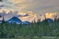
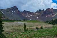
Broken Top is an iconic figure on much of the Central Orgon skyline, and the Broken Top Loop gives you a chance to explore the vast and dynamic landscape around this volcano. The mountain began erupting about 300,000 years ago and had periodic episodes of eruptions for the next 150,000 years. The mountain’s famous crater was likely initially formed through subsidence, or a sudden collapsing of the summit cone. This depression was then filled again by varying layers of lava which was then later destroyed, along with the entire southeastern face of the mountain, by glacial erosion. This loop allows you to both stare into the heart of the mountain and view its much less observed, incredibly steep and rugged, northern slopes.
The Broken Top Loop begins at Three Creeks Lake at the trailheads for Tam McArthur Rim or Little Three Creek Lake, near the entrance to the Driftwood Campground. The first decision you have to make is if you want to proceed clockwise or counter-clockwise around the loop. If you go clockwise, you can get the majority of the climbing out of the way right at the beginning, with the ascent of Tam McArthur Rim and the Broken Hand ridge occurring right out of the parking lot. However, it leaves you with a final day of walking through burned forest and a climb of about 500 feet during the final few miles. I prefer to go counter-clockwise, both to get the burn out of the way, and to spend the majority of the final day going downhill, depending on where you camp. In addition, I like the break-up of miles per day better going counter-clockwise. Besides, I’m writing this damned thing so that’s just how it’s going to be.
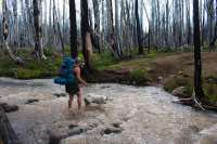
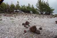
Before you head out, be sure to fill out your wilderness permit. You won’t find one at the parking area near the campground and will have to walk across the road to the Tam McArthur Rim trailhead to fill one out. Then, head towards the western end of the parking lot and begin your hike. The trail doesn’t take long before it enters the remnants of the 2012 Pole Creek Fire that scorched much of the area north of Three Creek Lake. While the burned trees aren’t especially pretty to look at, it does give you the opportunity to watch the forest recover. Plus, it has opened up a lot of views to both Tam McArthur Rim and the Three Sisters along the trail.
You will encounter your first trail junction after just 0.9 miles. Here, a right will take you to Three Creek Meadows, and a left will move you along to Little Three Creek Lake. You want to head straight ahead towards Park Meadow. You will then climb a small ridge and then head steadily downhill for a couple miles towards Snow Creek. Just before reaching Snow Creek, you will reach another intersection, this time with the Park Meadow Trail. Head west, towards your left and proceed to the first of three stream crossing on this segment of trail.
Snow Creek is the smallest and easiest of the three streams you most cross on your way to Park Meadow. Depending on the time of year, weather, and even time of day, some of the crossings can vary widely. There was a makeshift bridge of logs crossing Snow Creek, so we were able to make our way across it while keeping our feet dry. After Snow Creek, it is another 1.5 miles until you reach Whychus Creek. Whychus was running much higher and was full of milky glacial runoff, probably from the week of near 90 plus degree days we had had prior. Thus, there was no noticeable way to cross on logs or by rock hopping, so we donned our sandals and strolled across. It can be a little unnerving when you can’t see the bottom of the stream because the water is so turbid, but it was never over about mid-calf depth on us.
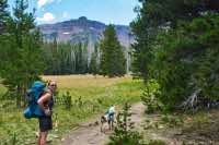
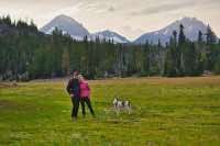
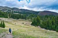
A half mile past Whychus, you finally reenter green forest and you are only another half mile from beautiful Park Meadow. Here you will find the third stream to ford, Park Creek. This one had much clearer water and not nearly the flow as Whychus, but still no easy way to rock hop across, so we just waded across again. Park Meadow could make a beautiful place to camp if you would like to end your fist day after a little over 6 miles. The beautiful green meadows and Broken Top rising up behind them are truly spectacular. However, if you have a little more juice left in you, another gem of a camping location is less than 2 miles away.
After crossing Park Creek, you will hit the intersection with the Green Lakes Trail. Head to the left and begin climbing up out of the Park Meadow Basin. You will climb about 400 feet in the next mile as you start working your way up the pass between Broken Top and South Sister. Once the trees begin to thin out some, watch for an unmarked trail on your left. The trail is well traveled and obvious. In about half a mile, this trail will take you to magical Golden Lake, and excellent place to spend the night. This little lake is set in a beautiful meadow on the northwestern base of Broken Top. Small waterfalls cascade down around you and the views are truly dramatic. Even if you don’t spend a night here, it is worth a visit.
Once you are done at Golden Lake, head back to the Green Lakes trail and continue up the pass. You have another 500 feet to climb in the next mile, but the views get even more impressive as you go. You will find yourself in a true alpine environment, with only little stunted trees to impede your view of South Sister and Broken Top. Then you will start heading into one of the most beautiful, and unfortunately, popular, places in Oregon, Green Lakes.
Green Lakes is located in a basin right between South Sister and Broken Top. The lakes were created by a dam from a lava flow originating from South Sister and then subsequently pinched by a couple of massive alluvial fans generated from glacial outwash off the Lewis and Prouty glaciers on South Sister. The views here on amazing and this can also be another wonderful place to camp. Due to its popularity, camping is only allowed in designated spots, so you always run the risk of not being able to find one. Plus, the spots tend to be back in the trees and not that close to the lakes. However, someone could just hang out here all day and the views would never get old.
As you hike through Green Lakes, it can get kind of confusing. There are side trails to camp sites all over the place. Most of them are marked with a little post, but not all. You will also pass the climbers trail up Broken Top at the southern end of the main lake. There are also trails that go around both sides of the southern lake, so pick your poison. I like the views better from the trail that goes around the western end, and it’s only a tenth of a mile longer. As you're leaving the basin, head out on the Broken Top trail to continue the loop around the southwestern side of the mountain.
You will climb about 300 feet in the next mile and a half as you leave Green Lakes. The trail passes between thick stands of timber and open, grassy meadows. Many of the meadows have little streams flowing through them and offer views of both Broken Top to the north and Mt Bachelor and even Diamond Peak to the south. At a little over 2 miles from Green Lakes, you will skirt around the base of Cayuse Crater, a cinder cone on the southern end of Broken Top. Continue around for another ¾ mile until you reach another junction. Stay to the left and remain on the Broken Top Trail and you enter the wide open plains along the mountain’s south side.
The next mile of the hike offers unobstructed views of Broken Top’s crater. Springs pop up below the trail all around and during certain times of the year, the grass is green and flowers are blooming. After this mile, you will reach Little Crater Creek and Crater Ditch. Many people choose to camp here because this is the last place to get water along the trail. Even though you will be walking along Crater Creek and up to No Name Lake, the dead elk in and above No Name make drinking out of it, or Crater Creek which drains it, pretty dicey. So even if you don’t camp here, be sure to fill up.
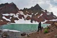
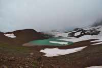
After crossing Crater Ditch, you begin the long climb up to No Name Lake. There are numerous user trails in the area, heading up to the crater and really all over the place, so do you best to stay on the main trail. The next two miles will gain about 1,000 feet in elevation as you march up Crater Creek. Just before you reach No Name, you will encounter a snowfield that is usually there, year round. If you look to the right, there is a beautiful little protected cove that makes an excellent camp spot. While I haven’t been able to find any info on the Deschutes National Forest website, there was a sign at the trailhead indicating that there was no camping within ¼ mile of No Name Lake at this time. (Summer, 2019). This spot is about that far away.
Here, you have to make one final decision on the last leg of the hike. That traditional path leads one past No Name Lake, up the ridge behind it, along that ridge, and then skirting along the side of Broken Hand. Broken Hand is a is a three-sided castle of cliffs located right along the top of the ridge. There is no safe way over or around it. To do it, you have to traverse a boulder filled scree field above cliffs and possibly over snow where if you slip, could send you sliding over 300 feet down the ridge. There are lots of people that do it, but we didn’t really feel like it. So the alternate path is, to skirt Broken Hand entirely and then climbing the ridge afterward. If you choose this route though, be sure to head into No Name Lake and up the ridge behind it. You won’t want to miss the dramatic scenery.
To skip the fun at Broken Hand, follow to small ridgeline right next to the snowfield heading straight at Broken Hand. Cross the snowfield and enter the boulders at the base of the ridge. Pick your way through the rock as you just work your way around the base of Broken Hand and before you know it, you should notice a user trail heading in the same general direction as you. Hop on the trail and follow it as it works its way back up the ridge. This 200 feet is the last real climb of the hike.
Once you reach the ridgetop, head to the right and follow it for the next 2 miles as it makes its way back to Tam McArthur Rim. The barren landscape is strangely beautiful and the views are plentiful. Once you reach an outcrop overlooking Three Creek Lake and you can see your car parked on the far side of the lake, know that it just an easy, 2.5 downhill miles to salvation.
Directions
From Highway 20 watch for signs directing you to Three Creek Lake right on the main drag. Head south on Elm Street and proceed for 18 miles until you reach the lake. The majority of the road is paved, with maybe the last couple miles being gravel, but most cars should have little trouble reaching the lake. Driftwood Campground will be on your right as you reach the lake, and the trailhead for Little Three Creek Lake will be almost immediately on your right again.
Things to Know
Passes: A Central Cascades Wilderness Permit is required to access this area between June 15th and October 15th. The permits will be available from recreation.gov and will go on sale in early April. A Northwest Forest Pass is also required to park at this trailhead.
Dogs: Dogs are required to be on leash between July 15 and September 15 from the Top of Green Lakes Pass to the intersection with the No Name Lake Trail. A map can be found here:
Usage: Most of the trail experiences pretty heavy usage, with exception of the rim near Broken Hand.
Open Season: Higher elevation trails usually melt off sometime in July and remain open until the first snow falls.
Bugs: Mosquitos can be bad during the melt season, usually July-August, then will mostly clear up later in August. The areas around Park Meadow and Golden Lake can be especially brutal.
Flowers: Different flowers will bloom depending on elevation, but July and early August are usually peak months.
No Name Lake: A herd of elk were killed in an avalanche during the winter of 2017 just above the lake. Some may have been swept into the lake and others can be seen in the snowfields near the shore. Thus, don't drink the water or the water of Crater Creek which drains from it.
Camping Restrictions: No fires within 1/4 mile of Golden Lake and no Camping with 250 feet of the lake. Camping is only allowed in the Green Lakes Management area within one of the 28 designated sites, seen here:. No fires are allowed, period. There is no camping within 1/4 mile of No Name Lake.

