Cape Lookout
Length: 5.0 miles
Elevation Gain: 890 feet.
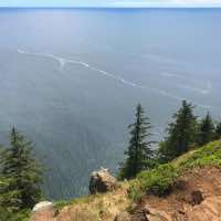
Cape Lookout is a rocky promontory that extends 1.5 miles out into the Pacific Ocean and towers hundreds of feet above the crashing waves below. The Cape Lookout Trail traverses this half mile wide sliver of land leading you to some unbelievable ocean views. If you time your hike for the winter or spring, you can even watch migrating gray whales as they have to swim out to get around the Cape. Just be aware, there are some dizzying drop-offs off the side of the trail, and the trail is root covered and sometimes muddy, so watch your step.
Begin your hike at the trailhead just off of Cape Lookout Road. Right from the parking area, there will be two trails. Head to the left on the Cape Lookout Trail and begin the steady downhill along the promontory. Quickly after beginning the hike, you will encounter another trail junction with the South Trail. Stay to the right this time, unless you want to hike about 800 feet down to the beach at the base of the cape.
The hike begins in a dense old growth forest, with huge Sitka Spruce trees covered in moss hugging the trail. The hike takes merely 2/3 of a mile before it momentarily breaks free from the trees and you find yourself gazing out at the ocean and beaches, far below. This is also the site of a B-17 bomber crash in 1943.
After hugging the edge of the cape for a stretch, the trail dives back into the forest. Here, the trail crosses over the promontory to the north side of the cape. At 1.25 miles from the start, an area with some wooden railing offers some amazing views to the north, including some natural archways in the ocean. Here the trail begins to climb slightly and cut back to the south side of the cape. You will pop out momentarily for some more views to the south before once again entering the dense forest.
At 2.2 miles into your hike, you will finally emerge from the forest for the last time. Here, the trail hugs the edge of the cliffs and you will likely find yourself hugging the right side of the path. The near vertical, 400-500 foot drop to the ocean below can be a little sketchy, but the views are incredible. In about ¼ mile, you will reach the viewpoint at the end, with a wire fence surrounding the terminus. The spot can get crowded on a nice weekend or in the summer. Once you’ve had your fill, turn around and head back. And enjoy the uphill climb. Sucker.
Directions
From Tillamook, take Highway 131 five miles west of town. That will turn into Whiskey Creek road as you hit Netarts Bay, so veer south and continue on. After about 8 miles, the road will turn into Cape Lookout Road, which you will follow another 2.7 miles. The trailhead will be on the right.
From Pacific City, take Cape Kiwanda Dr and then Sandlake Road north for 9 miles up the coast. Then, make a left onto Cap Lookout Drive and continue for 3.3 more miles until you spot the trailhead on your left.
Things to Know
Passes: $5 State Park Day Use Fee required.
Dogs: Allowed and must be on leash.
Usage: Heavy
Open Season: Trail is open all year, but can get rather muddy during wetter periods.
Hazards: There are some very steep cliffs right along the edge of the trail in places.
Whales: Whales usually migrate south towards Baja to their breeding grounds from mid-December through January. During this peak, as many as 30 whales pass by per hour. They will then migrate north, back towards Alaska, between late March and June.


