Juniper Butte
Distance: 5.2 miles
Elevation Gain: 1,020 feet.
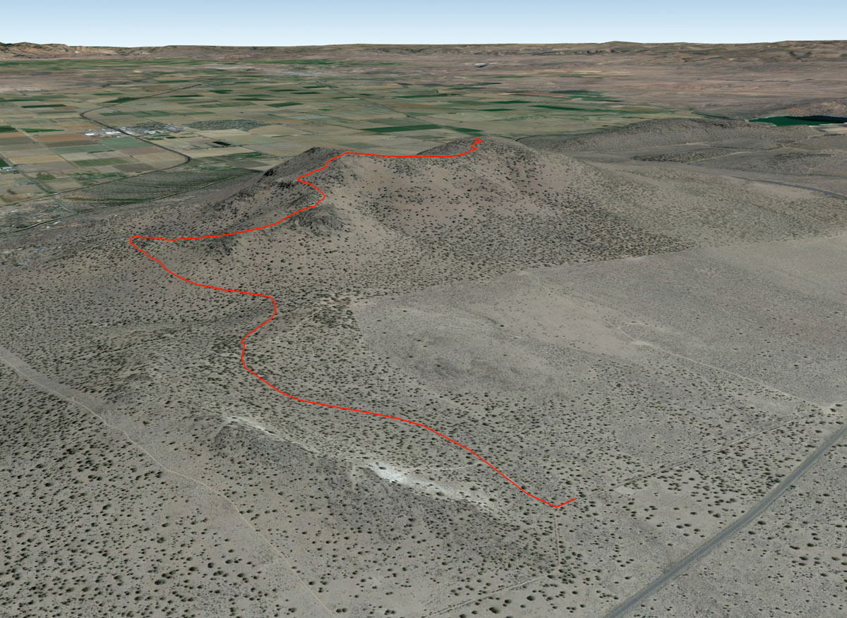
Juniper Butte is the northwestern most butte in a series of volcanoes that extend from Grizzly Mountain near Prineville. These buttes were all active around 30 million years ago and help form much of the red, green, light yellow tuff formations of the John Day Formation. These volcanoes are long dead, extinct for millions of years longer than the Cascades to the west, but they do offer some amazing viewpoints and great off-season hiking.
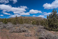
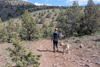
The route up Juniper Butte doesn’t have an official trail, so if you expecting a nice, manicured single track weaving through the juniper and sage brush, you may be disappointed. But, there are plenty of current and old roads to follow, so getting lost isn’t really an issue either.
You can begin you hike up Juniper Butte from a number of places, you will most likely want to start on the southern end of the butte, and thus not having to navigate through private property. I think probably the best option is to head down Monroe Lane, just south of the Butte, and then take a dirt road to the right as the road begins to veer left. Follow this road for about half a mile until you reach a tee junction. You could head right and follow the road, cutting some milage off your hike, but it does get pretty rocky in places. Plus, you are here to hike, right, so why ruining it by driving all the way. So find somewhere to park near the junction, lace up those boots, and get walking.
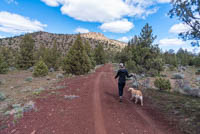
So at the junction, right north, to the right and towards Juniper Butte. There is a popular shooting area near the Butte, so don’t be surprised if you hear some gunshots. They shouldn’t be shooting at you. So just follow this road as it slowly works its way up the western shoulder of the butte. There will be a few side roads shooting off from your path, but just stick to the main, red cinder road and you will be fine. In about 1.3 miles and after 200 feet of climbing, you will see a road head off to your right and through a break in the fence. This is your road. Take it. If you are driving as far as possible, this is probably where you should park as well. Things get real ugly after this.
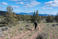
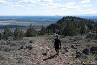
Your new road will quickly swing back to the south and you will really start to climb now. In about a quarter mile, the road will also seem to disappear and pretty much just become a path of rocks. Finding your footing isn’t too bad though, and if you are uncomfortable, you can walk just off the road (there are rocks here too, just not quite as many and they are hiding in the grass). Its only about ¾ of a mile along this road until you reach the wester summit of Juniper Butte, but you will march up about 600 feet during that time.
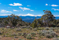
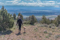
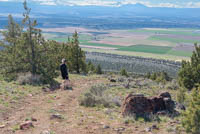
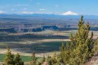
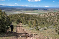
As you head up, the views really start to open up as well. All the Cascades stretching from Mt Bachelor to Mt Adams are visible on a clear day, and, as you get higher, you can all see down into Lake Billy Chinook where it resides at the bottom of some shear cliffs. Once on the western summit, there is a short spur road to the north to offer some views in that direction if you want more. Otherwise, keep heading east towards the true summit.
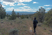
The trail will drip down into a saddle between the two summits where you will see what looks like the top of a silo. It wasn’t blown there from Culver during the latest thunderstorm but is actually a rainwater collector for wildlife in the area. Make the short climb up the next will and find yourself on top of Juniper Butte. If you're not sure you're there, look around some for the USGS marker. That’s the key. There are juniper trees (weird) blocking some of the view, but Mt Jefferson seems larger than life form up there. Once you're satisfied and tired of the wind, just head back from whence you came.
Directions
To reach the Juniper Butte “Trailhead”, take Highway 97 12 miles north of Redmond or 12 miles south of Madras, and head west on Monroe Lane, just on the south side of Juniper Butte. Follow Monroe Lane for about ¾ of a mile until it starts to veer to the left and take the dirt road to the right that continues straight ahead (west). There are a couple gates along this road, but they are usually open. Follow this relatively easy dirt road for about half a mile, and then find somewhere to park near the junction with a road heading north/south. There are some wide, grassy areas off the road to park here.
Things to Know
Passes: No passes are required.
Dogs: Allowed and must be on a leash or under voice command at all times.
Usage: Light
Open Season: Open and accessible all year, altough you may have to start the hike closer to Monroe Ave depending on conditions. The trail may be covered in snow or will be muddy or icy at times in the winter.