Marion Mountain
Length: 11.0 miles
Elevation Gain: 2,050 feet.
Marion Mountain is the northeastern most prominent point on a ridge of peaks that make up the western border of the Eight Lakes Basin. The basin has become somewhat forgotten over time since the devastating effects of the 2003 B&B Complex Fire, but the forest is slowly returning and this hike offers a little of everything. If you plan on hiking into this area, just prepare yourself for a whole lot of “Marions”.
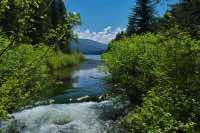
The hike begins from the Marion Lake Trailhead, just east of Marion Forks. Head out of the south side of the parking area, near the toilet, and begin your slow climb through the forest. There are some old growth Douglas Firs along this stretch of trail that are absolutely enormous. You will first reach Lake Ann in about 1.5 miles and 600 feet of climbing. As you approach the lake, you will walk through a section of trail as it passes over a field of rock. If you listen here, you can hear the outlet of Lake Ann rushing through the rock beneath your feet.
Shortly after passing Lake Ann, you will come to a trail junction with the Marion Lake trail heading to the left and the Marion Outlet trail to the right. Take the outlet trail and climb until you reach the top of a little hill, less than a 1/10 of a mile from the trail junction. Here, there will be a user trail heading off to the right and at the time of this writing, there were a couple of logs laying across it. This trail takes you to Marion and Gatch Falls, one of the more impressive waterfalls I have seen and definitely worth the short detour. The trail is easy to follow until you reach the creek, and then it kind of disappears into a mess of old, fallen timber that is rotting away. Just head downstream until you see the trail again. From here, the path gets extremely steep and slippery in places as the mist from the falls coats everything. Once you reach a nice viewpoint of Marion Falls, don’t stop, but keep heading down. Gatch Falls is just below it, and seeing both falls lined up together at the same time is an amazing experience. In all, it is only about 0.3 miles from the trail down to the falls.
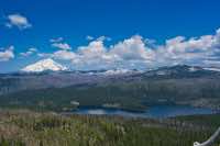
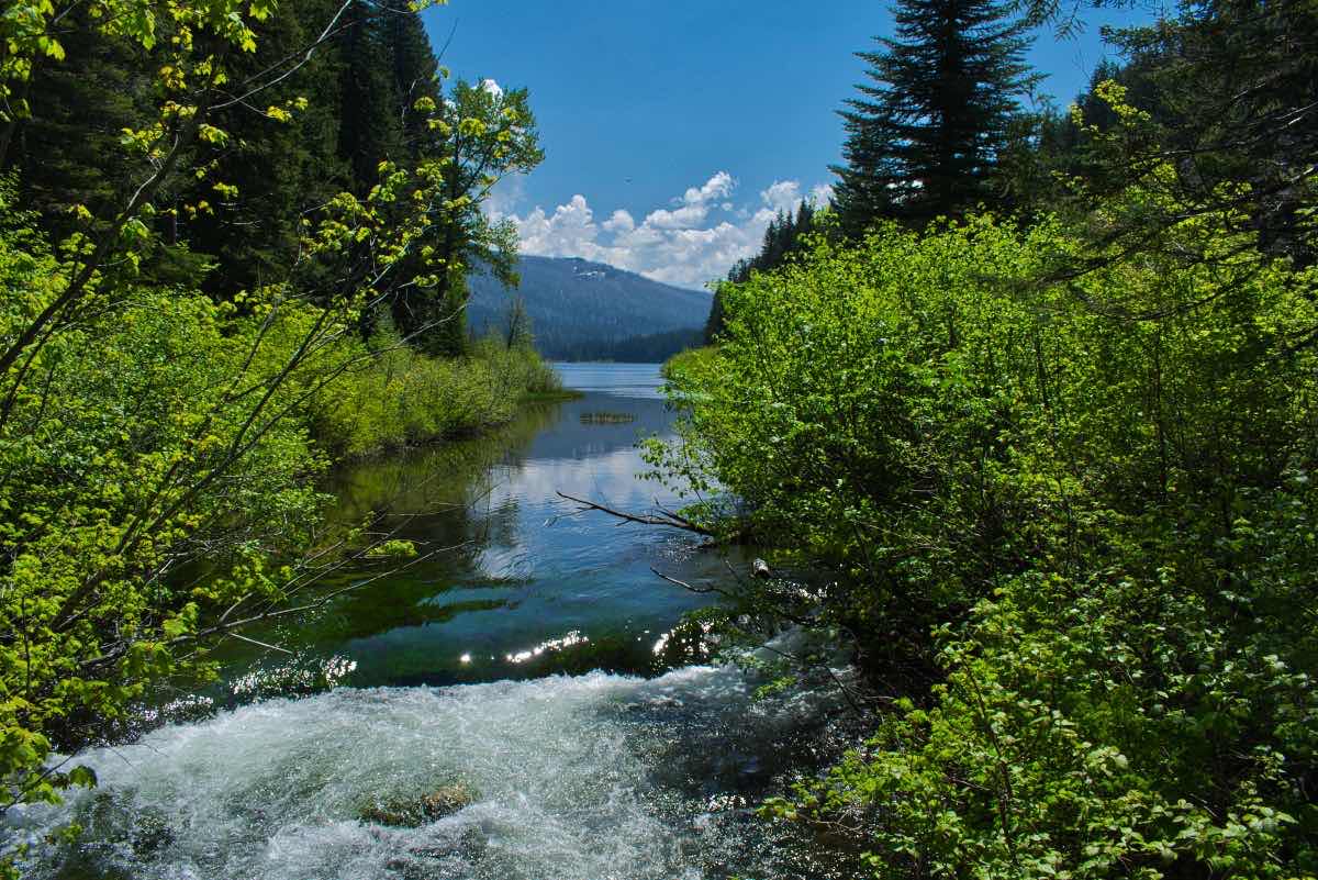
Once you’ve had your fill, climb back up and head back to the trail. Follow the outlet trail for about half a mile until you reach the junction with the Blue Lake Trail. Head over the bridge that crosses Marion Creek right at the outlet of Marion Lake and begin your slog up Marion Mountain. (See all those Marions). The trail climbs steadily up the ridge to the west of Marion Lake for the next mile, passing between burned areas and forest. As you climb, you will also notice Mt. Jefferson coming into view behind you. After a mile, you will come to another junction with the Pine Ridge Trail. Head right onto this trail and begin looping around the northwestern face of the ridge. This section of trail is a tad overgrown, with brush scraping your legs for much of its length and more than a few trees to clamber over.
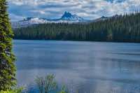
After 0.8 miles on the Pine Ridge Trail, you will come to the final intersection, with the Marion Mountain trail heading to your left. Make the left and climb the final 400 feet to the old lookout spot. From here, the views open up to you, with Mt Jefferson and Three Fingered Jack rising just on the far side of the valley. Have a nice snack and head down. Once you recross the bridge over Marion Creek this time, however, head to the right and walk along the lake shore. Maybe even head down for a quick dip or to soak your aching feet. This trail follows the northwestern shore of Marion Lake for .7 miles before intersecting with the Marion Lake Trail. Head left here and travel another 0.4 miles before re-encountering the junction with the Marion Outlet Trail. Continue to your right, heading down, and you will be back at the trailhead in no time.
Directions
To reach the Marion Lake Trailhead, head to the “town” of Marion Forks on Highway 22, about 15 miles north of the Santiam Junction or 16 miles east of Detroit. Head west on Marion Creek Road and the trailhead is 4.5 miles ahead. The first mile or so of the road is paved and it is gravel after that. The road doesn’t have anything in it that would preclude a passenger car from making the trip, although there are quite a few potholes to watch out for and it seems like some may span the entire road.
Things to Know
Passes: A Central Cascades Wilderness Permit is required to access this area between June 15th and October 15th. The permits will be available from recreation.gov and will go on sale in early April. A Northwest Forest Pass is also required to park at this trailhead.
Dogs: Allowed and must be on leash or under voice command at all times.
Usage: Heavy
Open Season: Trails will usually be snow free in June.
Bugs: Mosquitos can be bad during the melt season, usually June-July, then will mostly clear up moving into August.