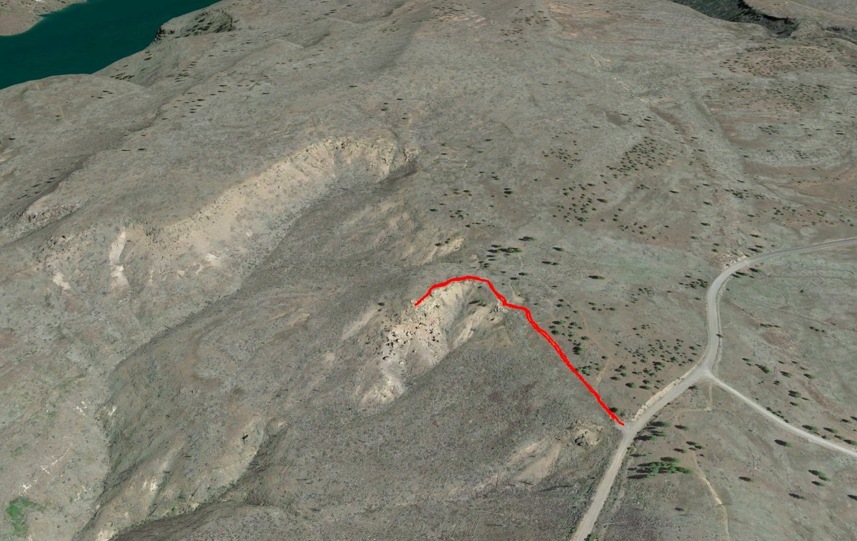
The Metolius Balancing Rocks
Distance: 0.5 miles.
Elevation Gain: 30 feet.
Viewing the Metolius Balancing Rocks for yourself is a surreal experience, one where your left scratching your head, thinking, “that can’t be natural”. Oh, but it is. The balancing rocks are just another weird result of Oregon’s volcanic legacy. This area was formed from three different layers of volcanic tuff, settling over the top of one another. Tuff is created when a volcano blasts rock, ash, and magma into the air. As the material settles back to earth, if it is compacted and cemented into a rock, that rock is known as tuff.
In the case of the Balancing Rocks, the tuff on the lower layer was much softer than the upper layers. This has resulted in the lower layer being eroded away more quickly, leaving just the spires on which the rocks sit. The “rocks” are actually larger remains of the upper, harder layers of tuff. But it really looks like someone is just playing a joke on us and set these boulders on all these nice little mounds.
The hike to the Metolius Balancing Rocks is pretty straight forward. The major downfall of this place is how far away it is from everything for such a short stroll. It’s only a half mile round trip and follows a nice gravel path that hugs the edge of the canyon. The balancing rocks will come into view pretty quickly over the edge of the canyon. The trail winds up rounding a corner and terminating on a viewpoint right above the rocks.
This location was kept a close guarded secret to protect it from vandalism until a fire in 2002 torched the area, removing the forested camouflage the rocks were hiding in. Now, the site is much more well-known and the secret is up. Homeward Bound even filmed a scene here, as the dogs ran from a cougar. So be a part of Central Oregon cinematic history and visit the site for yourself. Just don’t be a jerk and look, but don’t touch.
Directions
To reach the Metolius Balancing Rocks, head towards the Cove Palisades State Park from Culver Oregon. This involves some 90 degree turns here and there as you work your way through farm country, but signs mark the way. You will drop down into the Cove Palisades State Park and then head over the Crooked Arm of Lake Billy Chinook on your way into the park proper. The road will wind through the park and then pass over a one lane bridge over the Deschutes Arm. The road will get very windy as it travels back up the canyon towards Granview.
Although in the middle of nowhere, reaching the Balancing Rocks isn’t too confusing. Stay on Jordan Road is it whips though a couple of 90 degree turns before making a left onto Graham Road. The path will be the best condition, only paved road to follow. Stay on Graham Road for 4.6 miles as it heads west and then turns into Montgomery Road as it rounds Fly Lake. The road will continue down a draw and then up the far side. In 2.5 miles, you will reach an intersection with Forest Road 1170. Here, both roads will turn to gravel. Head straight and the parking area for the Balancing Rocks will be on your right in 0.1 miles.
If you are coming from the west, and are comfortable driving for about 30 miles through forest roads, the Balancing Rocks can also be reached from the Sisters area. Take the turnoff off onto Forest Road 11 at the sign for Indian Fords Campground, 6 miles northwest of Sisters on Highway 20. The forest road will remain paved for 5 miles or so before transitioning into gravel. Remain on the 11 road for 17 miles as it winds its way through the forest. This would not be an advisable route to take in the winter as you are very likely to encounter snow. After the 17 miles, you will make a right on in Forest Road 1170. Follow 1170 for 3 miles until you reach the intersection with Montgomery Road. Make a left and the trailhead will be 0.1 miles ahead on your right.
Things to Know
Passes: None
Dogs: Allowed and must be on leash or under voice command at all times.
Usage: Light
Open Season: Open year round. Can get very hot in the summer, but the hike is short.


