Middle Pyramid
Distance: 4 miles
Elevation Gain: 1,800 feet.
If you like your hikes short but sweet, and maybe you’re just a little into S&M, have I got a hike for you. The Middle Pyramid in the Old Cascades is an amazing hike, offering jaw dropping views, wildflowers, fall leaves, rocky outcroppings…. Everything your heart could desire in 4 short miles. However, the 1,800 feet you climb in just two miles to reach the summit will test your mettle and make this hike feel like much more than just a quick jaunt through the woods.
The Three Pyramids and like the smaller and older cousins of the Three Sisters. As part of the Old Cascades, they make up the base for the now much taller, and younger, High Cascades. These three volcanic plugs rise steeply above the surrounding landscape, and the glacier carved east faces make them even imposing.
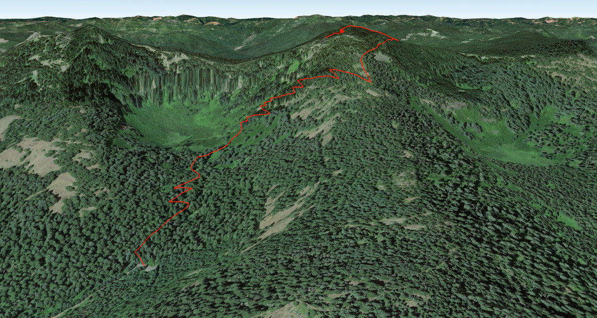
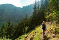
The hike begins at the Pyramids Trailhead which is really just the end of the road. Head down towards a small creek that runs along the road and cross over it on some rocks. Take a right at the trail junction right on the other side of the creek and prepare to climb. You won’t really stop until you reach the top.
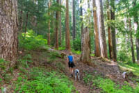
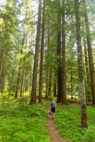
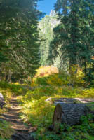
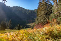
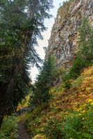
Climb up past a small waterfall and continue into the cliff lined meadows of the glacial cirque. Here, wildflowers will pop up everywhere if you are hiking during the early summer months. The cliffs rise up 1000 feet above you and are blanketed in vegetation. It almost feels like you are in Jurassic Park and waterfalls should be cascading down around you. You can even feel the humidity increase as you enter this bowl.
Keep on climbing as the trail climbs out of the northern wall of the bowl. After about 6,000 more switchbacks, you will start to be able to see sky ahead of you, which is always an encouraging sign. And soon you will top out on the western ridgeline of Middle Pyramid. Don’t get too excited though, you still have about 500 feet of more climbing to go. Here, it kind of looks like Middle Pyramid as a couple of horns, with two rocky pinnacles rising above you. The true summit and your destination is the back one, on the left.
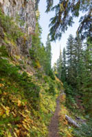
As you climb here, the trail will veer to the right and pass right beneath the rocky cliff face of the northern summit. This is the only flat spot along the trail, so enjoy it. It only lasts about a tenth of a mile. Soon after passing the rock cliff, you will reach a trail junction. Head to the left to continue up towards the summit.
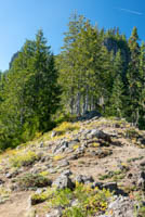
The trail gets pretty steep again, but take heart, you are almost there. After one long straight stretch you will switchback a couple more times, and then they trail seems to end at a saddle. Don’t quit here though, because you aren’t done yet. To your right, there are some boulders along the ridgeline and you can kind of make out what may look like a trail. Climb up through the rocks and after 50 feet or so, you will see the trail again. Continue marching and you will be there before you know it.
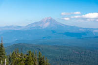
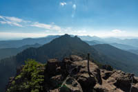
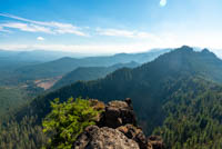
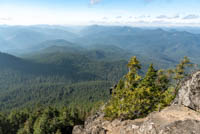
Upon reaching the summit, prepare yourself because you may gasp a time or two. You may notice a pole sticking up out of the ground and some remanent concrete blocks. This little flat area was the site of an old fire lookout what was built in 1934. This makes a great place to grab your lunch and chill for a little bit. And what a place to chill. If you didn’t notice on the way up, this mountain is pretty steep, and it if very noticeable from the top. The mountain seems to drop straight down away from you on three sides, and it leaves you towering over the surrounding landscape. This opens up some great views, ranging from Diamond Peak to Mt Hood on a clear day. The views of the other Old Cascades and valleys to the west and awesome as well. So enjoy it, you earned it. And give your knees a pep-talk for the way down.
Directions
There are a variety of forest roads in the area of Middle Pyramid, so there are several different ways you could approach the trailhead from. Probably the easiest and shortest is to take Lava Lake Meadow Road off of Highway 22, 10 miles south of Marion Forks or 5 miles north of Santiam Junction. Head west on Lava Lake Meadow Road and follow it for 1.9 miles. Right after going over a bridge, make a right onto NF-560. After another 1.8 miles you will cross over another bridge and reach an intersection with a large, logged hill in front of you. Head right and go around the hill for another mile until you reach one last intersection. Stay right here as will and the road will end at the trailhead in about half a mile.
Things to Know
Passes:No passes required
Dogs: Allowed and must be on leash or under voice command at all times.
Usage: Light
Flowers: Flowers will likely be in full bloom during June and July.
Bugs: Don't be surprised to find some swarms of mosquitos during the early summer months.
Open Season: The road to the trailhead will probably melt out sometime in early June and remain open until November. Snow will probably persist on the trail into early July.