Rooster Rock
Distance: 6.5 miles
Elevation Gain: 2,300 feet.
Rooster Rock is a rocky spire, an ancient volcanic plug located on the side of the mountain within the Menagerie Wilderness. The Menagerie Wilderness is a small wilderness area located above the South Santiam River on Highway 20 east of Sweet Home. This area protects a section of the Old Cascades where rocky pinnacles jut up from the forested slopes. While Rooster Rock is the only spire with a trail leading to it, if you have an adventurous spirit, other pillars can be reached with some off trail hiking over steep, rugged terrain. Rock climbers have named these feature an assortment of names over the years, such as Rabbit Ears, Hen Rock, Turkey Monster, and Chicken Rock, leading to the naming of the Wilderness Area.
There are two trails leading up to Rooster Rock, and they are the only two trails within the Menagerie Wilderness. However, unless you are in a hurry to get up to the ridge top, or just like punishing yourself with straight uphill climbs, the longer Trout Creek Trail makes for the more enjoyable outing.
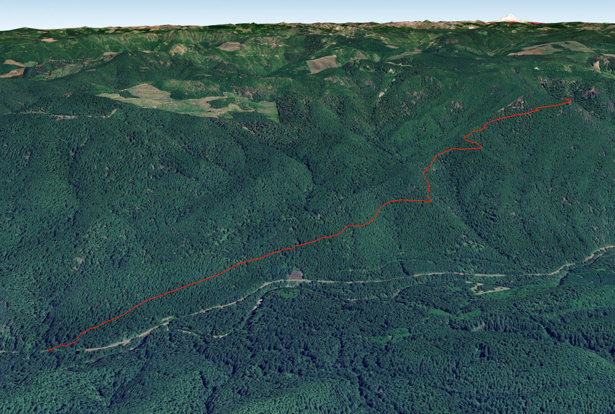
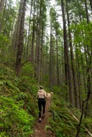
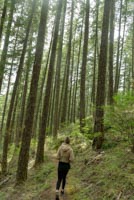
Begin your hike from the Trout Creek Trailhead, a small parking area along the north side of Highway 20. The trail leaves out of the right side of the parking area and dives into a deep forest of Western Hemlock and Douglas Fir. Rhododendrons are also prevalent along the lower slopes and will be in full bloom usually from late June to early July.
The trail begins climbing fairly quickly and doesn’t really stop until you reach the end. But it does get steeper as you go so you have that to look forward to. The trail kinds of just winds its way up the side of the mountain. There will be a couple side ridges that you round as you climb. After rounding the first one, you should likely finally lose the highway sounds coming below you. And, as you round the second, about 2 ¼ miles into the hike, you will be able to see Rooster Rock and Chicken Rock below in rising above the trees on the mountainside ahead of you. It will still look a ways away, but you are getting closer.
Less than half a mile after rounding the last crest, you will reach the junction with the Rooster Rock trail. Sta to the left and keep climbing. They trail gets noticeably steeper here which, frankly, kind of sucks. But you will also enter a cool section of Madrone trees, but also watch for poison oak. Head up a couple switch backs and you will find yourself at the rocky base of Rooster Rock. Unfortunately, because of the thickness of the forest, you can’t really get a good view of Rooster Rock unless you want to scramble down a climber’s trail to the east of the pillar. You may also notice some large bolts on the rock. These held ladders that used to lead up to a lookout that was perched on top of Rooster Rock until 1963.
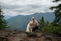
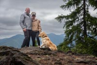
While you are at Rooster Rock, the namesake of this hike, just going a tiny bit further will get you to some sweet views of the South Santiam Valley. Follow the trail as it switch backs a couple times up above Rooster Rock and then bear right to find yourself on Rooser Rock Viewpoint. This site was once the site of a small cabin for lookout staff and offers a sweet view up the valley. But not Rooster Rock, unfortunately.
If you are still wanting to explore, there is a climbers trail that follows the ridgeline to the north. From here, you can probably spot some of the other formations through the trees, but keep in mind that the northern end of the wilderness area is closed from January 15 – July 31 to protect Peregrine Falcons.
Directions
The Trout Creek Trailhead is located on Highway 20, about 22 miles east of Sweet Home or 15 miles west of Tombstone Pass. The trailhead is on the north side of the highway and is a small parking area, about 500 feet east of the Trout Creek Campground. There is only enough room for probably 6 or 7 cars, but it is rarely busy.
Things to Know
Passes:A free self issue wilderness permit is required from June 15th to October 15th.
Closures:The trail is open year round, but if you are looking to do some additionaly exploring, the northern portion of the wilderness area is closed from January 15- July 31 to protect Peregrine Falcons.
Dogs: Allowed and must be on leash or under voice command at all times.
Usage: Light
Flowers: Rhododendrons will likely be in full bloom in late June to early July. A spattering of other flowers will likey be present in the late spring and early summer months.
Open Season: The trailhead is accessible year round and this area is below the regular snow line, but snow storms will likley leave the area blanketed in the snow in the winter months and don't be surprised to find some lingering snow in the higher reaches during those times.