Mirror Lake
Length: 4.1 miles
Elevation Gain: 650 feet.
Mirror Lake is one of the most popular destinations for day-hikers in the Mt Hood National Forest. The beautiful lake sits in a small basin high on the slopes of Tom Dick and Harry Mountain and the views across the lake to towering Mt Hood are stunning. Thus, visiting this lake in the winter could be one of the best times to make the trek. There will be less people (although still don’t except solitude by any stretch of the imagination), and the snow blanketed area around the lake is magical.
Begin your snowshoe from the Mirror Lake Trailhead located just to the west of the Ski Bowl West parking lot. The popularity of the trail, combined with its low starting elevation, means you probably won’t need snowshoes at the beginning of your adventure. However, if you decide to forgo on snowshoes at the beginning, it is best to wear microspikes or some other traction device. Even though there may only be 2 or 3 inches of snow, it is likely that the trail will be solid ice. As you gain elevation as you move towards the lake, the snow will also deepen up, so plan accordingly.
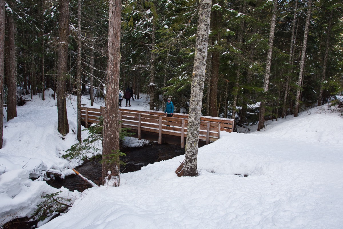
As you leave the trailhead, you will first march down a series of switchbacks towards Camp Creek. The Forest Service moved the trailhead to its current location in 2018 to lessen congestion along the highway, and first mile of the new trail is wide and pleasant. There are also 9 beautiful new bridges to cross during the first mile or so, helping to keep things interesting as you trudge through the forest.
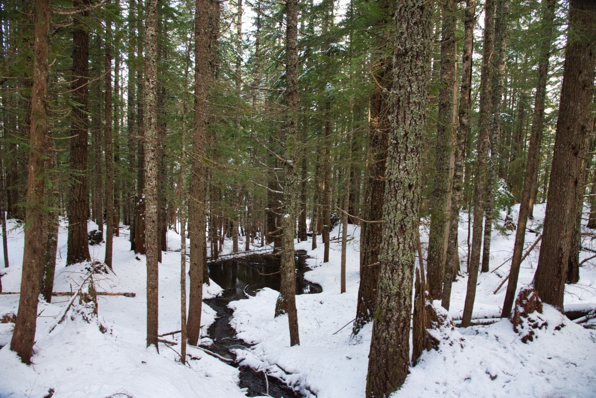
The trail is relatively level for the first mile or so, following that initial decent down to Camp Creek. There will be some slight ups and downs as you traverse the hillside, but nothing crazy. The thick canopy of Douglas fir, western hemlock, and red cedar will cast a pleasant green glow along the trail.
At the 1.1 mile mark, you will reach the intersection with the old trail (but probably won’t know it. It has been closed off and covered in downed trees), and things will start to get a little more challenging. The trail takes a hard turn to the left and begins to steeply climb to the lake. You will ascend over 400 feet in less than a mile. The trail also narrows up considerably here and will begin to switchback up the mountainside. Take caution, as passing other snowshoers can be difficult along this stretch.
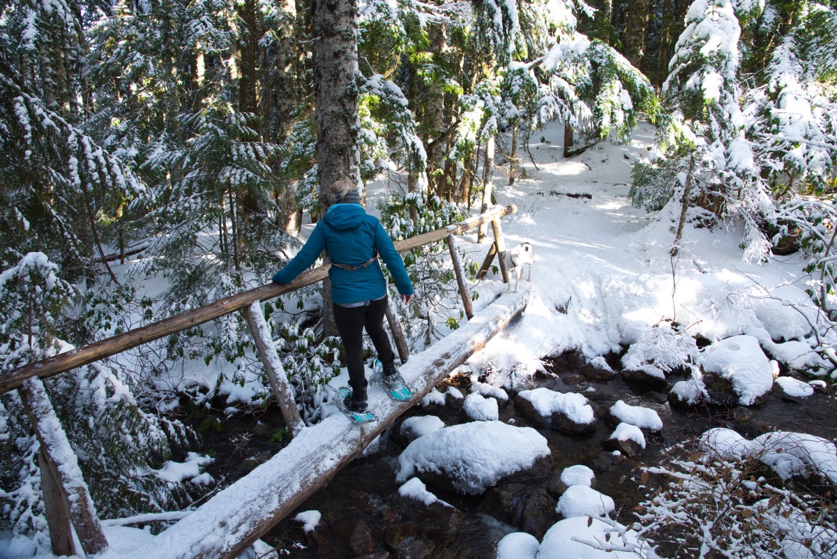
At the 1.8 mile point, you will reach the junction with the Mirror Lake Loop Trail. You don’t need to snowshoe around the lake to get the best views, but it’s a short loop and you’ve come all this way, so why not march around it. But, just as a forewarning, if you do decide to head left at the junction and continue around the lake, you will have to cross the 10th and final bridge over Mirror Lake Creek. This bridge is merely a log with a hand rail. While crossing a bridge like this is easy in the summer, it can be much more challenging while wearing snowshoes.
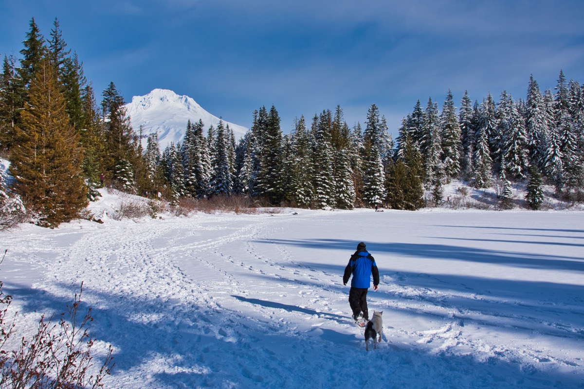
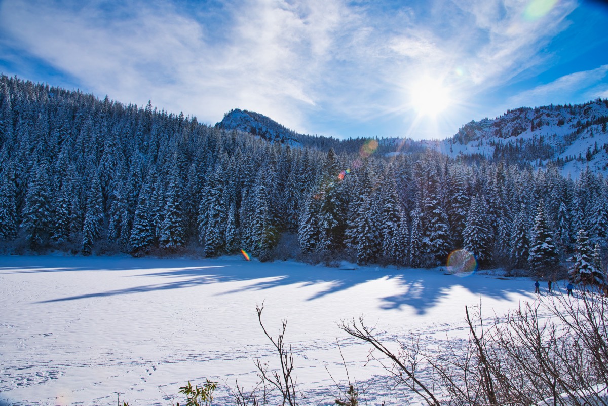
Once over the bridge, the trail will finally emerge into some sunshine. The ridges around the lake are covered in snowy trees and Tom Dick and Harry Mountain dominates the skyline across the lake. Continue along the narrow trail, ducking under the occasional low hanging tree, as you proceed around the east shore of the lake. As you make your way around the lake towards the western shore, you will find yourself in a nice marshy area, covered in snow. From here, as you look across the lake, you will see the iconic image of Mt Hood rising 7000 feet above you.
The loop is only half a mile around and once you have found yourself at the perfect lunch spot on the west side of the lake, you will have almost completed it. When you are ready to head back, follow the trail up into the trees and you will quickly come to another trail junction. Heading left will take you all the way up Tom Dick and Harry Mountain. So head right, march past some camping spots along the lake, and find yourself back at the beginning of the loop in a tenth of a mile. From here, it is a simple matter of retracing your steps back to the trailhead.
Directions
The Mirror Lake Trailhead is located right off of Highway 26, just west of Government Camp. If you’re coming from Portland, take Highway 26 for about 37 miles past Palmquist Road when leaving Gresham. Look for the turnoff for Ski Bowl West. The trailhead is located on the west end of the parking area.
If you are coming from the east, take Highway 26 for 64 miles past Madras. Continue past the Government Camp Rest Area for 2 miles, watching for the Ski Bowl West turnoff on your left. You will want the second entrance into the Ski Bowl West for the fastest access into the trailhead. Or you could drive through their parking lot too, if you take the first one. Not the end of the world with either decision.
Things to Know
Passes: An Oregon Sno-Park permit is required November 1 through April 30.
Dogs: Allowed and must be on leash or under voice command at all times.
Usage: Heavy
Open Season: There will usually be snow cover from December to some time in April.
Caution: Blue Diamonds have not yet been installed on the trail. Although the trail is well traveled and packed most of the time, if you and snowshoeing during or immediately after a storm, route finding skills would be required.