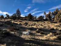
Badlands Rock
Length: 7.9 miles
Elevation Gain: 150 feet.
The Oregon Badlands offer a diverse landscape for adventurers who wish to explore the Central Oregon high desert and they make a particularly alluring destination during times of the year when higher elevation trails are blocked by snow. The Badlands were formed about 80,000 years ago when a lava tube flowing beneath the area formed a hole in its roof, allowing lava to boil out in all directions. The area is now home to some of the oldest Western Junipers in Oregon (some more than 1,000 years old), as well as numerous bird and wildlife species, such as golden eagle, sage grouse, prairie falcon, mule deer, elk, and pronghorn.
The hike to Badlands Rock and Flatiron Rock begins at the Badlands Rock trailhead, just off of Highway 20 east of Bend. The trail leaves the parking area from the northeast side, just to the right of the outhouse. The trail is relatively flat with small ups and down as it very slowly climbs towards Badlands Rock. The most challenging aspect of the hike is the extremely sandy soil you will be walking on. This soil is actually volcanic ash remnants from the eruption of Mt Mazama 2,500 year ago, which formed Crater Lake.
The hike can get a little confusing at times, with lots of different trail junctions and not very good signage. In addition, with the lack of ground vegetation, it can be hard to tell where the trail is and where there is just open ground. Having a map or GPS with you to guide you along the correct trail helps immensely. You will hit your first 4-way intersection after only ¼ mile. Continue straight ahead at this junction.
At roughly 3 miles into the hike, you will reach Badlands Rock. The rock formation rises like a castle out of the sand and juniper. If you feel comfortable in your scrambling ability, the view of the mountains from the top if very nice. The trail can be hard to find from this point, but it passes in front of the rock formation and to the west. This section of trail is known as the Castle Trail. In about ¾ of a mile, you will reach another rock outcrop known as the Castle, and less than a half mile later, you will reach the junction with the Flatiron Trail. Flatiron Rock is right in front of you as you hit the T in the trail. Take a left and start making your way back to the trailhead.
Continue south on the Flatiron trail for about another mile and a half until you start to hit a junction with a number of other trails. Look for the Homestead trail which will continue to the southeast. Two other trails branch off here and head to a different trailhead. You will follow the Homestead trail for the next two miles until you reach the very first trail intersection you encountered on the hike. Turn right and march the final ¼ mile back to your Subaru you yuppie bastards.
Directions
Head east on Highway 20 about 15 miles from the intersection of 27th Street. You will then make a left on Horse Ridge Frontage Road right in front of a gravel pit. Drive a mile down this road and the trailhead will be on the left. Easy Peasy.
Things to Know
Passes: No passes are required.
Dogs: Allowed and must be on leash or under voice command at all times.
Usage: Light
Open Season: All year but summer can get very hot.


