Gnarl Ridge
Length: 9.7 miles
Elevation Gain: 2,300 feet.
Gnarl Ridge runs up the eastern flank of Mt Hood and offers those with hardy enough legs one of the best views of Oregon’s tallest peak. The hike has fields of beautiful lupine, views of the Newton Clark Glacier, and grants one the opportunity to view one of the largest moraines on Mt Hood, the Newton Clark Moraine.
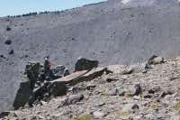
The hike up Gnarl Ridge begins at the Elk Meadow trailhead, near Mt Hood Meadows. The trail travels through a thick forest along the base of the mountain, with occasional openings of Lupine. You will enter the Mt Hood Wilderness at a bridge over Clark Creek. You will then have about another half mile before reaching the infamous Newton Creek. There is no established crossing on Newton Creek, and the gray glacial milk that flows down it makes it impossible to see into the water at all. Luckily, there are usually some logs somewhere that you can scurry across.
After crossing the creek, the trails immediately begins climbing up the flank of Gnarl Ridge. Eight switchbacks and 600 feet of climbing over the course of a mile will get you up onto the ridge. The trail then forks with the straight away path taking you to Elk Meadows. Head to your left up the Gnarl Ridge Trail. The trail continues to make its way up the ridge towards the mountain for another mile. You will then encounter another intersection, this time with the Timberline Trail. Head to the right and begin the 1.5 mile trek around Lamberson Butte towards the terminus of the hike.
You will finally begin emerging from the trees about a mile past the intersection with Timberline Trail. Watch out for the remains of an old CCC warming shelter just before you break out to the edge of the ridge. Once you do reach the ridge, the views can take your breath away. Mt Hood and the Newton Clark glacier tower above you, sending countless waterfalls down the cliffs to the valley below. Across the valley, the Newton Clark Moraine looms large. During previous Ice Ages, the Newton Clark Glacier carved its way down the mountain, but split when it encounter some harder layers of rock. Once it split, it carved two separate canyons down the mountain’s flank, pushing hundreds of millions of tons of rubble to the island between the two arms, creating this medial moraine. Gazing down form the top of the moraine to the crashing Newton Creek below helps to illustrate just how deep these glaciers once were.
From here, you have a number of options. You find yourself on one of the highest points of the timberline trail. You can continue a little higher, as the trail continues along the ridge for another half mile or so, and climbing an additional 500 feet. A scramble up the rocky Lamberson Butte behind you offers some dramatic views as well. Or you can just enjoy the view from here and then continue on your way.
Once you decide to head back down, walk the 1.5 miles back to the intersection of the Gnarl Ridge and Timberline Trails. This time, however, stay on the Timberline Trail and head down the Newton Creek canyon. Once again, you will have to cross Newton Creek, and this crossing can be a little more difficult. There usually aren’t the large trees laying across the stream like lower down, but often times, hikers have MacGyvered some kind of makeshift bridge out of small logs or something. Trekking poles can defiantly help for balance if you are unsure of yourself.
After crossing the stream, continue on the Timberline trail for another 0.4 miles as you climb the 200 or so feet out of the canyon. Then, take the Newton Creek Trail as it heads down the ridgeline above Newton Creek. There is one location were the trail travels right on the edge of the canyon, offering some heart stopping views if you aren’t a fan of heights. In 1.8 miles, you will reconnect with the Elk Meadows Trail. Turn left and finish off the final mile so you can hop in your car and dump all the crap out of your shoes.
Directions
The trail to Gnarl Ridge begins at the Elk Meadows trailhead near Mt Hood Meadows Nordic Center. To reach it, travel 7.2 miles east on Highway 35 from the junction with Highway 26, and make a left just after passing over a small bridge over Meadows Creek. The trailhead is on the right side of the road, about .3 miles from this intersection. Don’t take the main Mt Hood Meadows exit off of 35, as this will take you to the wrong part of the ski area. The turn off you are looking for is a little more than a mile further down the road.
Things to Know
Passes: Northwest Forest Pass is required at this trailhead. A free, self-issue wilderness permit is required upon entering the wilderness.
Dogs: Allowed and must be on leash or under voice command at all times.
Usage: Moderate
Open Season: Higher elevation trails usually melt off sometime in July and remain open until the first snow falls.
Bugs: Mosquitos can be bad during the melt season, usually June-July, then will mostly clear up moving into August.
Flowers: Different flowers will bloom depending on elevation, but July and early August are usually peak months.