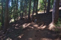
Lucky Lake
Length: 2.5 miles
Elevation Gain: 400 feet.
The Lucky Lake Trail is a great opportunity for hikers that can’t (or don’t want to) cover long miles but still want to visit an alpine lake in a wilderness setting. Lucky Lake itself is a beautiful blue lake, surrounded by forest with the Cascades reflecting in the water from its southern shore. The water is surprisingly warm, making this a great destination for kids as well. Nothing is more memorable than the reward of an afternoon of splashing around a lake after a little sweat through the woods.
Begin your hike from the Lucky Lake Trailhead on the Cascade Lakes Highway. This trailhead is located a little further away from Bend than many of the more popular lakes, helping to keep the crowds down. The trail leaves from the parking area and quickly crosses a powerline road cut through the trees. Picking up the trail on the other side of the road is easy as you move onto a trail intersection. Here, heading left will take you to the horse parking area of the trailhead, so go left instead and begin your march up to Lucky Lake.
The trail to the lake is only 1.25 miles, and the climb is relatively gradual, but steady. As you start to notice the terrain falling away from you to your right, keep your eyes open for glimpses of Mt Bachelor through the trees. As you continue to climb, the forest will also transition from a more open, Lodgepole Pine woods to thicker stands of Hemlock and fir. Just shy of a mile in, you will encounter your one and only switchback as approach the lake.
As you reach the lake, you will find yourself on the southeastern corner and at a trail junction. The Senoj Lake Trail continues up the eastern shore of Lucky Lake and, if you have 8 more miles left in you, will take you all the way to backward Jones (I’m pretty sure that’s where Senoj came from) Lake. If not, the eastern shore is lots of good swimming areas, with a sandy bottom that gets deep relatively quickly, but not too quickly.
If you head to the left at the junction, you will merge with the Metolius Windigo Trail. This is a long distance horse trail that extends from near the Mt Jefferson in the north to Windigo Pass south of Diamond Peak. This trail will take you along the south shore of Lucky Lake. The swimming isn’t as good along the south shore, as there are a lot of logs piled up here and the it fairly shallow and mucky for a while, but you will find some amazing views of the Cascades over the lake as you proceed. If you desire, there is a faint user trail that will circle the lake, but, primary along the western shore, it can be hard to follow and you will likely be climbing over a fair number of downed trees.
Directions
From Bend, take the Cascade Lakes Highway towards Mt Bachelor. Follow the highway for 36 miles, or 17 miles past Mt Bachelor, and look for the trailhead sign on your right, just half a mile past the entrance to Lava Lake.
If you are coming from the south, or from the Eugene area, take Willamette Pass (Highway 58) 13 miles northwest of Highway 97 or 37 miles southeast of Oakridge. Here, head east on to the Cascade Lakes Highway for 3.2 until reaching the intersection with the Crescent Cutoff Rd. Make a left to remain on the Cascade Lakes Highway and the trailhead will be 31 miles ahead, on your left.
Things to Know
Passes: Day users are required to have a Northwest Forest Pass at the trailhead. Beginning in 2021, between the Friday of Memorial Day Weekend and the last Friday of September, backpackers will be required to obtain a Central Cascades Wilderness Permit, which can be used in lieu of the Northwest Forest Pass.
Dogs: Dogs are required to be on leash or under voice control at all times.
Usage: Light.
Open Season: The Cascades Lake Highway from Bend usually opens around Memorial Day, but the Lucky Lake trailhead can generally be reached from the south a couple weeks before then entire highway has openned.
Bugs: Mosquitos will likey be present during the snowmelt, usually June into July, but will largely clear out after that.


