Potlid Trail
Distance: 6.4 miles. (one-way)
Elevation Gain: 2,000 feet.
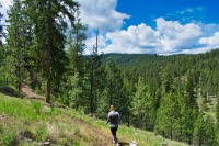
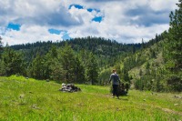
The Potlid Trail in the Ochoco National Forest is a great point-to-point hike through a sea of towering Ponderosa Pines and flower filled meadows, if you have access to a shuttle. If not, you could hike up from the northern trailhead or down from the southern to wherever you feel like turning around. There isn’t a major destination-like site along the trail, but it is a very gratifying hike through the woods. Plus, if you are looking for a chance to get some vertical in, the 2,000 foot climb from the north to south trailhead isn’t too bad of a workout.
We started our hike from the northern trailhead, mainly because my wife said we needed the training for our summer backpacking plans. You can start from wherever you choose, but the description will be from the northern trailhead, up the southern, where we had stashed our shuttle. When you do hike the trail, also be on the lookout for mountain bikers flying down the trail. While it is not frequently used, the Potlid Trail is a fun mountain bike downhill route.
Head out of the northern end of the trailhead and find yourself immediately facing Trout Creek. There is a nice log across it if you don’t feel like wading. Your call. The trail will then begin to swing to the left and you will start climbing. This trail is a nice mix of steep up-hills, slow, steady up-hills, and flat spots intermingled with the up-hills. The bottom end of the trail is also characterized by nice, green, grassy meadows, especially in the spring and early summer.
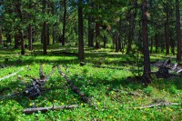
The Potlid Trail crosses three main, gravel roads on its way up the mountain. You will cross the first one around the 2 mile mark. You will know you are getting close when the trail gets steep again and the canyon drops steeply off to your right. After crossing the first road, the meadow areas are not quite as common, but you will start to enter some beautiful stands of red-barked Ponderosa Pine. You will cross the road you likely drove in on a mile after the first crossing. There are some spectacular groves of Pondos after this crossing./p>
The final gravel road will be crossed near the 4 mile mark. After this crossing, the terrain will start to shift from grassy, Ponderosa stands to a more of a rocky landscape with bare ground and firs and Western Larch mixed in with the trees. You will continue to climb steadily for another 1.5 miles as you approach the summit of the breaks between McKay Creek to the south and Trout Creek to the north. The final mile is relatively flat, with some ups and downs, as you work your way through a fairly recent timber sale and your shuttle you so cleverly stashed at this trailhead.
Directions
Both Potlid Trailheads can be reached from Prineville, and are only a 15-20 minute drive or so from each other, making arranging a shuttle not to difficult. Head out of Prineville by heading north on Main Street from downtown. Main Street will turn into McKay Road and eventually into Forest Service Road 27. Just stay on the paved road and it will take you all the way to the southern trailhead. After 21 miles, the road will take a very sharp turn to the right, with a gravel road heading straight ahead. Make a note of this spot. Continue on the paved road for 1.7 more miles and the trailhead will be on your left.
To then head down to the northern Trailhead, head back the way you came to that very sharp corner, and then head right down the gravel road. At first, things can get a little confusing, because it seems like about four other roads branch out in every direction. You will want the straight path. There will first be a road heading to your left. Don’t take it. Then right after, another road will veer to the right. Don’t take that either. Following those intersections, you will continue down the road for 3.4 miles until you reach another intersection. Here, a road will veer off to your left, but you will want to stay to the right and continue on the road you are traveling. 2.8 miles further, the road will turn to the left as you reach the bottom of the hill. The road will Y again, and you will stay to the left. Head over a cattle guard and the trailhead will be on your left right afterwards.
Things to Know
Passes: No passes required.
Dogs: Allowed and must be on leash or under voice command at all times.
Usage: Light
Open Season: The road to the trailheads is not maintained, and the upper trailhead will likey be buried in snow until early May or so.
Flowers: Spring time should be best, May and June, with different flowers blooming based on elevation.


