Twin Pillars
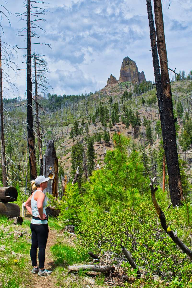
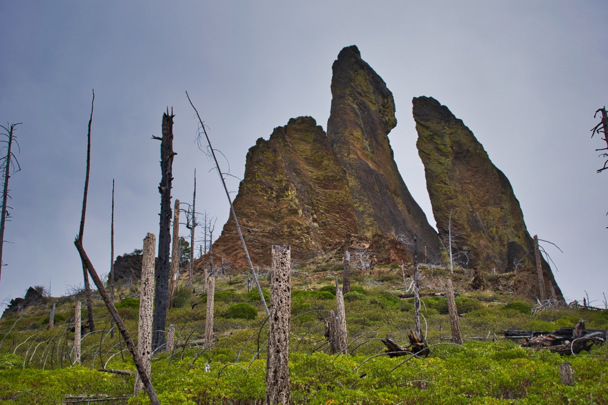
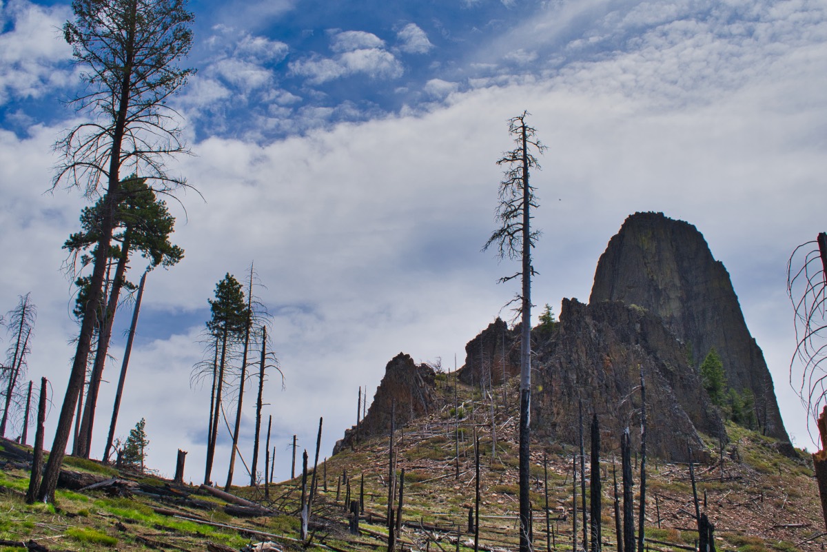
The Twin Pillars are a set of 200 foot spires located within the heart of the Mill Creek Wilderness. The pillars are the volcanic remnants of a 40-million-year-old caldera and continue to stand as weaker material has eroded away around them. The Hash Rock fire burned much of the area around the pillars in August of 2000 which have helped open up views of the pillars and have allowed for snowbrush, grasses, and flowers to dominate the hillsides.
The hike to the Twin Pillars can be done from one of two trailheads, or as a thru hike if you access to a shuttle. This description will describe the hike from the south trailhead up. Why? Well, I suppose I’m kind of a masochist and like going uphill. I’m probably just stupid. So Anyway, if you don’t want to do the thru-hike, turn around at the pillars. Or, if you want to start from the north trailhead, read the description backwards. Like this. “sdrawkcab noitpircdsed eht daer”. Good luck.
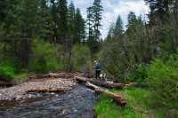
The Twin Pillars trail begins at the South Twin Pillars trailhead, located right before Wildcat Campground. When preparing for this hike, be sure to plan for the seven times you will have to cross the East Fork of Mill Creek, just on the way up. While the first three crossings at the time of this writing had logs that we were able to walk across, the other four did not. During the Fall, the water may be low enough to find places to hop or run across without getting too wet, but I wouldn’t count on it. So be sure bring alternate footwear unless you like hiking in wet boots. And crossing barefoot is a good way to smash your toes on the cobble streambed.
From the parking area, follow the trail to the east and cross the bridge to the group picnic area. Follow some user trails to your left and head through Wildcat Campground. The real trail begins at the back end of the campground with a small gate separating the campground from the wilds beyond (The wilds in this case mostly consisting of cows and sheep. They will be sharing the area with you if you hike during the summer months.).
In less than a quarter mile, you will come to a trail junction. Make note of this one for your return trip if you are not thru-hiking. The right fork will direct you to the Twin Pillars trailhead and the left to Wildcat Campground. It seems like you would want to head right towards the trailhead. You would be wrong, unless you feel like wading across the creek for the 15th time. But that is all for later, now, just keep trucking ahead.
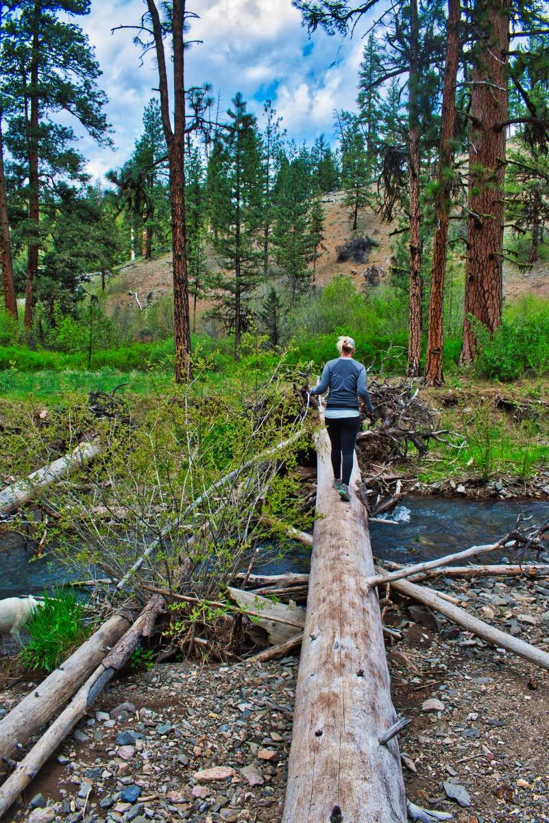
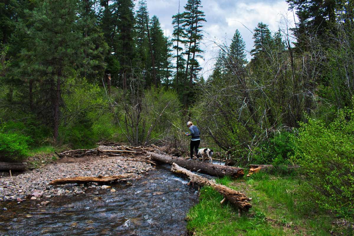
The trail to the Twin Pillars follows the East Fork of Mill Creek, primarily along the valley bottom for the first 3.8 miles of your trek. There will be small ups and downs as you head up the side of the canyon and back down to the creek. The first crossing of the creek occurs 1.2 miles in. From here, they start happening quickly. As of May of 2019, there were logs across the first three stream crossings, but each one gets progressively smaller. The first log appears like it has been there for quite a while. There is even a trail worn through the rootwad on the far bank. By the time you reach the third crossing, it appears that this log is temporally caught up on a gravel bar and may not be the most permanent structure. It could be gone in the next flood. It also moves a little while you are crossing, so if you aren’t super coordinated, it may be easier to just swap out your shoes and wade the stream. After all, the 4th crossing is only 500 feet away and there’s no getting by this one.
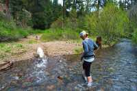
Once you remove your shoes, if you have suitable footwear for walking in that you use for crossing the creek, you may as well leave them off for a little bit. The 5th crossing occurs a mere 375 feet upstream from the 4th, and then it is about 0.4 miles to the 6th crossing. You will only have one more crossing to go at this point) minus the return trip, of course), but it is a good 1.5 miles further upstream, so feel free to lace up your boots once more and keep trekking on for a while. Once you make the final and 7th crossing, you will finally see the Twin Pillars in the distance and will begin climbing up and away from the East Fork of Mill Creek.
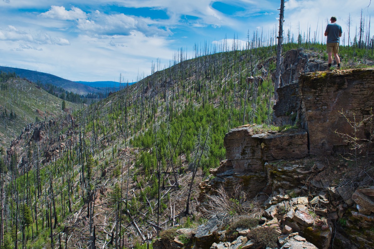
The initial climb away from the creek is short, but very steep. But once you get up a little bit, the views start to open up. This is the heart of the fire from 2000, but the forest is beginning to recover. The sound the wind makes blowing through the snags is kind of creepy and cool as well. You will climb steadily toward the pillars, gaining about 1,100 feet in the next two miles. There will be a brief respite from climbing as you cross Brogan Creek on the way up. Once you get up out of the Brogan Creek Valley, the Twin Pillars appear on the hillside right in front of you. The trail continues to switchback up the mountainside and will pass right by them in another mile.
From the base of the Twin Pillars, the trail circles around the west side of the volcanic plugs. The trail continues to climb the hillside and can get a little brushy, but the views as you round this impressive feature will distract you from the scratching on your legs. It takes less than half a mile to circle around the pillars, but you will climb over 250 feet in the process. The Twin Pillars look dramatically different from all the different angels, keeping your eyes glued towards the sky.
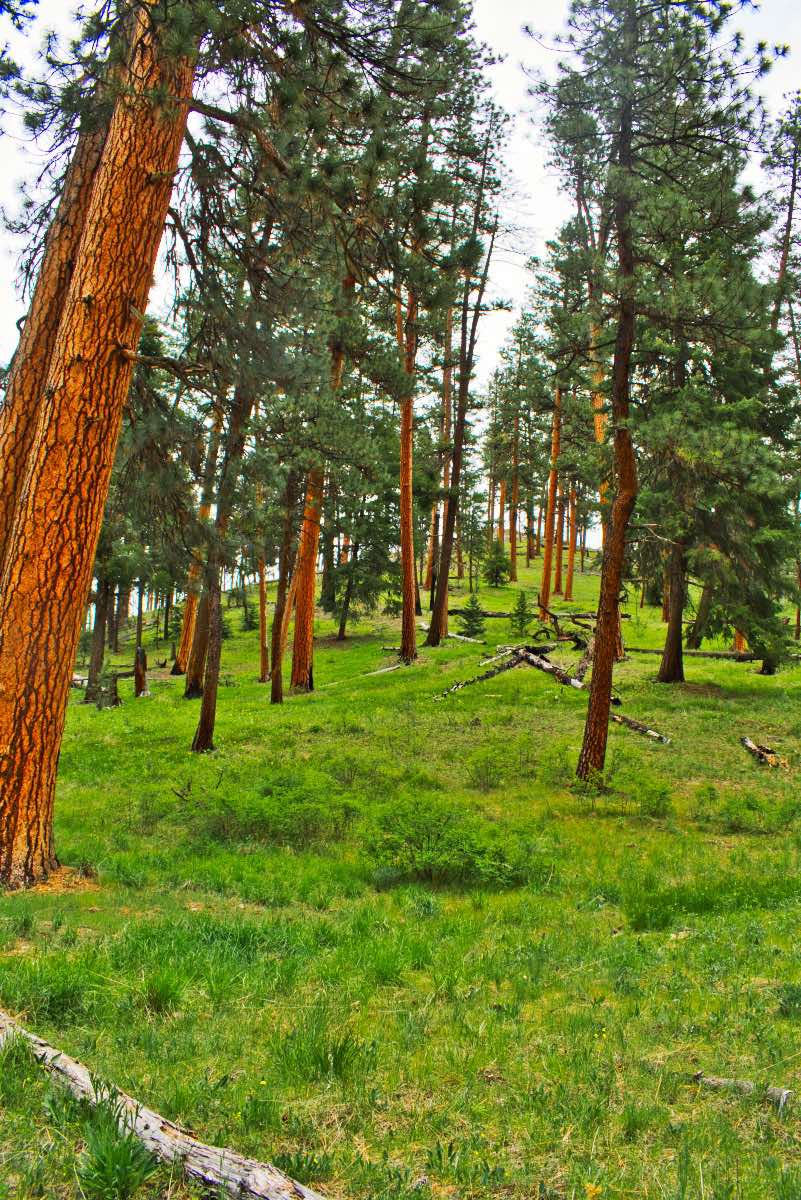
Finally, you will find yourself on the north side of the pillars. The trail continues you climb the mountainside for a little more than half a mile, with more than 400 vertical feet left to the top. You will reach it soon enough, however, and find yourself in a thick forest of small, regrowth lodgepole pine and Western Larch. You will be happy to not be climbing anymore, though, as you plow through the forest for about a mile until you find yourself on the rim of Desolation Canyon.
Desolation Canyon is very steep sided, with some cliff edges you can stand on to take in the view. You can hear the stream crashing through the rocks below you. Once you are content with the world, follow the trail as it descends 400 feet to an area of some beautiful meadows with small streams running everywhere. You may have thought all your fords were done, well you were wrong. Kind of. Depending on the time of year, you will likely have at least 3 creeks and one wet meadow to get through. Luckily, the creeks are all pretty small on this end of the trail, and if you can clear about 4 feet with a good jump, you shouldn’t have to get your feet wet. Once down, it is only about a mile to the North Trailhead and beautiful Bingham Prairie.
Directions
To reach the Twin Pillars South Trailhead, head about 9 miles east on Highway 26 from Prineville, just to the far end of Ochoco Reservoir. There, you will see a sign directing you to the left to head to Wildcat. Follow that onto Mill Creek Road. The road is paved for the first 5 miles and the then turns into a two-lane gravel road. It remains in pretty good shape for the next three miles and then transitions into more of a dirt road for the last two miles. The road is still in relatively good shape, with some washboards and potholes, but if taken slow, most passenger cars should be able to travel on it. Once you cross over a large culvert, the road will split. Stay to the right and head towards Wildcat Campground. The trailhead is on the right side of the road before you enter the campground.
The North Trailhead can be reached by heading north on Main Street form Prineville. Main Street will turn into McKay Rd after a couple of miles. Just keep heading up the valley, veering right whenever the road Ys. The road to the North Trailhead is paved for the vast majority of the trip. It is almost 30 miles from downtown Prineville to the trailhead, and all but the last mile are paved. Once you enter the forest, just remain on the paved road (it will be the only paved option) until you reach the spot where the pavement ends. There will be a sign here, directing you to the right to head to the Twin Pillars North Trailhead. This last mile is pretty bumpy because the road seems to have gotten nailed by a meteor shower and is now full of craters. Most vehicles should be able to navigate it though, if you take it easy. In just under a mile, you will see a sign directing you to the Twin Pillars North Trailhead to your right. Make the turn and you will be there.
The two trailheads can also be connected via forest roads if you are looking to do a shuttle. I will leave this up to you and the suitability of your vehicle and your ability to navigate forest roads.
Things to Know
Passes: A free, self-issue wilderness permit is required upon entering the wilderness.
Dogs: Allowed and must be on leash or under voice command at all times.
Usage: Light
Open Season: The southern trailhead can likely be accessed for much of the year. During the dead the dead of winter, snow may start to make this difficult. The northern trailhead is at a much higher elevation and usually can only be reach between May and November.
Flowers: Flowers are usually blooming in this area in late-May through June.