Santiam Lake
Distance: 9.5 miles.
Elevation Gain: 1,100 feet.
Santiam Lake is a wonderful alpine lake situated near the base of Three Fingered Jack. The hike to this gem will take you through some nice, old growth forest, past Duffy Lake, and through some flower filled meadows. Santiam Lake makes for a great destination to backpack to or day hike. Even though the mileage to the lake is relatively long, the climb is gradual and not too difficult.
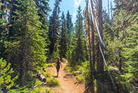
The hike begins from the Duffy Lake trailhead right near the border with the Mt Jefferson Wilderness. The trail quickly dives into a beautiful mixed conifer forest and begins the long but slow climb up to Duffy Lake. The trail is lined with Bear Grass, so if you time your hike right, and it happens to be one of the years when the grass blooms, except to find beautiful stalks of white flows along the path. Mosquitos are also big fans of the area, so if you are here before August, make sure to bring bug spray. And long sleeves and pants. And a mosquito net. And hey, maybe even pull a small trailer spraying DDT so you can walk in a cloud of the chemical. However you feel comfortable.
The trail slowly climbs pretty much the entire 3.3 miles to Duffy Lake. You will come across a few trail junctions along the way, with a trail to the Big Meadows Horse Camp heading to the right almost immediately after the parking area. You will also pass junctions to the Turpentine Trail 1.5 miles in and the Lava Lakes trail right before reaching Duffy Lake. 2.5 miles from the trailhead, you will come to a crossing of the North Santiam River. This is a pretty wide crossing and you will probably have to wade across it. It usually isn’t’ anything more than ankle deep or so, but could always be more. If you are planning your adventure after about mid-July though, the river will likely be dry and this will be nothing to worry about.
As you reach Duffy lake, there will be a whole big junction of trails. The trails to your left are user trails and will make their way to the lake. It’s not far so pick your way through some trees and pop out on the shores of this beautiful blue lake. Duffy Butte’s rocky summit spire will dominate the skyline to the north. This is also were you will start seeing the first impacts of the devastating 2003 B&B fire, which burned much of this area. The water is also surprisingly pleasant, so if you feel like a swim, you should go for it. There are lots of good camping places along the lakeshore if you brought your gear.
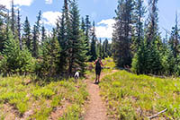
Once you have had your fill of Duffy Lake, head back to the trail junctions and take the southern trail towards Santiam Lake. You will quickly enter a beautiful, wildflower filled meadow just south of Duffy Lake. The trail skirts around the edge of the meadow and then begins climbing towards Santiam Lake. You will reach the junction with the Dixie Lakes trail after ¾ of a mile. If you enjoy meadows, you could head a short distance down that trail and to find another flower-filled meadow with Three Fingered Jack looming in the distance.
Santiam Lake lies about 0.6 miles from the Dixie Lakes trail junction. The trail will stay up above the lake and pass it by, so look for some side trails heading down to the lake after you pass by the signing informing you of no fires with 100 feet of water. The best spot to be on the lake is along the western shore. That way you can see Three fingered Jack rising above its crystal blue water. This lake also makes an ideal swimming spot and has several good camping locations along its shores.
Directions
To reach the Duffy Lake trailhead, take Highway 22 six miles north of Santiam Junction or 26 miles southeast of Detroit and then head East on Forest Road 2267. The road is paved but only one lane with turnouts. Follow the road for 2.6 miles before making a left towards the Duffy Lake Trailhead. It’s only 0.3 miles to the trailhead from here, but he road changes to gravel and gets pretty bumpy. Most cars should be able to navigate it though, if you go slow enough.
Things to Know
Passes: A Central Cascades Wilderness Permit is required to access this area between June 15th and October 15th. The permits will be available from recreation.gov and will go on sale in early April. A Northwest Forest Pass is also required to park at this trailhead.
Dogs: Allowed and must be on leash or under voice command at all times.
Usage: Moderate
Open Season: Most of trail should be melted out sometime in July.
Bugs: Mosquitos can be really bad here during the melt season, primarly June and July. They start to clear up in August.
Flowers: Different flowers will bloom depending on elevation, but July and early August are usually peak months.


