Scott Mountain
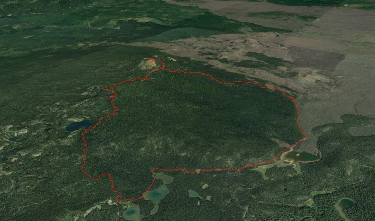
Length: 9.8 miles
Elevation Gain: 1,380 feet.
Scott Mountain is a small summit located just to the west of the McKenzie Pass lava fields. While small in stature, the views from this rounded peak are incredible. The Three Sisters tower to the southeast, granting you views of the mountains that you may be unaccustomed to. The 360-degree views from 6,113 foott summit offer something to hold your interest no matter which direction you face. And the lakes and ponds located along the way make for a very enjoyable outing.
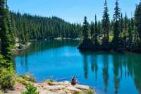
Begin you hike from the Scott Lake trailhead. Head out on the Benson Lake trail leaving from the north end of the parking area, and begin your slow but steady ascent up to Scott Mountain. In just 1.3 miles and about 400 feet of climbing, you will notice Benson Lake’s shimmering blue waters off to your left. There will be a small user trail heading down to it if you would like a closer look. Benson Lake sits in a basin carved by glaciers and covers about 26 acres to a maximum depth of 55 feet. The water is a stunning blue and it makes for an excellent break in the hike.
Once you are finished at Benson Lake, head back up to the trail and continue on your journey. You will pass a number of small ponds hidden in the trees over the next mile as you make your way to the Tenas Lakes junction. There will also be abundant huckleberry and blueberry bushes along this section of the trail, making for a nice little snack if you are there during August/early September. Once you reach the trail junction, head ot the left for 0.1 miles to head down to the Tenas Lakes.
The largest of the lakes covers only 15 acres and is less than 20 feet deep. However, its rocky, cliff lined shores and beautiful blue water make it one of the most beautiful little lakes in the Cascades. You could spend the whole day here, exploring all of the little lakes and ponds and even swimming in the surprising warm (for a mountain lake) water. Alas, more dust is calling you, so once you’ve relaxed for a bit, head on back to the main trail.
Once back on the Benson Lake trail head to the left again and continue towards Scott Mountain. After less than a quarter mile, you will reach an intersection with the Scott Mountain trail. Head to the right and continue climbing towards the peak. You may even see it starting to peak through the trees from time to time. It’s about a mile to the intersection with the Scotty Trail. Stay on the Scott Mountain trail to the left and make the final 0.6 mile push to the summit. The trail can get pretty steep here, but luckily it is in the shade for the majority of the length. Once you start breaking out into some meadows, you will know you are almost there.
After enjoying your summit time, head back down to the Scotty trail and continue on its path. The next 2.2 miles are pretty uneventful after the site filled beginning of the hike, but you do kind of get the sense of being in the deep wilderness. The trail is a little overgrown, but you probably won’t see many, if any, people on it. You could be anywhere as you ramble down the mountainside towards the McKenzie lava flows. Eventually, you will get there, so head to the right on the Hand Lake Trail and begin heading back towards the highway.
The next mile of the trail borders the edge of the lava flow. You will be granted with some welcoming views of Middle and North Sister after that long bout in the woods. Eventually, you will reach where Hand Lake piles up against the end of the lava. Depending on the time of year, the lake or at least most of it can be dry. Continue on the Hand Lake trail (Don’t take the Hand Lake by-pass trail unless you like hitch-hiking) for another mile and a half until you return to Scott Lake and the trailhead.
Directions
From Sisters, head over McKenzie Pass on Highway 242 for 20.4 miles, or 6 miles past the Dee Wright Observatory on the top of the pass. From the valley, head east on highway 242 for 16 miles up towards McKenzie Pass. Follow a dirt road to the west for 0.7 miles past Scott Lake campground. The trailhead is at the end of the road.
Things to Know
Passes: A Central Cascades Wilderness Permit is required to access this area between June 15th and October 15th. The permits will be available from recreation.gov and will go on sale in early April. A Northwest Forest Pass is also required to park at this trailhead.
Dogs: Allowed and must be on leash or under voice command at all times.
Usage: Moderate
Open Season: McKenzie Pass closes seasonally, and is usually only open form July til early Novemeber.
Bugs: This area is a mosquito paradise with all the lakes and ponds. If you go before September, bring some extra blood.


