Tom Dick and Harry Mountain
Distance: 8.2 miles - 8.7 miles with Mirror Lake Loop
Elevation Gain: 1,550 feet.
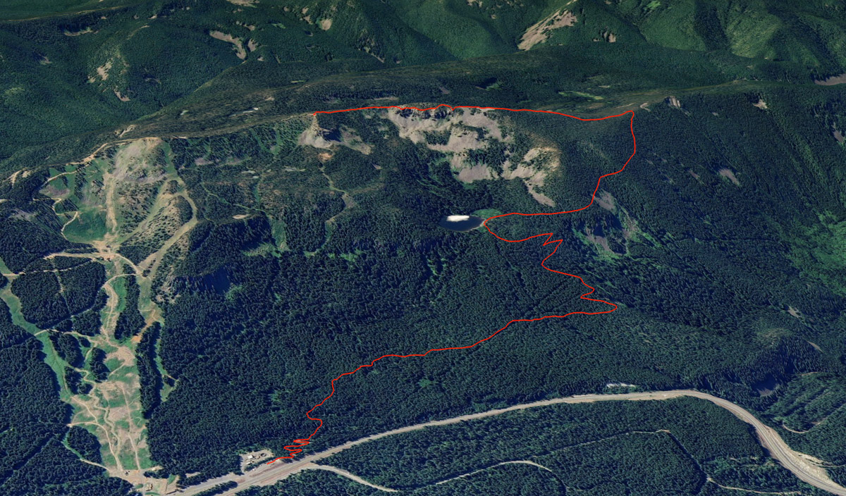
Tom Dick and Harry Mountain is the rocky ridge Skibowl occupies just to the south of Mt Hood. In the summer, it also makes for an amazing hike with some of the best views of Mt Hood and surrounding peaks you can find. Don’t expect any solitude though, as this trail is easy to access right off of highway 26, and shares the first half of the hike with popular and beautiful Mirror Lake. But if you can brave the crowds, or hike at unpopular times, this is a trip you won’t forget.
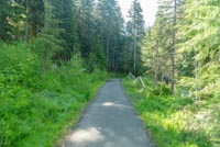
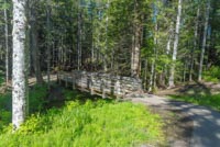
Begin your hike from the Mirror Lake Trailhead located just to the west of the Ski Bowl West parking lot. As you leave the trailhead, you will first march down a series of switchbacks towards Camp Creek. The Forest Service moved the trailhead to its current location in 2018 to lessen congestion along the highway, and first mile of the new trail is wide and pleasant. There are also 9 beautiful new bridges to cross during the first mile or so, helping to keep things interesting as you trudge through the forest.
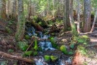
The trail is relatively level for the first mile or so, following that initial decent down to Camp Creek. There will be some slight ups and downs as you traverse the hillside, but nothing crazy. The thick canopy of Douglas fir, western hemlock, and red cedar will cast a pleasant green glow along the trail.
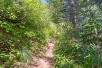
At the 1.1 mile mark, you will reach the intersection with the old trail (but probably won’t know it. It has been closed off and covered in downed trees), and things will start to get a little more challenging. The trail takes a hard turn to the left and begins to steeply climb to the lake. You will ascend over 400 feet in less than a mile. The trail also narrows up considerably here and will begin to switchback up the mountainside.
Three quarters of a mile further, you will reach the junction with the Mirror Lake Loop trail. If you anxious of climb Tom Dick and Harry, you can veer right and skip the lake. Or, you could still veer right and hike just a little further and then take the back end of the loop down to the lake. The best views are found along the southwestern shores of the lake, so if you wanted to, you could just march down real quick to take it all in and then head back. But the loop itself is only half a mile, so if you feel like heading around it to experience the hike in its fullest, head left at the junction cross a footbridge over the outlet.
If you are hiking around the lake, dense alders and willows make along the east shore make views or access difficult, but there are better spots ahead. Soon, there will be some small trails dropping down to the lakeshore through the trees. Keep heading around the lake for the best views though. As you reach the western shore you will find yourself entering a marshy area with wooden planks along the ground. During the early summer, the lake can get pretty full and these planks may be slightly underwater, just so your shoes have adequate warning. Just before the marsh, look for a break in the trees to get some amazing views of Mt Hood. There are some more great views within the marshy area as well.
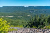
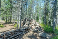
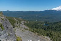
Once you have circled the lake, follow the trail back up and then make a left onto the Tom Dick and Harry Mountain trail. The trail climbs at a gradual rate here through some beautiful thickets of rhododendrons and over for rocky slopes, offering startling views of the highway and valley floor, way below you. About a mile past the lake, the trail will switchback to the left at a giant pile of rocks and you will begin the final push up the mountain. This last stretch is the steepest of the hike, and it can get rocky, but stick with it. It’s worth it.
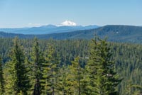
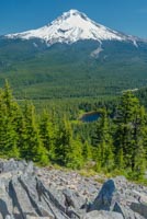
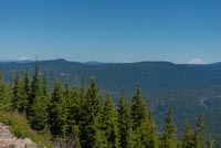
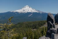
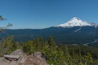
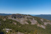
About half a mile following the rock pile, you will begin to break from the trees and see what appears of be another giant pile of rocks ahead of you. (This one is natural though. The first definitely isn’t. You will probably be able to tell the difference). The trail skirts around the front side of it and then climbs up to the top. Congratulations. You are now on the summit of Harry, one of the three prominent points of Tom, Dick and Harry Mountain. Turn around and have your breath taken away as Mt Hood looms in front of you, just across the valley, seeming almost close enough to touch. To the left of Mt Hood, you will be able to spot Mt St Helens, Mt Rainer, and Mt Adams lined up just for your satisfaction. If you turn to your right, you will also be able to see Mt Jefferson to the south. And Mirror Lake glistens in the sunlight below you.
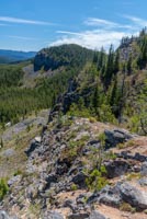
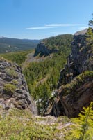
This is a common stopping point for many people making this trek. And all things considered, it is probably the best view of the hike. But if you all enjoying this high alpine environment and can’t get enough of the views, there is a little more to be had. From the high point on Harry, you can probably make out a faint “trail” dropping off the backside of the peak through the rocks. Follow this down and then make your way along the trails as they follow to the ridgeline towards Dick and Tom. Things can get a little confusing as user trails crisscross all over each other, but as long as you keep heading along the ridgeline, you will get to where you want to go.
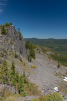
You will reach Dick first, which is a cliff faced rocky outcrop along the ridge. It too offers some amazing views of Mt Hood, combined with cool rock formations that surround you. Keep heading East down a small saddle and then make the final push up to Tom. You will see a large solar panel powering something here, along with some ski area signs. Tom is also the highest point of the mountain, so reaching here counts as summiting Tom Dick and Harry. While this trail is only half a mile from Harry to reach the summit, it is jumbled, rocky, and confusing, so know that it will take longer than a normal half mile trek. So plan accordingly.
Directions
The Mirror Lake Trailhead is located right off of Highway 26, just west of Government Camp. If you’re coming from Portland, take Highway 26 for about 37 miles past Palmquist Road when leaving Gresham. Look for the turnoff for Ski Bowl West. The trailhead is located on the west end of the parking area.
If you are coming from the east, take Highway 26 for 64 miles past Madras. Continue past the Government Camp Rest Area for 2 miles, watching for the Ski Bowl West turnoff on your left. You will want the second entrance into the Ski Bowl West for the fastest access into the trailhead. Or you could drive through their parking lot too, if you take the first one. Not the end of the world with either decision.
Things to Know
Passes: A Northwest Forest pass is required..
Dogs: Allowed and must be on leash or under voice command at all times.
Usage: Heavy
Bugs: Mosquitos can get pretty pesky around Mirror Lake, mostly in July or so.
Open Season: There will usually be snow cover from December to some time in May.