Tumalo Mountain
Distance: 4.0 miles.
Elevation Gain: 1,440 feet.
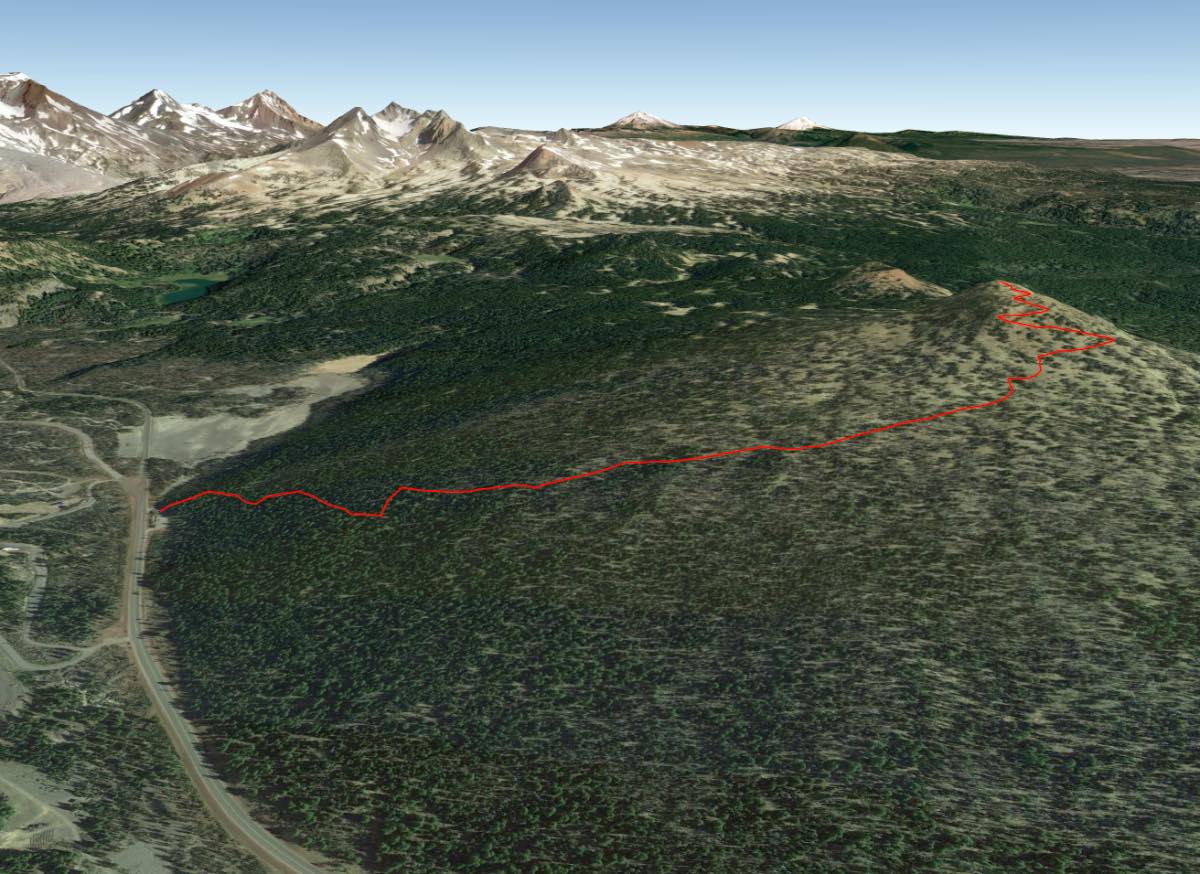
Tumalo Mountain is a shield volcano located just across the highway from Mt Bachelor. While the majority of the mountain isn’t nearly as steep as many of its more famous neighbors, glaciers carved out a large and steep cirque into the northeast face of the mountain, making for some great skiing if you are here in the winter. If not, enjoy some of the best views of the Central Oregon Cascades possible. Dogs are allowed on the mountain only during the summer, between May 2nd and October 31st.
The trail begins form the Dutchman Flat SnoPark, on the east side of the Cascade Lakes Highway between the Sunrise Lodge and West Village Lodge on Mt Bachelor. The trail leaves the parking area from the north side near the vault toilet and quickly begins climbing through a forest of mountain hemlock and true fir. The trail up Tumalo Mountain is relatively steep. Although it is not very long, the climbing never really lets up. But just power through it, because even though there isn’t much to look at in the beginning except trees, the views really open up and become very dramatic as you climb.
About a mile or so into the hike, if you turn around, you will start to notice Mt Bachelor peaking through the trees. It appears so close that you feel like you should be able to hit it with a rock if you throw hard enough. Don’t. You can’t and the people behind you on the trail won’t appreciate it. Flowers will also be blooming along the trail if you time your hike right. As you climb higher, the vegetation starts to change to primarily the gnarled remains of white bark pine. The landscape is also very delicate, so the Forest Service advices people to please, remain on the trail, and not cut off any switchbacks to avoid damaging the fragile ecosystem.
Finally, after a never-ending couple of miles, you will find yourself standing on the 7,779-foot summit. The northeast bowl drops so steeply away from you, you can’t see the ground as you look in that direction. You can also spot Tumalo Creek canyon and its rocky cliffs in that direction. To the north, the views of Broken Top and the Three Sisters are spectacular.
Directions
From Bend, take Century Drive, which turns into the Cascade Lakes Highway, west for 20 miles. The trailhead for Tumalo Mountain is located in the Dutchman Flats SnoPark, which is less than half a mile past the turn off for the Sunrise Lodge on Mt Bachelor and just before the road splits, dividing up the West Village Road and the continuation of the Cascade Lakes Highway. The SnoPark will be on your right.
Things to Know
Passes: No permit necessary in the summer. Sno-Park Permit required November 1 - April 30.
Dogs: Dogs are not allowed in the winter, from November 1 - May 1. Afterwards, dogs must be on leash or under voice command at all times.
Usage: ModerateOpen Season: The trailhead is accessible all year but expect snow on the trail into June and maybe July.
Bugs: Mosquitos can be present in the early summer months, but usually aren't very bad in this area.


