Wickiup Plains Loop
Length: 7.3 mile
Elevation Gain: 1,460 feet.
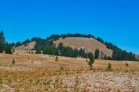
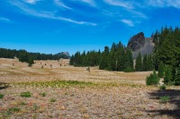
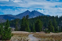
The Wickiup Plains are a barren land of pumice and ash with occasional pockets of trees near the southern base of South Sister. Because of the extremely porous nature of the soil, pretty much all snowmelt soaks into the ground before it gets a chance to runoff, and, with the exception of Moraine Lake, there is no surface water to be found. The lack of vegetation (which usually likes water to grow) and gentle rolling nature of the plains gives way to some amazing views of South Sister and some of the minor peaks surrounding it. And a short side trip over to Moraine Lake can make this loop around the Wickiup Plains Trail one of the more enjoyable in the Three Sisters Wilderness.
Begin your hike from the Devil’s Lake Trailhead just off of the Cascade Lakes Highway. You can choose to go either direction around the loop, joining the masses heading up the South Sister climbers trail and getting all the uphill down quickly, or heading clockwise for a longer, but not a steep climb. I prefer the clockwise method because you will be facing South Sister as you hike through the plains, awarding you with much better views.
From the Devil’s Lake parking area, head out on the Elk-Devils Trail from the southeast corner. The trail will quickly join up with the horse trail and then head through a large culvert under the highway. Just past the highway, you should see the information kiosk letting you know that you are at the Wickiup Plains Trailhead. Pat yourself on the back for not getting lost and power on!
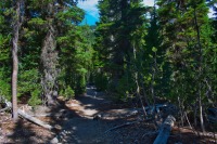
The trail gently climbs through forest dominated by Lodge Pole Pine for the first mile until you reach the intersection with the Wickiup Plains Trail. Head right here, along that trail and continue the gradual climb to the plains. The forest will begin to transition to more fir and hemlock as you climb, granting you a little more shade. This isn’t much more than a walk in the woods for the first 2 miles, but then things will start to get interesting.
As you approach the Wickiup Plains, you will notice the ground begin to get a little sandier and harder to walk in. At 2.1 miles, you will come to another intersection, the the Wickiup Plains trail heading left and the Moraine Lake Trail heading right. Turn right and follow the Moraine Lake Trail. Soon, the trees will start to thin and then, BAM, there’s South Sister in all her glory, dead ahead.
Just because you are now in Wickiup Plains, you may expect the climbing to be over. Well, it’s not. In fact, things start to get steeper at this point. You just may not notice it because the views are pretty cool. Your first introduction to the plains lasts about a third of a mile. From here, you can see South Sister rising above a wooded hill in front of you. Le Conte Crater is the rounded hill to the left of it. As you frolic through the meadow, you will even see the top of the Wife poking up between Le Conte and South Sister.
As you begin to approach the trees on the far side of this opening, there will be another trail, the Le Conte Crater Trail veering off to your left. Stay to the right on the Moraine Lake Trail and plow back into the trees. The next mile and a half is a mixture of climbing up steep benches, thick with trees, and then breaking out of the trees into sections of the Wickiup Plains, with South Sister dominating the skyline. Climbing the benches are fairly steep, but short, and the open areas are a much more gradual up hill. Following that fun, you will encounter the climbers trail and have a decision to make.
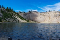
If you want, you can head right down the climbers trail and back to the trailhead. Or, if you prefer, Moraine Lake is less than ¾ of a mile, dead ahead. You should head to it because you have come all this way and it is worth the extra mileage. So continue on, with views of Broken Top opening up before you. The trail loops around a bluff and enters a virtual moonscape, with just patches of grasses growing on the pumice soil. The trail drops a little over 200 feet on its way to the lake, but the water is surprising warm and a quick soaking of your feet or even a swim will certainly refresh you for the climb back up.
Once you finish with Moraine Lake and return to the climbers trail, head to the left and begin your decent towards Devils Lake. The trail dives into a canyon and quickly begins descending back towards the Cascade Lakes Highway. The forest is thick and offers plenty of shade, and you will likely pass your fair share of hikers on your way down. Watch out for a large boulder lying in the middle of the canyon, with a sign in front of it telling you that if you write on the rock, the MAN will come find you. This also closely marks the halfway point of your decent.
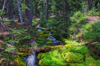
Soon, you will hear the roar of Hell Creek, and cars, as you near the highway. Follow the trail across the highway and then the final quarter of a mile back to the parking area. Maybe you even brought a kayak or SUP so you can enjoy a relaxing float in beautiful Devils Lake as a celebration of your great adventure.
Directions
To reach the Devil’s Lake trailhead, head south on Century Drive in Bend towards Mt Bachelor. Remain on the highway past the mountain for about 7 miles until you reach the brilliant turquoise water of Devil’s Lake. The parking area is just past the lake on the left side of the road.
Things to Know
Passes: A Central Cascades Wilderness Permit is required to access this area between June 15th and October 15th. The permits will be available from recreation.gov and will go on sale in early April. A Northwest Forest Pass is also required to park at this trailhead.
Dogs: Dogs are required to be leashed from July 15th through September 15th on the climbers trail and within the designated camping area at Moraine Lake.
Usage: Light except on the climbers trail and near Moraine Lake, then heavy.
Open Season: The Cascades Lake Highway usually opens around Memorial Day. Expect snow in the Wickiup Plains and around Moraine Lake probably late July.
Bugs: Mosquitos can be bad during the melt season, usually July through early August and primarily along the climbers trail, then will mostly clear up moving through August.

