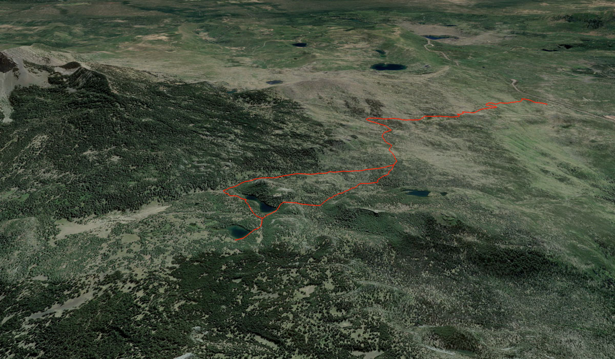
Berley Lakes Loop
Distance: 8.3 miles
Elevation Gain: 1,050 feet.
The Berley Lakes are a couple of beautiful, high mountain oases perched near the base of Three Fingered Jack. Although located in the popular Mt Jefferson Wilderness, there’s a good chance you could have these lakes entirely to yourself. Plus, if you are just day hiking, you don’t even need the Central Cascades Wilderness Permit. But, being able to route find is essential on this trip.
Begin your hike to the Berley Lakes from the Pacific Crest Trail trailhead at Santiam Pass, just across the highway from Hoodoo. The trail leads out of the west end of the loop that makes up the parking area and can be a little tricky to find. But there is a kiosk where you can fill out your wilderness permit just back from the road a little bit. The trail just doesn’t leave by the restroom, so don’t look for it there.
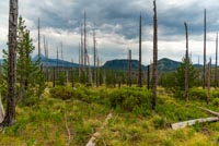
Soon after leaving the parking area, you will hit the Pacific Crest Trail, PCT if you’re cool. Make a left and begin you long, dusty trek through the burn scar of the 2003 B&B Fire as you head towards Three Fingered Jack. The forest has come far along the road to recovery however, as new trees are reaching heights of around 20 feet. The additional light also means plentiful flowers in July and August and the open canopy helps the wind to blow away the bugs. Just don’t count on much shade.
After 1.25 miles, you will reach the intersection with the Santiam Lake Trail at a cool rocky dome. Make the left here and continue along the trail. There are some pretty ponds on the left and views towards the Old Cascades. The trail remains mostly level here for the next ¾ of a mile until you reach a big, sweeping horseshoe and then begin dropping down into the Lost Lake Creek drainage and out of the burn area (Yay!).
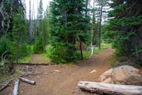
Another ¾ of a mile will get you to the junction with the Berley Lakes Trail. But keep your eyes open, cause you might miss it. There isn’t a sign or anything, and there is a picture of the junction in the photos, but it is easy to miss. Having a GPS app with the trail loaded in (or possibly, the Roaming Log App with All Access so you can follow the trail with ease. Selfless self-promotion here) can help greatly.
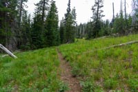
The Berley Lakes trail can also be difficult to follow, especially in the beginning, The trail has not been maintained and there are places of downed trees over it (but not too many) and places where the trail just seems to disappear in meadow-like areas in in tree thickets. If you aren’t comfortable route-finding on unmaintained trails, you can still reach the Berley Lakes by continuing the Santiam Lakes Trail. There will be a short user trail to reach the Lakes, but it is easier to follow. Just skip ahead a little if that is your decision.
Good, I see that you are adventure prone and looking to follow the Berley Lakes Trail. So head on out. Just be sure you are keeping to the trail. Most areas, the trail is pretty easy to spot. It just kind of disappears every now and then. If you lose it, start looking around and you should be able to locate it. There is one spot where it is very easy to get off track however. About ¾ of a mile (3/4 seems to be the magic number here), the trail will turn to the right and head up a saddle between two buttes. It looks like the keeps heading up the valley though and the turn is easy to miss. (There is a picture of this intersection too). If you miss it though, you trail will disappear on you after a couple hundred yards. That should be your first clue. So head back and find the right one.
Heading up this saddle is probably the steepest part of the hike, but it is short. And as soon as you start marching down the far side, the blue-green waters of Lower Berley Lakes will come into view. Follow the trail down to the western lakes shore where you will find a nice, sandy beach to hang out at with stunning views of Three Fingered Jack over the lake.
There is still one more lake on your itinerary, so don’t get too comfortable. Continue along the trail as it heads along the western shore and into some meadowy areas. You will notice some camping areas to your right, but keep heading up the draw-like area dead ahead. Soon, the trail will kind of peter out again and you will notice that what you were following kind of looks like a creek that it heading straight for a wall. You can scratch your head in confusion now and while you do it, look to your left. You will see a small single track heading up the hill through some trees. Found it!
Once you locate the trail, it’s an easy tenth of a mile to Upper Berley Lake. The views from here and pretty awesome as well, but there aren’t quite as cool of areas to hang out at here. So enjoy the views and then head back towards Lower Berley Lake.
Once back at Lower Berley, you will have a little off roading to do to make your way make to the Santiam Lake Trail. Head west along the northern shore of the lake past the day use only sign. (Seems a little out of place, not going to lie). You will kind of have to climb up onto a bluff here, as the northern shore is pretty rocky. There is also a draw and dry creek that heads more northerly and looks like the right way to go. Its not, stay in the trees with the Lake immediately to your right. Before you know it, you will start running into some more camping areas and a user trail will drop you down towards the east side of the lake. Follow that trail as it guides you back to the Santiam Lake Trail.
If you skipped the Berley Lakes trail portion, this is the trail than you need to take down to Berley Lakes. Just know that this junction is not signed either and can be easy to miss. (one more picture is here for you showing it). If you are going this way, be sure to follow the lake to its western shore however, as that is where the views are.
Once back on the Santiam Lake trail, make a right and follow it back towards the PCT. You will get to hike along the banks of Lost Lake Creek for a while, but don’t get too excited. Its usually dry. In one quick mile, you will be back at the junction with the Berley Lakes Trail. Now that you’ve seen it all before, I believe you can find your way back to the trailhead now. I’m so proud of you.
Directions
To reach the Pacific Crest Trail- Santiam Pass Trailhead, simply take highway 20 towards Santiam Pass (20 miles west of Sisters or 5 miles east of Santiam Junction). The trailhead is well marked on the highway and will be on the north side of the road. (If you can’t figure out which side north is, you probably shouldn’t be doing this hike).
Things to Know
Passes:A Norwest Forest Parking pass is required at the trailhead and a Wilderness permit is required upon entry into the wilderness. If you plan on backpacking, a Central Cascades Wilderness Overnight Permit will be required.
Dogs: Allowed and must be on leash or under voice control and all times.
Usage: Heavy on the PCT, Light once you vere off on the Santiam Lake trail.
Open Season: The trailhead will likely be snow covered well into May or even June. Expect to find snow on the trail into early July.
Bugs: Mosquitoes can be plentiful here during June and July, especially once you leave the burn and get into the trees.
Flowers: Flowers will be blooming along much of the trail in July and early August.