Sand Mountain
Distance: 3.8 miles
Elevation Gain: 810 feet.
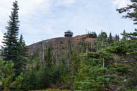
Sand Mountain is one of a group of cinders cones located in the high Cascades, just west of Mountain Washington. It lies within the Sand Mountain Volcanic Field which began erupting 4,000 years ago and consists of 23 cinder cones running along a north-south fault line. The lava from this area dammed up the McKenzie River to the west, creating Clear Lake. Now, a cool, restored fire lookout resides on it’s a summit and a relatively short and easy hike (for being located high in the mountains) can take you to it.
The hike begins from a very nondescript trailhead which is really just a wide spot in front of another gated road. There is a sign here though, at least letting you know you are in the right spot. The hike begins by just following the gated road as it slowly works its way around and up Sand Mountain.
About 1.5 miles from the car, you trail/road will climb up into the saddle between the two summits of Sand Mountain. There will be another parking area here (this one for whomever is staffing the lookout) and a trail that begins climbing the south peak. The “trail” actually becomes a trail here and the steepness of the climb noticeably increases. The views also really start to open up, but they will only get better.
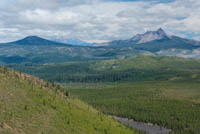
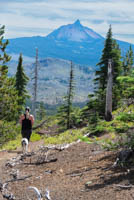
Its only about a quarter of a mile from the final parking area to the summit of Sand Mountain. Here you will find a beautifully restored fire lookout that is usually staffed during the summer months. This area gets way less visitors than some of the other nearby lookouts, like Coffin Mountain, so the lonely lookout may be inclined to chat it up with you for a while and explain much of what is up there. The views of Mt Washington and the Three Sisters are amazing, as are the vistas of the Old Cascades to the West. You can continue past the lookout for a short distance if you like to a marked off area at the southern edge of the rim, if you want to get just a little closer to the mountains.
Directions
To reach the Sand Mountain trailhead, turn onto Big Lake Road towards Hoodoo at the summit of Santiam Pass on Highway 20. Follow Big Lake Road past Hoodoo and Ray Benson Sno-Park for 3 miles. Just before you reach Big Lake, veer to the right and follow Forest Road 810 for 2.9 miles. The 810 Road is a sandy 2 track with some rocks in it. Normal passenger cars may have some trouble navigating the rocks, but anything the with clearance of a Subaru or more should be fine. Park at the beginning of the gated 810 road to begin your hike. There will be a sign and kiosk here, just to reassure you your in the right spot.
Things to Know
Passes: None.
Dogs: Allowed and must be on leash once you leave the road and head up towards the lookout.
Usage: Light.
Open Season: The area is usually accessible from mid to late June into November most years.
Bugs: Don't be surprised to find mostiqoes haunting this area once the snow melts until August or so.
Restrictions: No off-trail hiking due to fragile terrain recovering from disturbance.


