Cape Arago State Park - North and South Coves
Distance: 1.0 mile
Elevation Gain: 220 feet.
Cape Arago is a scenic headland jutting out into the Pacific Ocean about 15 miles southwest of Coos Bay. The cape was long used by Native Americans in the area, but was first visited by Sir Francis Drake when to may have taken shelter in one of the cape’s coves in the late 1500s. Now, Cape Arago State Park occupies the end of the cape and offers visitors the opportunity to spot migrating whales, watch seals and sea lions lounging on sea rocks, visit tide pools, or catch an unbelievable sunset.
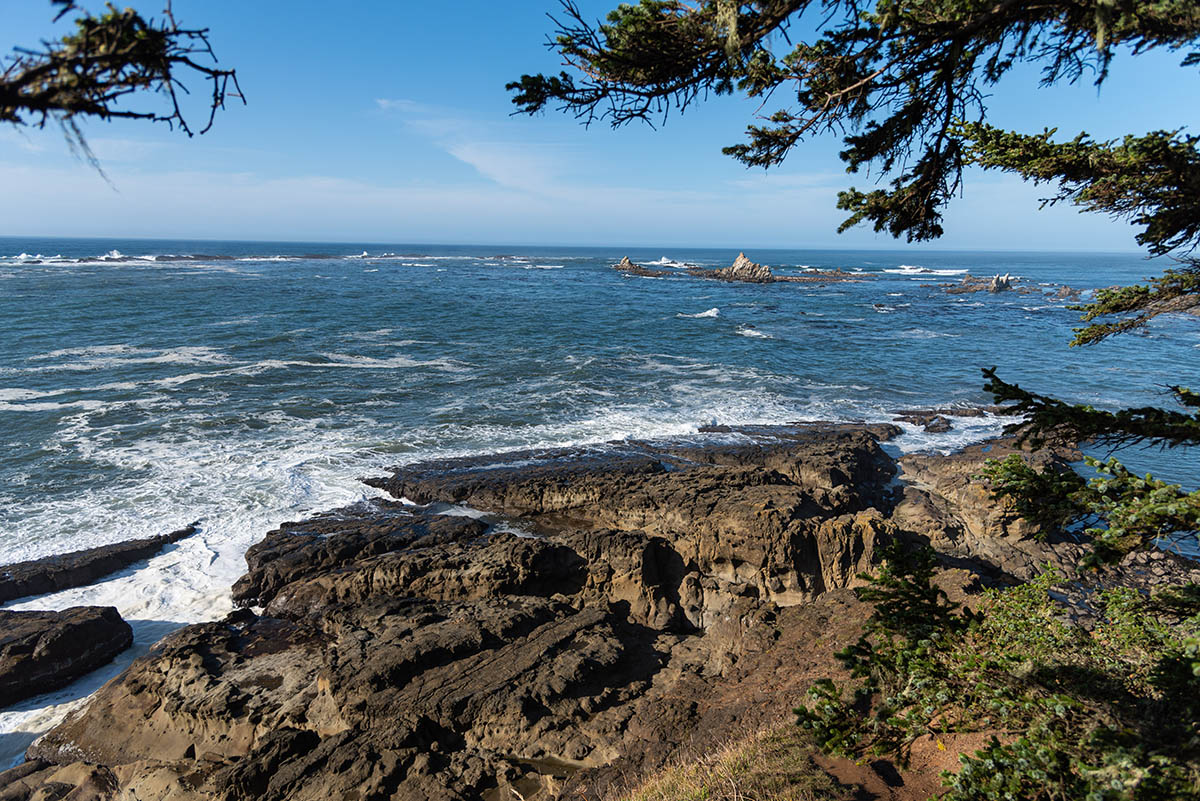
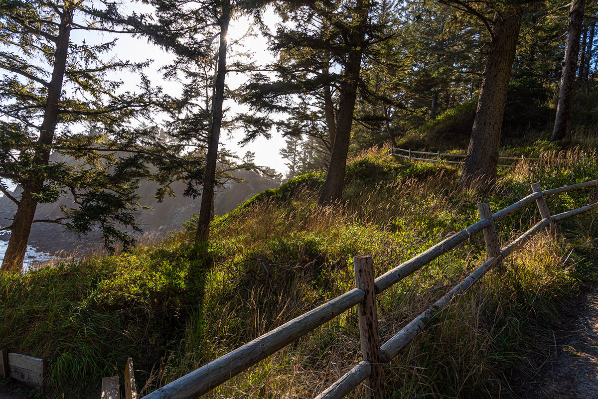
The trails leading out of the parking area at Cape Arago State Park are all relatively short, so you can just park in one sport and combine them all together. To begin with, head off to the north and hike to the Cape Arago North Fork Trail. This trail descends for a little more than 0.1 miles towards the northern tip of the cape. Be sure to check out the ocean to your left, as it crashes through some really cool rock formations. Soon, you will come to a viewpoint, looking out over Simpson Reef and Shell Island. Lots of times you will be able to spot Sea Lions and seals lounging on these rocks. Watch for the tell-tale spouts of water shooting up as well, as you may catch a whale swimming by.
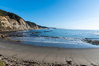
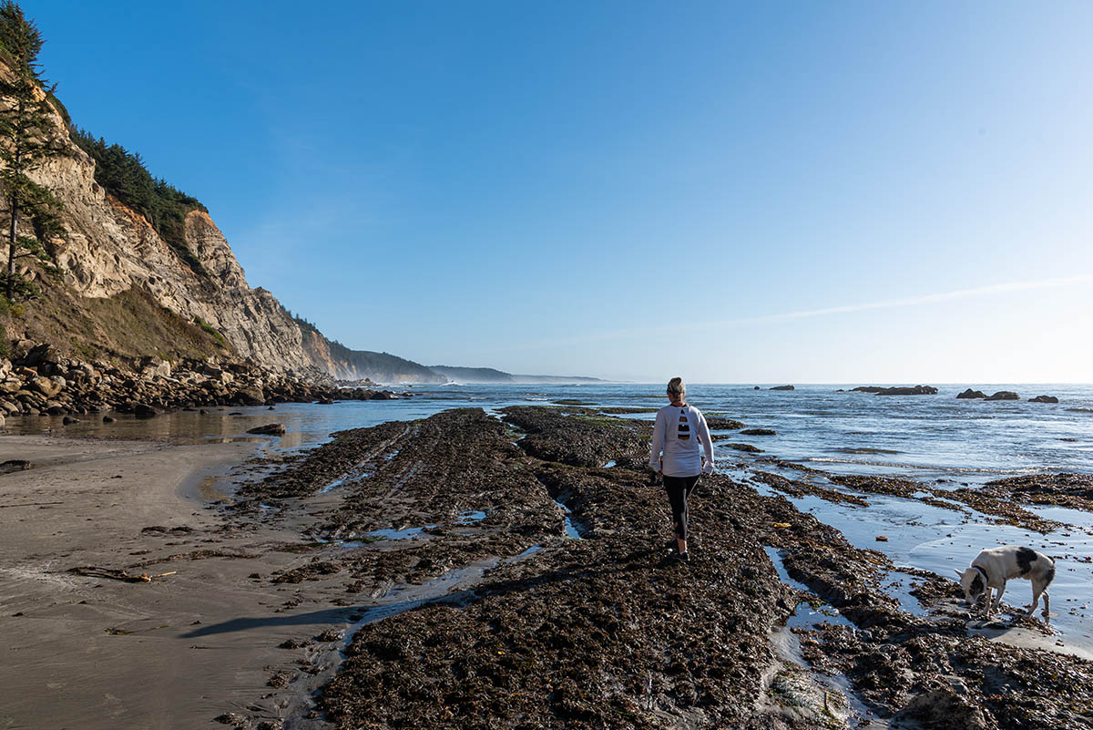
Just before the lookout, if you choose, you can take a small side trail down to the North Cove beach. At low tide, you can walk along the beach and do some additional site seeing. The North Cove trail is closed March 1 – June 30 to protect seal pups though, so plan your trip accordingly.
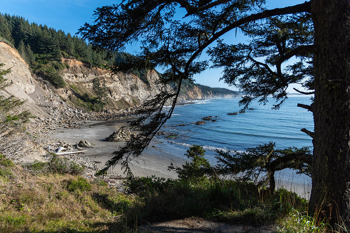
After exploring the north cove, head back towards the parking lot and make your way towards the south cove. Along the way, there are a couple small trails leading you to some overlooks over Middle Cove’s rocky beaches. The trailhead for South Cove is located about a quarter mile from the North Cove trail, heading around the loop road.
Once on the South Cove Trail, you will begin to descend pretty steeply towards the beach. It’s about .2 miles and a 140 foot descent down to the cove. Keep an eye out for the Seven Devils, a long line of sheer cliffs that extend south from the cove. The south cove also has some excellent tide pools if you visit during low tide.
Directions
To reach Cape Arago State Park, head west on Highway 540 from Coos Bay/North Bend. If you are coming from the south. Make a left onto West Beaver Hills Road 9 miles north of Bandon. Follow it for 6.2 miles until you reach Seven Devils Road, make a right and travel another 6.2 miles until you intersect highway 540 in Charleston. From Charleston, continue on 540 for 5.1 miles and the park will be located at the end of the road. You can’t miss it.
Things to Know
Passes: No passes required.
Dogs: Allowed but must be leashed or under voice control at all times.
Usage: Moderate-Heavy
Open Season: The state park is accessible year round. The North Cove trail is closed from March 1 - June 30 to protect seal pups.