Shore Acres
Distance: 1.3 mile
Elevation Gain: 50 feet.
Shore Acres State Park was originally the estate of the timber baron Louis J. Simpson, who purchased the mansion for his wife in 1906. The mansion burned in 1921, shortly after the death of Simpson’s wife, and was eventually sold to the state of Oregon in 1942. Now, visitors can stroll along paths through a Japanese-style formal garden, nor take a nice, easy hike along some dramatic sea cliffs.
To begin the hike along the cliffs, find a trail that heads northwest out of the parking area. IT will be located on the opposite side of the parking area from the gardens and observation building. The trail quickly takes you towards the oceans edge, where so impressive sandstone cliffs await. If you happen to be out visiting the area during a storm, you may be witness to some unbelievable waves. During times when swells are high, it is not unusual to see waves higher than 100 feet crashing against the cliffs and spraying those above them.
After making your first initial stop at the cliffs, the trail kind of disappears into a mess of old, flat stones. This used to be the estates tennis court. So make your way across it and pick up the trail again on the far side. You will then drip through a small draw and reach a trail junction. You can head right to head back and make a short hike even shorter, or head leftward and continue the loop.
As the trail will continue to loop around the rugged coastline, offering fantastic views of jagged rocks and crazy looking cliffs. The cliffs were created when, millions of years ago, ancient inland volcanos created sediment that was transported into the sandy beaches and mudflats that made up the Oregon coast at the time. These sediments continued to pile up and harden up where the rivers dumped into the sea, which just happened to be between Sunset Beach and Cape Arago. Later, once the sediments had solidified into sandstone, the rocky beds were uplifted and tilted, created the dramatic formations present today. There are even some petrified logs and stumps found in the weathered rock.
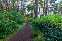
The Loop trail for another 2/3 of a mile from the first junction, hugging the coastline and offering views of Sunset Bay and out towards the Pacific as you go. If you are here between December and June, keep your eyes peeled for migrating whales as well. The trail will eventually intersect with a trail that will continue on towards Sunset Bay, or take you back to the Shore Acres Parking Area. So, head right and enjoy a nice, scenic walk through the woods for the final 1/3 of a mile towards your car.
Directions
To reach Cape Arago State Park, head west on Highway 540 from Coos Bay/North Bend. If you are coming from the south. Make a left onto West Beaver Hills Road 9 miles north of Bandon. Follow it for 6.2 miles until you reach Seven Devils Road, make a right and travel another 6.2 miles until you intersect highway 540 in Charleston. From Charleston, continue on 540 for 3.9 miles and the park will be located on your right.
Things to Know
Passes: A $5 state park day use parking pass is required
Dogs: Dogs are not allowed at this park.
Usage: Moderate-Heavy
Open Season: The state park is open and accessible year round.


