Eagle Cap - East Eagle Loop
Length: 32 miles
Elevation Gain: 7,700 feet.
The East Eagle Loop completely circumnavigates Eagle Cap while traveling over three seperate mountain passes. The Wallowa Mountains, in which the Eagle Cap Wilderness is located, are oftentimes referred to as the Alps of Oregon. When hiking through these rugged mountains, one can see why. This long, granite ridges and deep glacial, valleys feel like something much more akin to the Rockies or even Europe more so than what most Oregon hikers are used to in the Cascades. A much shorter trip to Eastern Oregon can transport you to a whole new world.
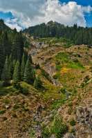
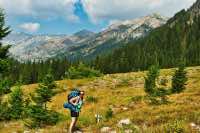
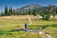
This loop begins from the East Eagle Trailhead, at the southern end of the wilderness area. Fairly quickly, the trees begin the thin out and you find yourself emerged in a what appears to be a never-ending glacial valley. The valley just heads up and up, slowly curving around the corner to the left, and a constant line of mountains line both sides of it. The trail is pretty well defined as it marches through stands of willow and aspen. Looking up the mountains, you will see numerous small creeks flowing down their granite sides, with little waterfalls everywhere.
The trail continues up this valley pretty much unperturbed for about 6.5 miles, climbing over 1,600 feet before reaching the first trail junction. Here, a 1.7 mile side trail will take you to Hidden Lake, a beautiful little lake surrounds by jagged peaks. Many people head up that way to spend their first night along its shores.
Following this junction, the trail begins to climb more steeply, gaining 2,000 feet in the next 3 miles as it heads up Horton Pass. Pretty quickly after the junction, the trail kind of disappears for a little bit in a confusing jumble of dry creek beds. Just kind of work through them, keeping your eyes open and you will spot the trail again in no time.
As you climb Horton Pass, following about 4 switchbacks, you will pass through a narrow gulley and enter into a cool little bowl right below the pass. The trail circles around the bowl like you are trying to climb out of a toilet and there are glacially cut pink granite slabs everywhere. Soon, you will be standing atop 8,400 foot Horton Pass. From the top of the Pass, you can see down multiple drainages as you stand near the center point of the Eagle Caps. Both the Lostine and Hurricane Creek drain away to the north, East Eagle Creek lays behind you, and the Minam heads off to the West.
After passing over the pass, the trail begins a series of rapid switch backs as it begins steeply dropping down the east side. In less than a mile, you will encounter another decision, if you want to climb Eagle Cap. When you reach the trail junction, the trail up Eagle Cap heads to your right. If you choose to go, expect a steep mile and a half as you climb another 1,100 feet. The view from the top is considered one of the best in Oregon. We chose to skip it, primarily because of a thick haze of smoke in the region at the time, so I can’t tell you what it’s like. But I hear good things.
If you head left at the intersection, or after your ascent of Eagle Cap, you will begin descending down into the Lakes Basin. This beautiful area is one of the most popular in the wilderness area, and you are likely to encounter the most people here. You will first pass by Upper Lake, and then drop down to beautiful Mirror Lake. Mirror Lake sits right up against the base of Eagle Cap, surrounded by little peninsulas of granite. It makes a wonderful place to relax for a bit or camp.
Leave Mirror Lake on the Moccasin Trail and it passes through a little slot and then drops down to Moccasin Lake. Once you reach the lake, the trail actually becomes a series of rocks that span a shallow, narrow part of the lake. Hop across the lake and begin your climb up Glacier Pass.
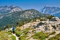
After crossing Moccasin Lake, the trail climbs another 1,000 feet in a little less than 2 miles. There are a lot of small switchbacks as you work your way up a narrow gully and through some small, flower filled meadows. When you feel like you should be getting close to the crest, the trail will turn away from the pass and do a little loop around some rock outcrops. Just keep trudging though, enjoying the views of rocky cliffs and snow fields that persist for most of the year. Soon, you will reach the top and be staring down at one of the beautiful lakes I have ever seen.
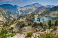
Glacier Lake sits just 300 feet below the top of Glacier Pass. The lake's mirror like surface seems to just hover on the edge of a cliff, with the valley dropping steeply away below it. This lake is also nestled along the east face of Eagle Cap, with the mountain soaring above it. Small islands in the eastern half of the lake just add to its majesty. Upon reaching this lake, we just took our shoes off and hung out for over an hour, not wanting to leave.
Eventually, you do have to get going. This lake is a long way from anything. Follow the trail as it heads towards the outlet of the lake. The West Fork of the Wallowa River is born at the north end of Glacier Lake, and quickly tumbles down the valley in a series of falls. The trail parallels the creek as it swings down this huge, steep valley. Hike another couple miles, dropping another 1,000 feet before reaching Frazier Lake.
There are a number of good camping spots near Frazier Lake, primarily in the trees along the southern end of the lakes. The hike continues up a small valley to the west of Frazier Lake. Climb 350 feet in a little more than half a mile on your way to Little Frazier Lake. You will also have to cross both the West Fork of the Wallowa and the creek that drains Little Frazier Lake. Neither of these crossings was difficult, but it did require us to remove our shoes and wear some sandals. Once you cross the West Fork, you may as well keep your sandals on if they are sturdy enough, because the second crossing is only a tenth of a mile away.
Little Frazier Lake is a beautiful little lake tucked into a rocky basin. There is a cool waterfall that drains Prospect Lake above it into the northwestern corner of the lake. That creek falls about 1000 feet in only half a mile. The trail continues up the south side of the lake on the way up Hawkins Pass. You get to climb about 900 feet in the next mile as you scale your third and final pass.
Upon reaching the top of the pass, the South Fork of the Imnaha drops away from you in a beautiful valley. You are truly at the head of the valley here, with narrow streams of creeks cascading around you in all directions. This also isn’t the best place to be if you aren’t fond of heights. The valley floor is a thousand feet below you, and the trail is pretty wide open as it switchbacks down the headwall. Just don’t step off the trail and you will be fine.
Once reaching the valley floor, you will follow the river for about 4 miles as it drops over 1,500 feet. The mountains here are really cool, with interesting swirls of rock carved into them. Also look for old avalanche scars that have torn up trees and wiped out everything on the hillsides. About a mile down the trail, you will have to cross the Imnaha. Again, because we are so close to the headwaters, the river is little more than a creek here, but you will have to get your feet wet. There is also a cool little waterfall just above the crossing, if you are wanting to take a quick, really cold shower.
At mile 22 of the hike, you will have to cross back over the Imnaha. The river is a little bigger here, but still an easy ford. You will then begin working your way up Cliff Creek. This part of the hike enters some deeper woods and seems to take forever. The views aren’t that great and you have to climb another 1,500 feet in 4.5 miles. Once you do, though, your uphills will be done and you will be standing on the shores of Crater Lake (not that Crater Lake, a different one). There are numerous places to camp here and Granite and Red Mountains rising behind it make for a beautiful backdrop.
Once leaving the lake, prepare your knees for 3,000 feet of straight down. It’s only a little less than 5 miles back to the trailhead, but you will have to endure about 50 (not kidding) switchbacks on the way down. The trail is also a little overgrown with brush, and we saw about 20 piles of bear crap in the trail, so keep your eyes peeled for Bo-bo. Finally, dive back into the forest and watch for the last intersection. Head right towards the East Eagle trailhead, just in case you forgot. Don’t go to the Kettle Creek Trailhead or you will have to walk about an extra mile up the road, and who the hell wants to do that.
Directions
From Baker City, take Highway 86 east for 23 miles until you reach Sparta Lane. Make a left onto the road and remain on it for 4.7 miles. You will then reach an intersection with East Eagle Creek Road heading to the left. Take that and proceed for another 3 miles until it joins with Forest Road 70. Stay on 70 for 2.8 miles until you reach a 4-way intersection. Head straight from here on road 7020 and putter along for another 4.6 miles until you pass over Eagle Creek. Here, the road will intersect with Forest Road 77. Make a left and drive for just 0.1 miles before bearing right on road 7745. If you cross over another bridge, you missed it. Stay on the 7745 road for 5.4 miles until the very end where you will find the trailhead.
The Sparta Lane is a pretty good gravel road, and most of the roads are pretty decent, although they do transition to dirt. I wouldn’t want to bring your Honda Accord up here, but a Subaru or something would be fine.
Things to Know
Passes: A free, self-issue wilderness permit is required upon entering the wilderness.
Dogs: Allowed and must be on leash or under voice command at all times.
Usage: Light - most of the hike. Moderate in the lakes basin and near Crater Lake.
Open Season: Lower elevation trails are usually snow free by the end of June, with snow persisting on higher elevation trails til mid-July through early August.
Flowers: Early August tends to be the best month for wildflowers along this trail.
Bugs: Mosquitoes can be pretty bad until about mid August or so, then they seem to die down.


