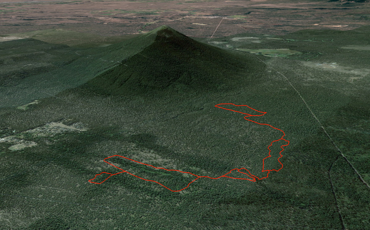
Metolius Preserve - Grand Tour
Distance: 9.1 miles
Elevation Gain: 350 feet.
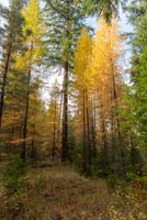
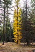
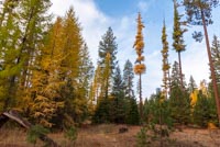
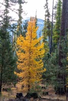
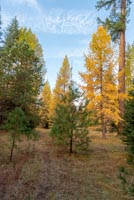
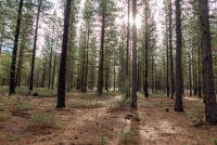
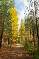
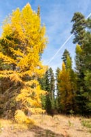
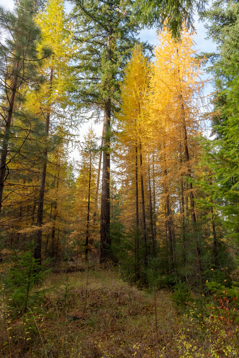
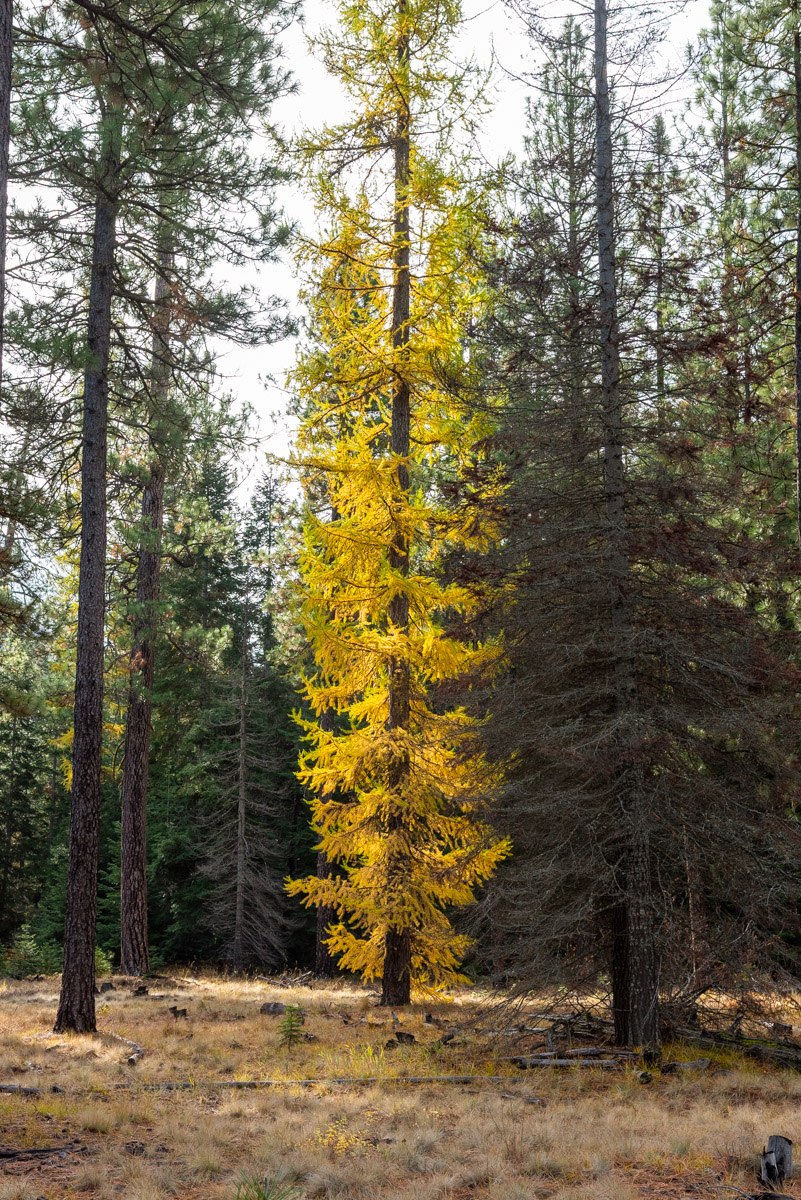
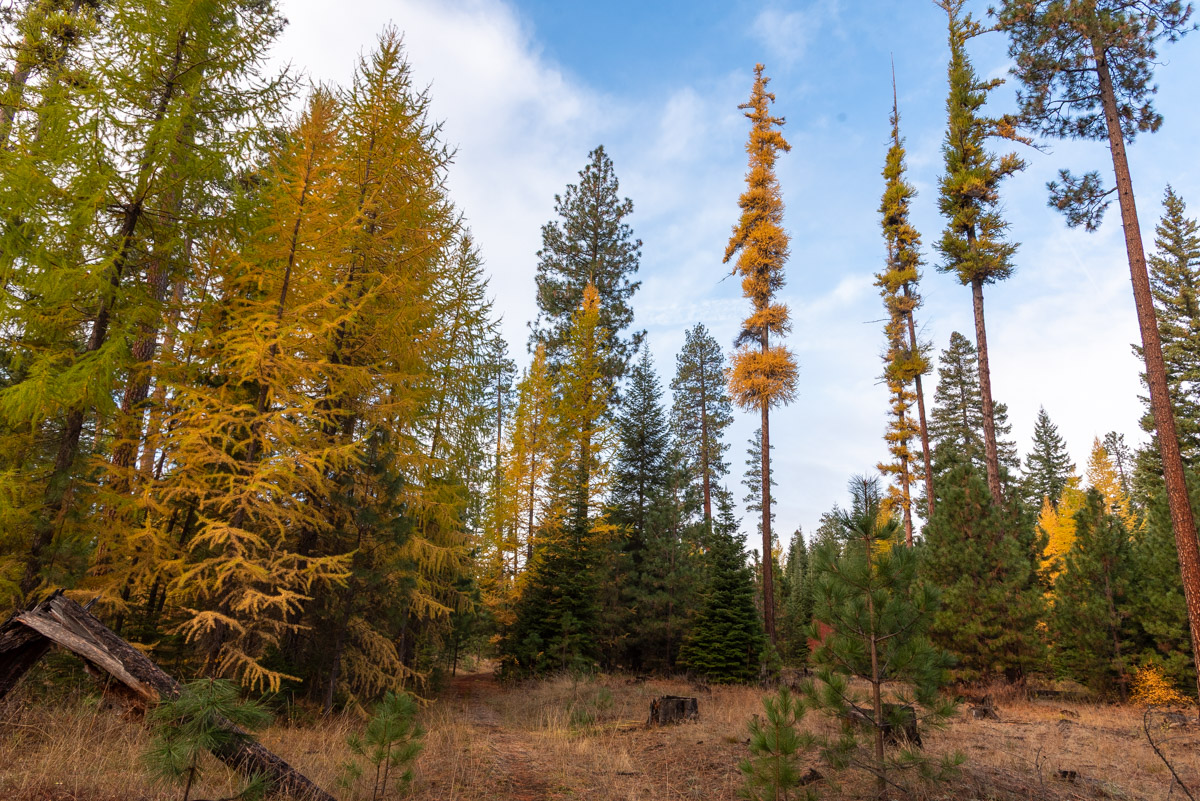
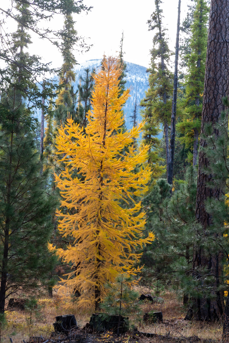
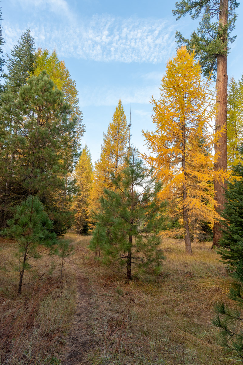
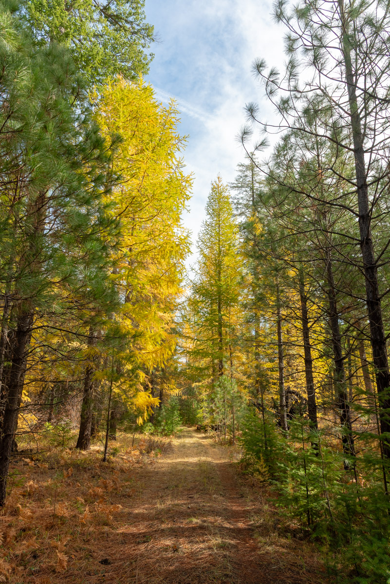
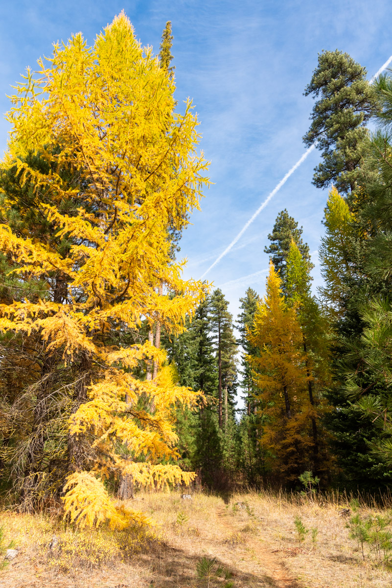
The Metolius Preserve is a 1,200 acre chunk of land owned by the Deschutes Land Trust and located within the Deschutes National Forest along Lake Creek. The preserve is home to a rich forest of Ponderosa Pine, Douglas Fir, and Western Larch. And it is the Larch that really steal the show, especially in the autumn months when their needles turn golden. There are three different loops within the Preserve, the Pine Trails, Fir Trails, and Larch Trails. The highlight of the Preserve is the Larch Loop, but if you are wanting to experience the area in its entirety, then hike them all in the Grand Tour.
>Start your hike from the North Trailhead, so this way and you start and end with the magic of the Larch Trails Loop. Head south out of the parking area and follow the trail for a quarter mile int the forest until you reach a junction. Head left over a bridge of the North Fork of Lake Creek and then it is just a short jaunt to the bigger larch loop. Make another left and enjoy the show.
The Larch Trails make a big loop with the Middle Fork of Lake Creek traveling through the middle of it. The larch are magnificent here in the fall, the trees large and small all along the trail. After 1.5 miles you will reach the southwestern junction of the loop. Make a left and work your way towards the Fir Trails.
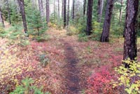
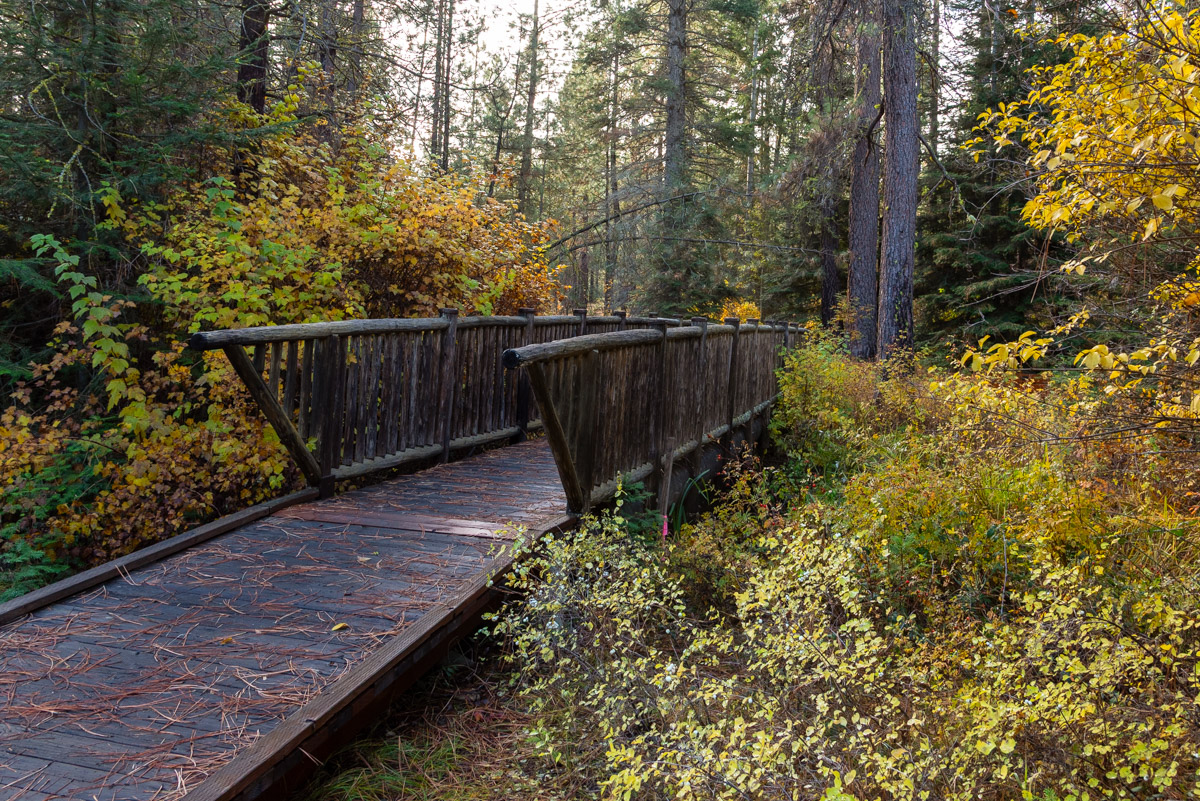
The Fir Trails are divided up into two different loops, one on each side of the South Fork of Lake Creek. The Northern Loop is small and you will reach it in just .2 miles after leaving the Larch Trails. Take a right and head towards the South Fork. After a short walk through the woods, the trail will then follow along the banks of the Creek until you reach another bridge. Head over the bridge towards the South Trailhead.
The Fir Trails are divided up into two different loops, one on each side of the South Fork of Lake Creek. The Northern Loop is small and you will reach it in just .2 miles after leaving the Larch Trails. Take a right and head towards the South Fork. After a short walk through the woods, the trail will then follow along the banks of the Creek until you reach another bridge. Head over the bridge towards the South Trailhead.
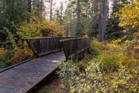
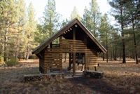
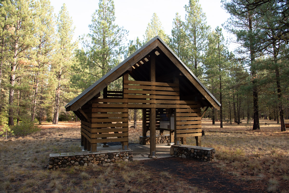
Once over the bridge, you can check out the cool shelter and informational kiosks near the parking area if you wish. Otherwise, turn back up the creek and follow the trail as it heads of the opposite side of the South Fork. There will be a couple of viewing platforms that hang out over the creek where you can look for spawning or migrating fish along the way.
Once over the bridge, you can check out the cool shelter and informational kiosks near the parking area if you wish. Otherwise, turn back up the creek and follow the trail as it heads of the opposite side of the South Fork. There will be a couple of viewing platforms that hang out over the creek where you can look for spawning or migrating fish along the way.
About half a mile from the South Trailhead, you will climb up a small hill and will reach the start of the Southern Fir Trail Loop. Stay left here and wonder your way through a Doughlas Fir and Pine Forest with a cool blanketing of ferns along the forest floor. There is a cutoff trail about halfway around the loop, but you are here for the Grand Tour, so just pass it by.
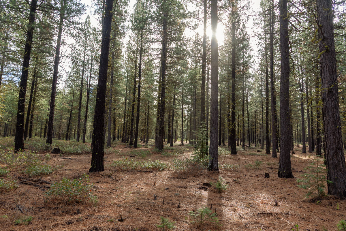
About 3/4 of a mile from the start of the loop, you will reach the southern end of the loop. Make a right here and cross over a forest road. Its then another 3/4 of a mile through the pine forest until you reach the Pine Trails. This is the final loop so you can really go either way you want. The loop is about 1.5 miles around as it meanders through the forest in the shadow of Black Butte.
Once you have made your way around the Pine Loop, head back up the trail towards the Fir Loop. Vere right this time after crossing back over the forest road. This section of trail follows and old road, so keep your eyes open for the actual Fir Trail towards the end of the loop. It will veer off to the left and head up a hill where the road you have been following will just keep heading straight ahead. All the trails are pretty well signed, so as long as you are paying attention to them, you should be fine.
After closing off the southern Fir Loop, follow the trail back towards the South Trailhead along the South Fork and head back over the bridge. Make a right here and follow a short section of trail along the creek before heading back towards the Larch Trails. Once you reach the Larch Loop, head left and reenter the land of the larches. Cross over a culvert that crosses the Middle Fork and in 3/4 of a mile after rejoining the loop, make a left and head back towards the Northern Trailhead.
Directions
To reach the North Trailhead of the Metolius Preserve, head 12 miles northwest of Sisters on Highway 20 until you see the sign for Mt Jefferson Wilderness Trailhead. Make the right onto Jack Lake Road. Follow this road for a mile and after crossing a bridge over Lake Creek, make a right on the gravel 1216 Forest Road. This is a two lane gravel road and most vehicles should have no problem on it. Follow this for 1.8 miles and when you see the signs for the Metolius Preserve, make the left and follow the road for a quarter mile to the parking area.
Things to Know
Passes:No passes or permits are required
Dogs: Allowed but msut be on a leash.
Usage: Light.
Leaves: Larch will usually be changing from Late October through Early Novemeber..
Open Season: The area can be accessible year round, depending on snow. The Jack Lake road will oftentimes be blocked by plowing along Highway 20 during the winter, but the trailhead may still be accessible from the Camp Sherman side.