Gray Butte
Distance: 3.0 miles.
Elevation Gain: 1,320 feet.
Gray Butte is a volcanic butte which makes up part of the Crooked River caldera and is located just east of Smith Rock State Park. This distinct summit is a short but steep hike which offers panoramic views of Central Oregon as well as a chance to really get your legs burning, if you’re into that sort of thing. Just avoid this hike when conditions are wet, as the clayey soils can turn into a goo which makes this adventure way more interesting.
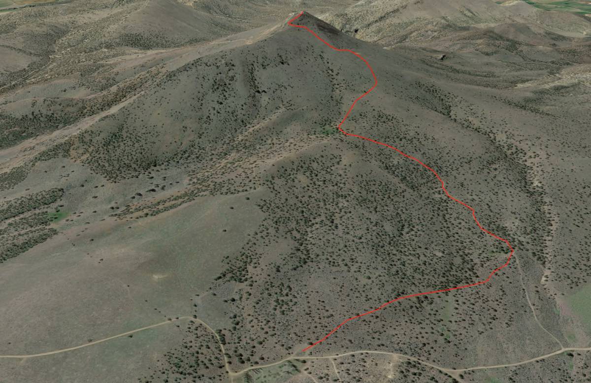
The hike up Gray Butte starts at the Gray Butte Trailhead, located on the north side of the butte. The parking lot is just across the road from the old McCoin homestead and orchard, which is surrounded by big, old poplar trees, something which seems a little out of place in this juniper, sagebrush, and grass landscape. The trail starts as a single track out of the northwest corner of the parking lot.
Follow the trail as it hugs the northern base of the butte through the juniper. After 0.4 miles you will intersect a 2-track road. Turn to the left and begin to follow the road up the butte. This is where the fun begins. The next ½ mile climbs slowly but steady as you ascend about 400 feet. After this first push, you will reach a large water trough and the trail/road will turn to your right and appear to start heading straight up.
There is only a little more than half a mile left in the hike, but you will climb almost 1,000 feet during it. The trail goes through a series of really steep climbs, followed by stretches of just normal steep climbs. Just continue to follow the road up and after puking 2 or 3 times, a few dizzy spells, and a lot of time wondering how something so close can be taking you so damn long to reach, you will be there. The views from the top are awesome. Just be careful on the way down. Sometimes heading down steep stuff can be more challenging than getting up it.
Directions
The Gray Butte Trailhead can be reached a number of different ways, but the most direct are through the Skull Hollow campground to the south or from the north off of Laurel Lane. If you are coming from the south, follow Lone Pine Road about 5.5 miles north and east from O’Neil or 3.25 miles south and west form Highway 26 until you see Skull Hollow. Follow the road up through Skull Hollow for about 2.5 miles until you reach a T in an open area after you have passed through the canyon. Take a left a go another ¾ of a mile until you see the poplars. The trailhead is on the left, just past them. During certain times of the year, this route can get muddy and rutted.
If you are coming from the North, look for the signs pointing to Gray Butte Trailhead off of Highway 26 between Madras and Prineville. Head east on Laurel Lane for just over 2 miles and then make a left onto Jasper Road. Follow this road for 2.5 miles and the trailhead will be on your right.
Things to Know
Passes: No passes are required.
Dogs: Allowed and must be on leash or under voice command at all times.
Usage: Light
Open Season: Technically accessible all year, but the road and the trail can get really muddy and slick during the winter and early spring.
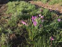
Flowers: Spring time should be best, April and May.