Gray Butte Trail
Distance: 12.0 miles.
Elevation Gain: 1,850 feet.
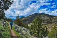
Gray Butte is a volcanic butte which makes up part of the Crooked River caldera and is located just east of Smith Rock State Park. The Gray Butte Trail offers a fantastic opportunity to circumnavigate the west side of the butte and continue on through some surprisingly rugged terrain until you reach a nice overlook just above Smith Rock. This area is also very popular with mountain bikers and horseback riders, so be sure to share the trail. And be aware, if it's wet, the awesome combo of clay and sandy soil in the area can make for some interesting mud.
The hike begins at the Gray Butte Trailhead, located on the north side of the butte. The parking lot is just across the road from the old McCoin homestead and orchard which is surrounded by old poplar trees, something which seems a little out of place in this juniper, sagebrush, and grass landscape. The trail starts as a single track out of the northwest corner of the parking lot.
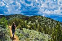
Follow the trail as it hugs the northern base of the butte through the sagebrush, juniper, and, if the time of year is right, wildflowers. After 0.4 miles, you will encounter a two-track road. A left here will take you up Gray Butte, but unless you’re feeling super energetic today or your legs did something awful to you the night before and you’re punishing them, continue across on the single-track trail.
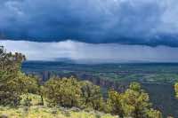
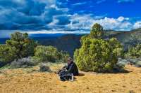
The trail climbs fairly steadily up the west shoulder of the butte gaining about 500 feet in the first 1.5 miles. A little past the high point of the shoulder, you will come across a nice rock outcrop which offers beautiful views to the west. From here, you start heading back down the southwest side of Gray Butte. At the 2.7-mile point, you will encounter a trail intersection at a gate. The Cole Loop trail peels off to your right so head straight trough the gate and continue on the Gray Butte Trail.
At around 3.5 miles, you will find yourself back down the butte, and possibly amid a parking lot/campground. This section of the trail parallels a road for about half a mile and this area can be heavily used by mountain bikers and climbers heading to Smith Rock as a base camp. Soon, the trail will turn to the southwest and will begin to traverse a ridgeline. It continues fairly flat and level, although perched upwards of 400 feet above the valley floor. After 4.7 miles, the trail will round a nob in the ridge and the view of your destination lies ahead of you. It's that big hill with a trail going straight up it.
Continue traversing some cool terrain, filled with interesting rock formations until you reach a junction on top of a saddle. Here, the Gray Butte Trail will continue on ahead and would intersect with the Summit Trail in Smith Rock. You are more adventurous however, you dirty dog you. Turn to the left and start heading up that steep ass road. Good for you. Climb a very steep 200 feet in about 1/10 of a mile. Then crest that lip...... and realize that the real summit is still half a mile away. But push on. It’s only 300 more feet of climbing and the views are worth it.
Directions
The Gray Butte Trailhead can be reached a number of different ways, but the most direct are through the Skull Hollow campground to the south or from the north off of Laurel Lane. If you are coming from the south, follow Lone Pine Road about 5.5 miles north and east from O’Neil or 3.25 miles south and west of Highway 26 until you see Skull Hollow. Follow the road up through Skull Hollow for about 2.5 miles until you reach a T in an open area after you have passed through the canyon. Take a left a go another ¾ of a mile until you see the poplars. The trailhead is on the left, just past them. During certain times of the year, this route can get muddy and rutted.
If you are coming from the north, look for the signs pointing to Gray Butte Trailhead off of Highway 26 between Madras and Prineville. Head east on Laurel Lane for just over 2 miles and then make a left onto Jasper Road next to the horse corals. Stay to the left at both major intersections you come to and in 2.5 miles, the trailhead will be on your right.
Things to Know
Passes: No passes required.
Dogs: Allowed and must be on leash or under voice command at all times.
Usage: Light
Open Season: Technically accessible all year, but the road and the trail can get really muddy and slick during the winter and early spring.
Flowers: Spring time should be best, April and May.


