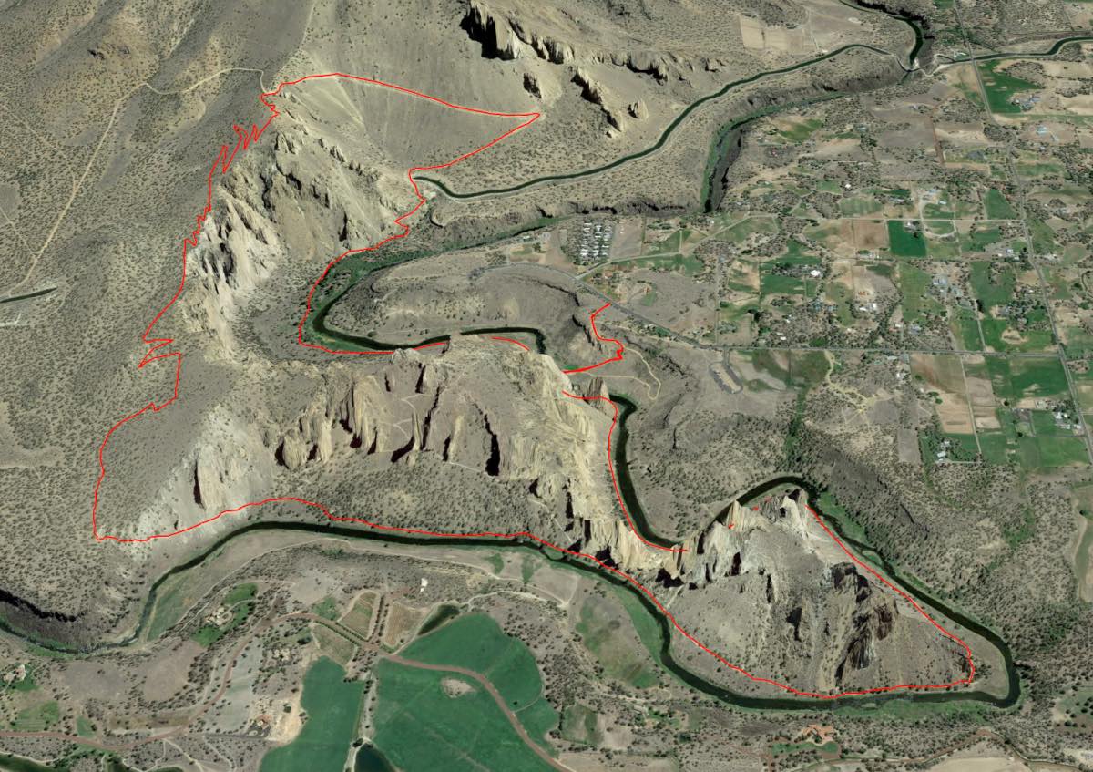
Smith Rock - Summit Trail
Distance: 7.0 miles.
Elevation Gain: 1,150 feet.
Smith Rock began its formation around 30 million years ago when a large caldera that stretched from Smith Rock, through Powell Butte, and all the way to Prineville, collapsed into an underground lava chamber. The resulting avalanche of rock and ash filled the caldera and then solidified into a rock called tuff which makes up much of Smith Rock’s amazing cliffs.
The Summit Trail is one of Smith Rock’s newer trails and circumnavigates the park. Begin your hike at the welcome center and head down the trail/road towards the river. If you don’t mind steep descents, take the cutoff trail rather than the main road to quickly descend to the river. Enjoy the crowds of hikers and climbers as you make your way across the bridge over the Crooked River.
Once you cross the river, head towards your right, up river. The trail follows right along the river for about .75 miles before it begins to climb out of the canyon. This climb is one of the steeper sections of the trail and can be very loose, so watch your footing. Once you pop back up out of the canyon, the trail heads over the top of a tunnel that the North Unit Canal flows into and then heads up the Burma Road. Your 350 foot climb out of the canyon made for a nice warm up as you power up an additional 700 feet in the next mile. Be sure to look towards the west though for some amazing birds eye views of the cliffs and river.
Once you reach the saddle, the trail will head to your left and return to single-track form. Make your way down 750 or so switchbacks as you easily descend down the back side of the park. There are a few cool viewpoints along the way that allow you to gaze down at the park from above.
At the 4.5 mile mark you will once again drop down to the Crooked River. Monkey Face looms ahead of you as you continue your hike another 2+ miles back to the bridge. Be sure to watch all the climbers scurry up those cliff faces as you pass the best climbing routes and keep your eyes peeled for wildlife like river otters or blue herons. Once you make it back to the bridge, prepare for one last kick in the balls as you have to make the final, steep push back up to the parking lot.
Directions
From Highway 97 in Terrebonne, head east on Smith Rock Way where all the signs direct you. Follow the road down the hill for about 1.5 miles until you reach 17th street and see another sign directing you to the park. Turn left on 17th street and the right at the end of the road on Wilcox Ave. After another ½ mile on Wilcox, turn left again onto 25th street and follow that about half a mile to the park. You will know you are there when you can’t find a place to park.
Things to Know
Passes: A $5 day use permit is required.
Dogs: Must be leashed.
Usage: Heavy, but the back side of the Summit trail usually has very few hikers.
Open Season: Open year round. Can get very hot in the summer.


