Head Of Fall River
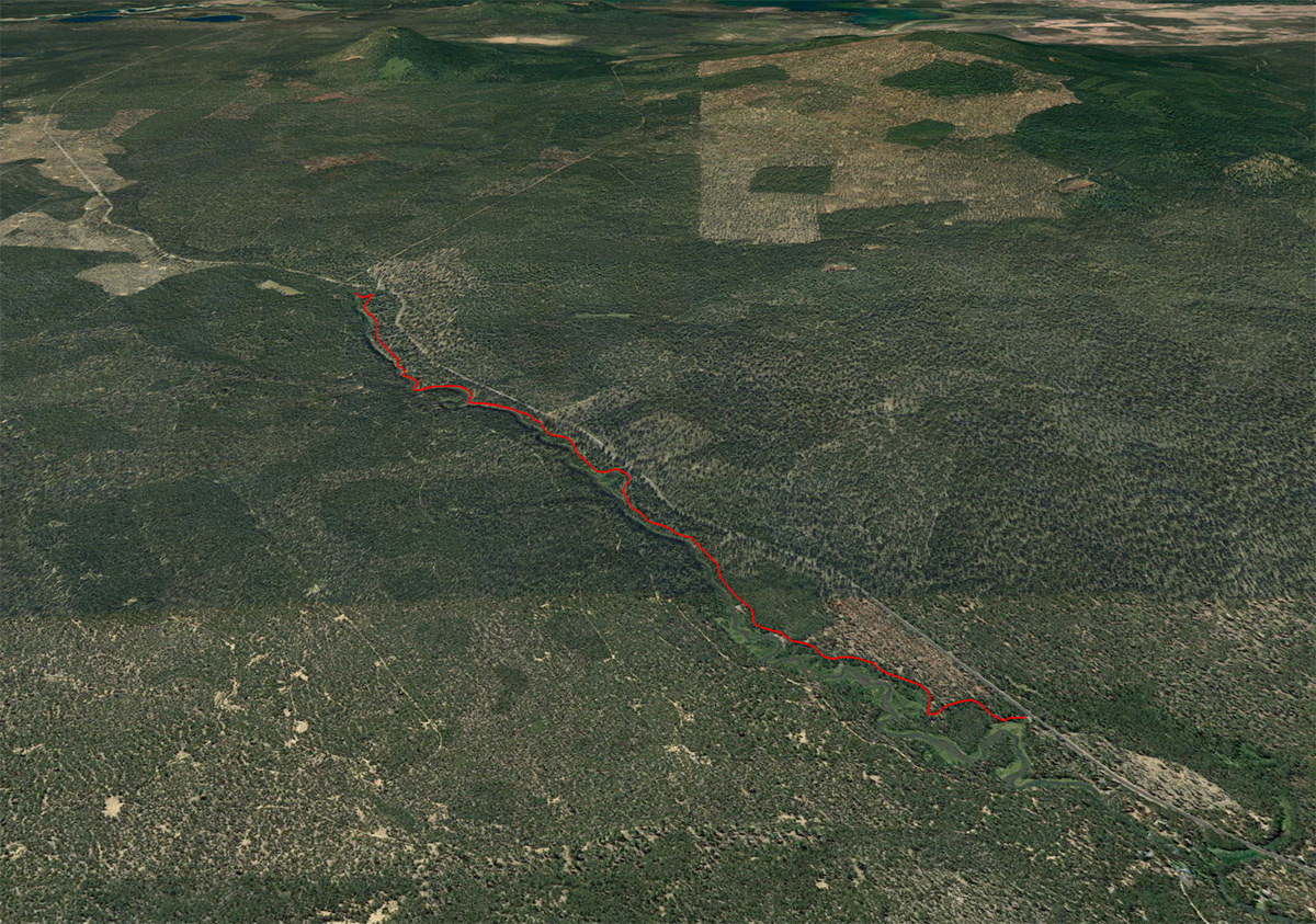
Distance: 6.2 miles.
Elevation Gain: 175 feet.
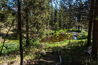
The Fall River is one of those magical Oregon rivers that emerges nearly full grown, similar to the Metolius, from a spring and flows 12 miles to the Deschutes River. The river flows through a beautiful forest of Ponderosa and Lodgepole Pine as it slowly winds its way downstream. Its crystal clear water allows you to see all the way to the bed of this shallow river, so keep your eyes out for fish. You might even get lucky and watch as an Osprey nabs one out of the water.
While technically, you could drive to the springs that mark the head of Fall River, where would the fun in that be? (the trail is never far from the road, so expect some traffic noise along your hike.) Plus, you would miss out on some beautiful scenery along the way. So park at the Fall River Trailhead, along South Century Drive just past the fish hatchery. The trail leaves this small parking area and immediately begins heading upstream.
As you hike, you will find yourself moseying through the forest at times, and at others, right along the banks of Fall River. The trail itself is mostly level, with small ups and downs as you head upstream. You will also pass numerous parking areas, mostly used by fisherman, as you hike.
A little over 2 miles from the trailhead, you will pass by the Fall River Campground. There is a nice toilet in there is you are feeling the urge. Keep heading upstream and you will soon come to a nice pedestrian bridge crossing the river. Don’t cross it and remain on the same side of the river as you head upstream. This is also a mecca for fisherman, so expect to see quite a few dudes and dudettes in waders wondering around.
About ¾ of a mile from the campground, you will come to the head of Fall River. There are two forks from which springs emerge here. Head around the first one and hike fast the guard station (this can be rented if you are looking for a cool place to stay) and continue upstream for just a little bit before you see the entire river just pop out of the ground at the bottom of a hill. That’s it, you made it. Chill for a little bit, dip your feet in the icy, and just enjoy the beautiful scenery.
Directions
To reach the Fall River Trailhead, dead south of Bend on Highway 97 towards Sunriver. Take the main exit off the highway towards Sunriver onto South Century Drive. Go through the round-a-bout but continue on South Century Drive. The road will travel through a traffic light and then angel to the right. Soon after the corner, you will see a sign directing you either towards Mt Bachelor, dead ahead, or Wickiup Reservoir to the left. Head left to stay on South Century Drive.
Continue down South Century Drive for another 3 miles before the road will head to the right at another intersection. There will be a sign for Thousand Trails pointing you in the right direction. As long as you stay on South Century Drive, you will be fine. After this last turn, head west and the trailhead will be 8 miles ahead on your left. Look for it about a mile after passing the fish hatchery. It will just be a small parking area with enough room for maybe 8 cars or so.
Things to Know
Passes: No passes are required
Dogs: Dogs are allowed and must be on leash or under voice control at all times.
Usage: Moderate
Bugs: Mosquitos can be pretty bad during the late spring and early summer months.
Open Season: The trailhead can be reached all year, but expect to find snow along the trail into April most years.