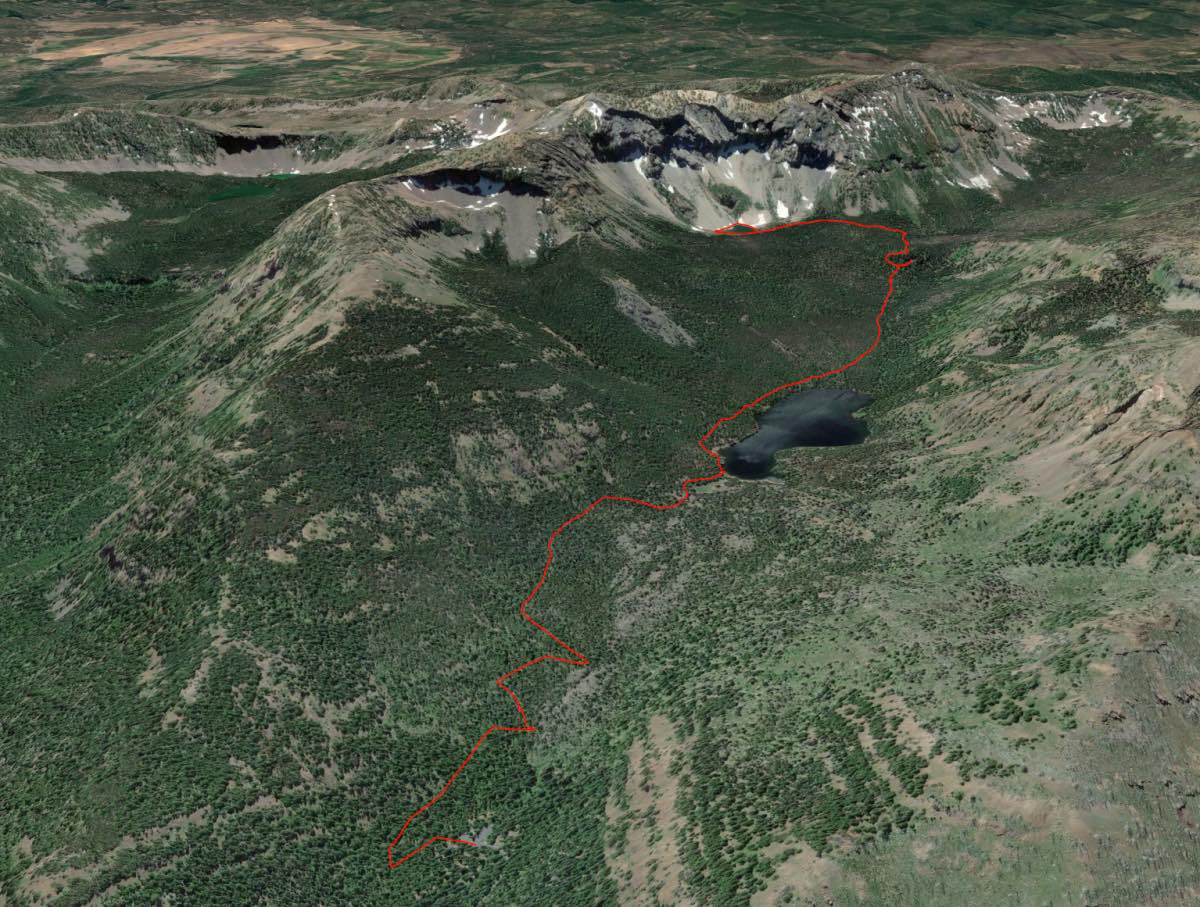
Little Strawberry Lake
Distance: 7.0 miles.
Elevation Gain: 1,270 feet.
The Strawberry Mountain Wilderness is a little gem of a wilderness area located just to the east of John Day. The mountains were first formed millions of years ago when an ancient seafloor buckled creating the western part of the range. Later, volcanic ash and lava helped create the eastern half. Following that, glacial ice flowed down the mountain sides, creating their signature U-shaped valleys and carving out depressions in the rock which help form the 7 lakes that dot this wilderness. The wilderness is also known for its large quantities of wild strawberries that grow throughout the area.
The hike to Little Strawberry Lake begins at the Strawberry Basin Trailhead, adjacent to the Strawberry Campground at the end of Forest Road #6001. The trail climbs steady up the valley and over the remnants of a landslide which helped to form Strawberry Lake. March on through a forest of grand fir, western larch, ponderosa pine and lodgepole pine for 1.2 miles before reaching Strawberry Lake.
Strawberry Lake covers 36 acres of the valley bottom at the base of Strawberry Mountain and only averages 9 feet deep. Enjoy the views as rocky ridges rise along both sides of the lake. Continue along the left side of the lake for about ½ a mile until you reach its shallow and marshy south shore. The trail continues for another ¾ of a mile and you steadily climb again until you reach Strawberry Falls. This pretty falls cascades over 50 feet down a rocky face. If you’re feeling a little hot and enjoy having the breath sucked from your lungs, go ahead and climb into the falling water. It will cool you right off.
Following Strawberry Falls, the trail climbs steeply as you work your way up the creek and to the base of the ridgeline that makes up Rabbit Ears and Indian Butte. As you climb higher, the forest will begin to thin out and huge boulders will dot the landscape. At only 0.6 miles past the falls, you will come to Little Strawberry Lake, a beautiful body of water tucked into the base of the mountains. You can continue your hike around the lake to enjoy the views as much as possible. Just be aware that some of the meadow areas can get swampy during wetter months and you will have scramble over some of the rock where the lake pushes up against the slope. Keep your eyes open for mountain goats as they often frequent the area.
Directions
From Prairie City, turn south onto Main Street and follow it until the junction with Bridge Street. Turn left onto Bridge Street and follow it until it leaves the city. This will involve another right turn to the south across from Depot Park. As Bridge Street leaves Prairie City, it turns into County Road 60. Follow this road for about 7 miles until it then becomes Forest Road 6001. Follow the forest road another 2 miles to the trailhead and campground at its terminus.
Things to Know
Passes: A free, self-issue wilderness permit is required upon entering the wilderness.
Dogs: Allowed and must be on leash or under voice command at all times.
Usage: Moderate
Open Season: Trails should be snow-free by mid-July.
Bugs: Mosquitos can be pesky well into August.


