Peter Skene Ogden Trail
The Peter Skene Ogden trail is one of those nondescript sounding, ho-hum trails that can really end up surprising you. It’s long, climbing pretty much all the way up the Newberry Volcano in 8.25 steady uphill miles. There aren’t really any views. You’re walking along a creek that is often times in a canyon below you. Images fill your head of a dusty slog through lodgepole and manzanita. You’ve heard rumors about a natural waterslide in there somewhere, but don’t really know much else about it. Well, sometimes the surprises these types of hikes can grant us are the best.
The trail is long, pretty long for just a day-hike, unless you have a shuttle available at the top. Or you are just into those 16+ mile days. However, there are other options. Since there is access at both ends and kind of in the middle, you could do the start of the trail one day, and then head up to Paulina Lake and come down the trail on another. Or, if you are mostly interested in just seeing the coolest section of the trail, you can start it in the middle at the McKay Crossing campground and hike the waterfall reach. “Wait, waterfall reach?” you ask, “I thought Paulina Falls was up near the lake at the top..” We will get to that. Have some patience.
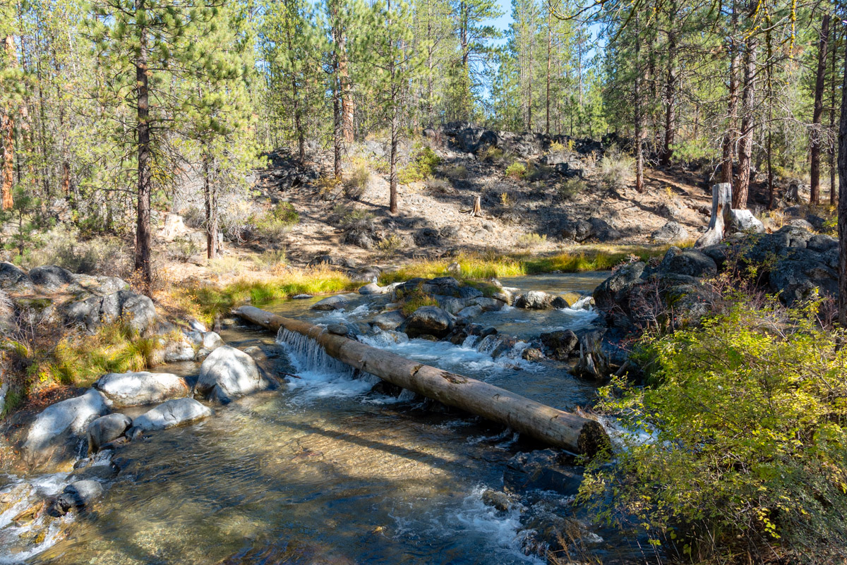
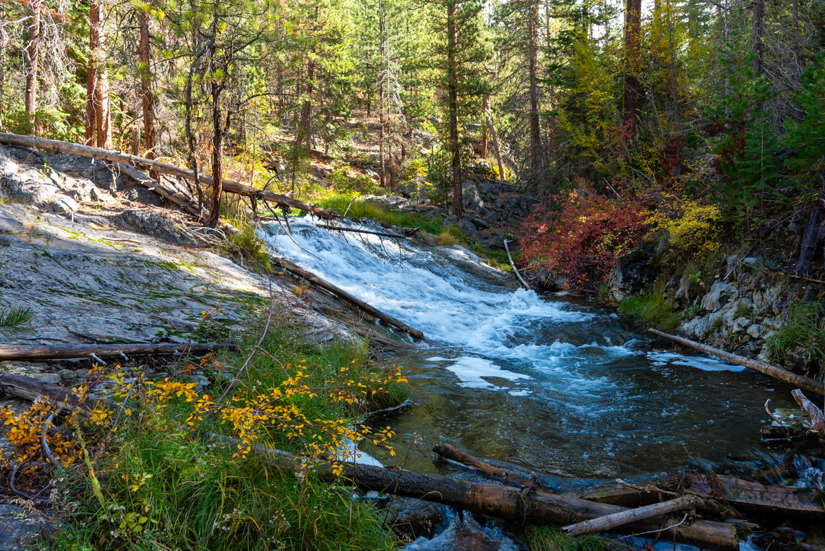
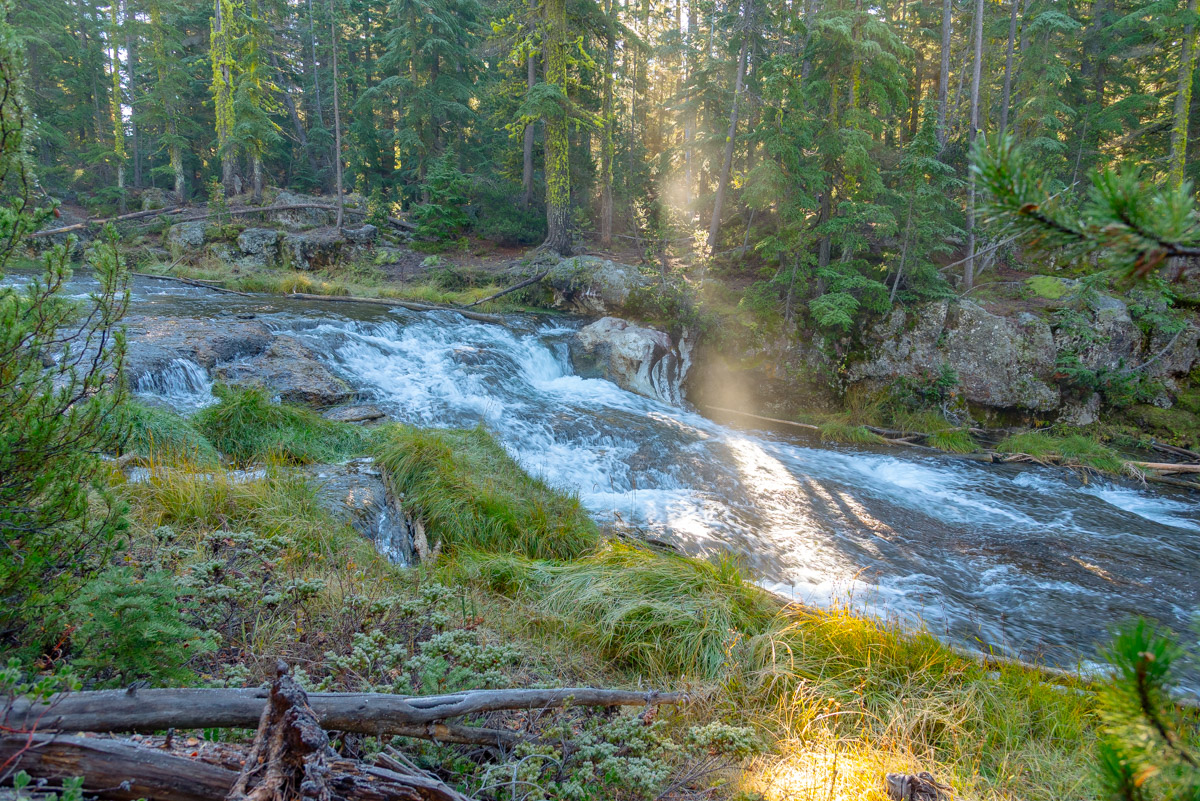
So the directions given here start at the bottom and work their way to the top. IF you want to mix and match things up, I believe in your ability to figure it out. The trailhead is located at the Ogden Group Camp site, just a couple miles up the Paulina East Lake road from Highway 97. Head past some boulders and look for a bridge heading over the creek as the trail begins. The trail stays pretty close to the creek for the majority of the hike, especially these lower sections. There are some cool, small waterfalls and rapids as the creek works its way down the mountainside. After about a mile, you will cross back over the creek to its north side on another wooden bridge.
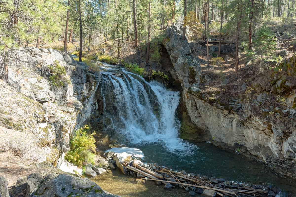
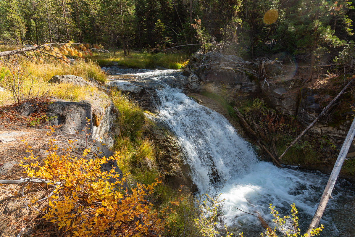
round 2.5 miles, you will come to McKay Crossing Falls, a pretty waterfall that drops 23 feet into a small gorge. There is a nice little pool at the base of it if you ever wanted to swim in a waterfall, but getting down to it requires some scrambling down steep hillsides and then wading up the creek. Just after McKay Crossing Falls, you will reach, the aptly named, McKay Crossing Campground. If you are wanting to do the waterfall reach, this is where you will begin your hike. But don’t forget to hike down the tenth of a mile or so to check out McKay Crossings Fall.
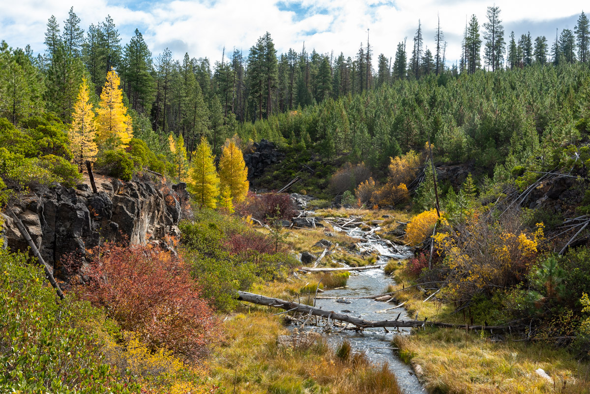
Following McKay Crossing Campground, the Peter Skene Ogden Trail continues marching up Paulina Creek. The forest will also start to change from more Ponderosa Pine dominated to a mixed forest of pondos, lodge poles, firs, and even some larches. This makes this section of the trail especially beautiful in the fall.
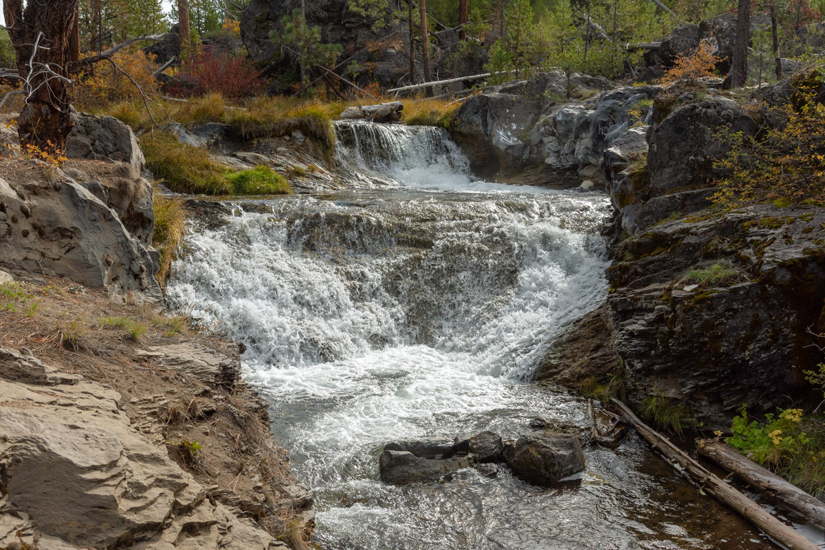
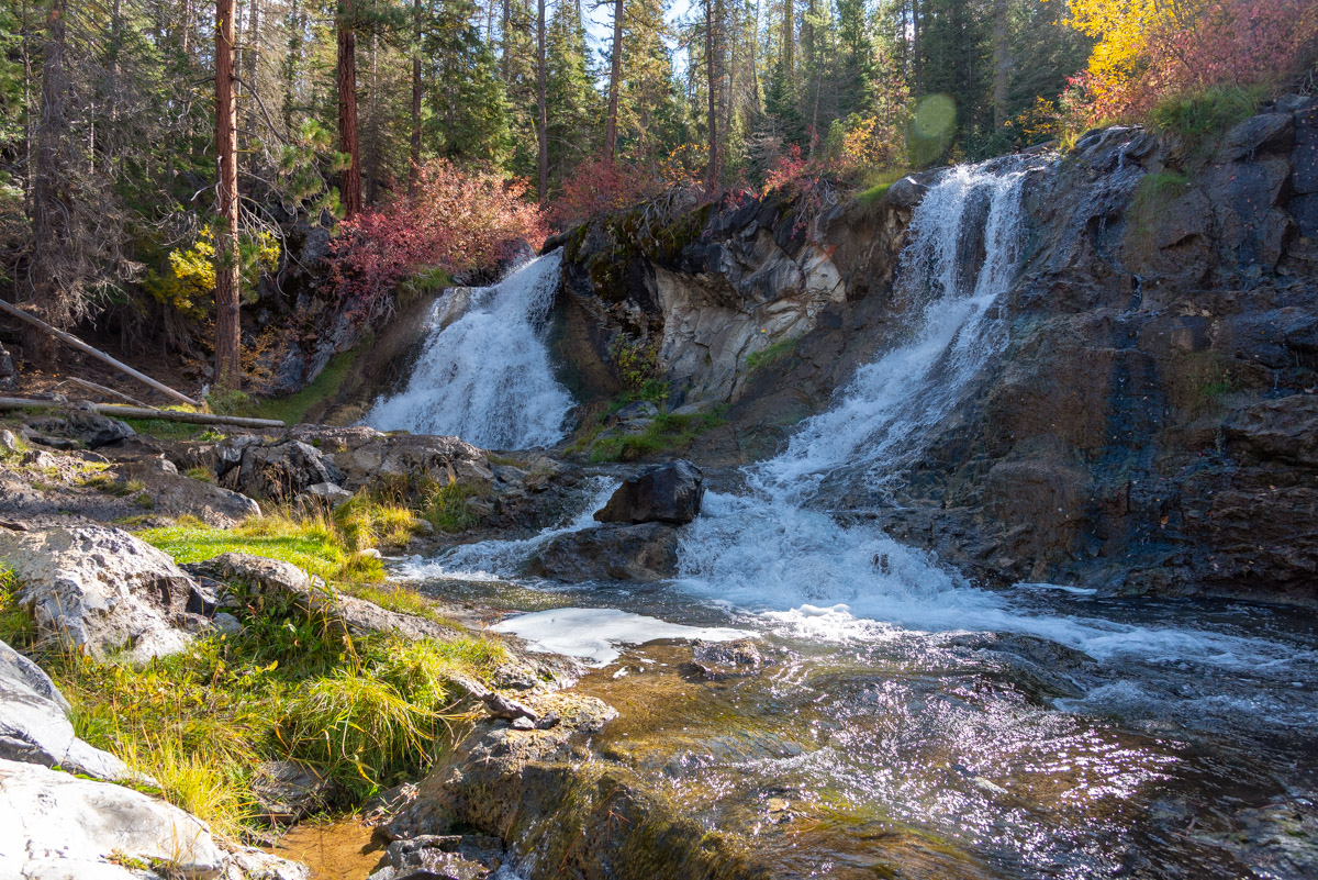
The trail isn’t right next to the creek, as it is often in a small canyon and through the trees, so be sure to watch for user trails heading off towards the stream. These will oftentimes lead you to some of the coolest spots. The waterfalls and slides will start showing up about ¾ of a mile from the McKay Crossing Campground. Over the next couple of miles, there are tons of falls that warrant your attention. There are also some beautiful areas of golden larches and grassy meadows as the creek flows down the canyon, allowing for numerous photo ops. There are two really pretty falls, almost back to back, with 10-15 ft vertical drops about 2.25 miles up from McKay Creek Crossing. Soon after those falls, you will also come to a cutoff trail that will lead you to another bridge over the creek and to a forest road near the 10-Mile SnoPark. But this isn’t winter, so keep heading up the trail.
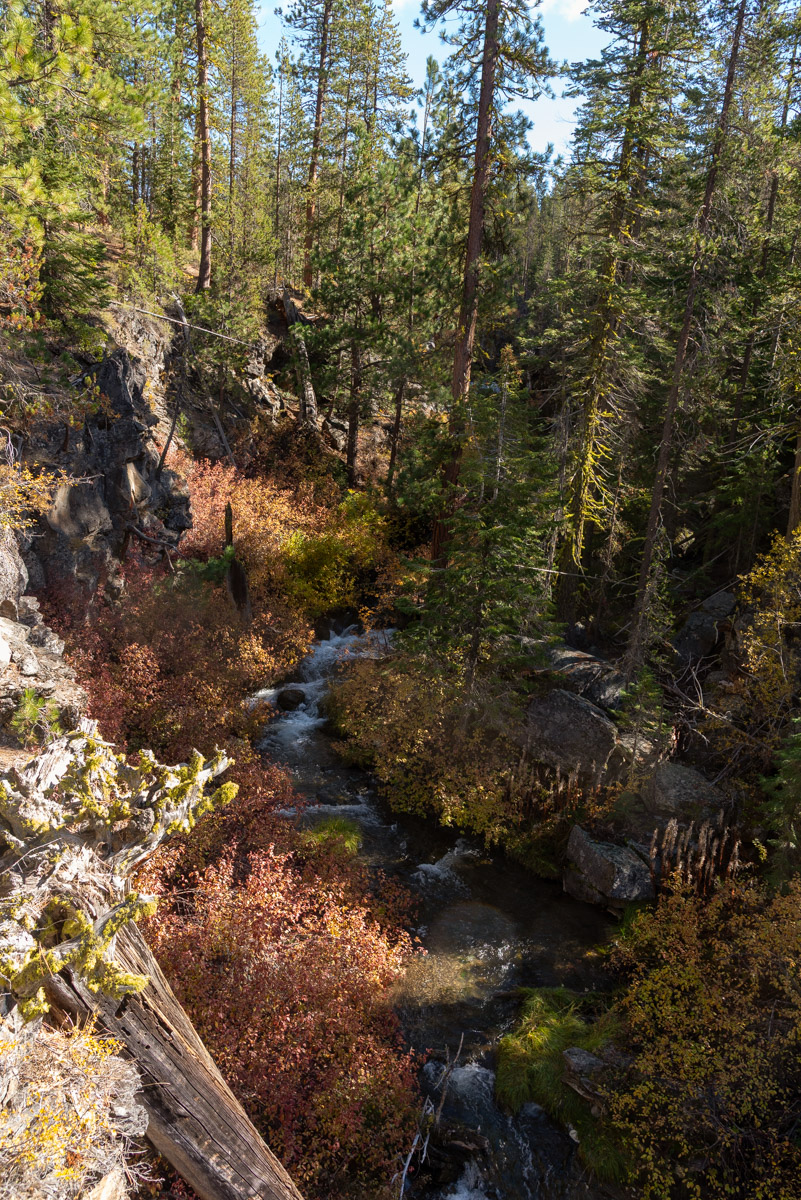
Half a mile above the cutoff trail, the trail will dip down right next to the creek to a nice large flat area. Downstream, the creek flows through a grassy meadow and above, it drops through a series of small drops. This is a good turn around spot if you are hiking the Waterfall Reach. After this, the trail climbs up above the creek, as the stream enters a deep and narrow canyon, making viewing it much more difficult.
If you are continuing on, follow the old road up and away from the Creekside spot. Keep an eye out for the trail continuing to your left. IT is easy to miss while walking the road and then you will end up at a dead end spot wondering what the hell happened. For the next 2.25 miles, the trail remains pretty high above the creek. There are some spots where you can peer out over the canyon, but it is pretty hard to see what the creek is doing down below through all the trees.
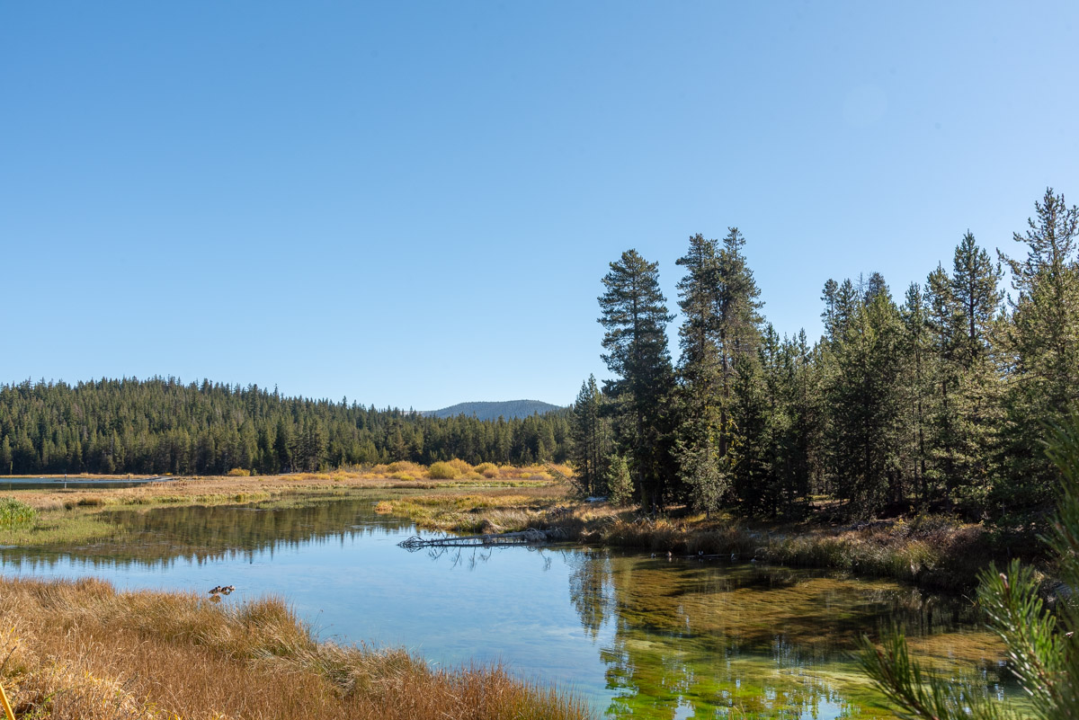
At 8 miles from the trailhead, you will encounter a side trail leading you Paulina Falls. This short little jaunt takes you to an overlook of the falls on the north side of the creek, offering some contrasting views from the more popular roadside lookout. Following the lookout, the trail returns to creek level and there are a couple more small falls to enjoy. Plus, it’s just a short, quarter mile and BAM, there you are at Paulina Lake. You did it! Now you just have to figure out how you’re getting back down. Only 8.25 miles to go……
Directions
To reach the Peter Skene Ogden Trail, head east on the Paulina East Lake Road, 6 miles north of La Pine or 19 miles south of Bend on Highway 97. Look for the signs directing you the Newberry Caldera. After 1.4 miles, you will see a sign for Ogden Group Camp to your left, just before a bridge heading over Paulina Creek. If you are starting from the bottom of the trail, turn here and follow the gravel road along the creek til you reach a large parking area.
If you are wanting to start from the McKay Crossing Campground, continue on the Paulina East Lake Road just past the turnout for Ogden Group Camp and see a sign directing you to the McKay Crossing Campground. Make a left onto the gravel 2120 Forest Road and follow it for 2.1 miles until you reach the campground. The trailhead if on the far side of the creek over the bridge and there is parking for about 3 or 4 cars there.
Finally, if you are wanting the hike the upper reaches, head all the way up Paulina East Lake Road for 12.6 miles until you reach Paulina Lake. Probably the best place to park here would be at the parking area near the boat ramp. Then walk back down the road and then follow the road towards Paulina Lake Lodge. Once you cross of the bridge, the Peter Skene Ogden trail will head down the creek, just past a set of gates.
Things to Know
Passes:A Northwest Forest Pass is required at this trailhead.
Dogs: Allowed and must be on a leash.
Usage: Moderate
Open Season: The road up to Paulina Lake closes in the winter at 10-mile Snopark, 10 miles from the highway. It usually opens for the season in late May and closes in Mid Novemeber. The Lower Trailhead can ge accessed year round, but don't be surprised to find a fair amount of snow on the trail in the winter months.
Bugs: Mosquitos will likey be present and persistent from late May into August or so, particaully higher up the trail.