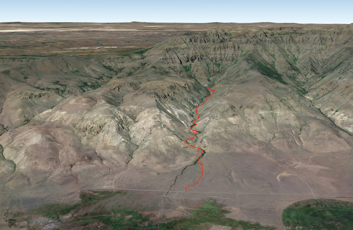
Pike Creek
Distance: 6.2 miles
Elevation Gain: 1,500 feet.
If you are looking for remote, then Pike Creek on the eastern side of the Steens should be on your bucket list. Located hours from pretty much anywhere, this trail is the only designated route offering you the chance to explore the steep and rugged eastern face of the Steens as it rises above the Alvord Desert. So let’s go!
The trailhead for Pike Creek trail is not really what you would consider a typical trailhead. While there is a sign and information board, the “trailhead” is really just the beginning of a closed road at cattleguard. So scan the area and try to find somewhere out of the way to park, (just kidding. If there is even one other vehicle there, you may want to skip the trail because it’s obviously overcrowded.) cross over the cattleguard and start hiking.
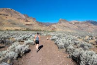
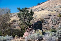
The first ¾ of a mile or so of the hike is just up this road to the old trailhead. Its nothing to exciting except you get to watch as the mouth of the canyon creeps closer. Once you see a juniper (the only tree is site) growing out of giant cracked boulder, you know you are getting close to that start of the cool stuff.
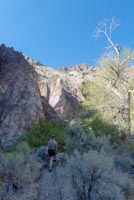
Dive into the willows and cross over Pike Creek and begin the climb into the canyon. This first bit follows an old mining road as it climbs the canyon side high above the creek. It is a good steady climb, but not too steep for the most part. After about a mile, you will pass a sign signaling that you are crossing into the Steens Mountain Wilderness. There is also an old dynamite shed here from a time when they were prospecting for uranium.
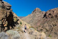
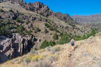
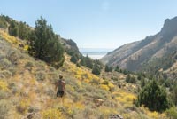
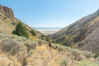
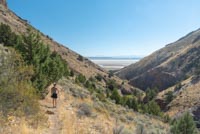
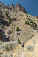
The trail will continue up the creek and proceed over a few washed out areas before crossing once again. Here, things can get a little interesting. The rock formations along the canyon walls and the view of the headwall of the Steens summit ridge are awesome and help keep you going. There isn’t much shade and being surrounded by rock, while also finding yourself in hot and dry southeastern Oregon means things can get pretty hot. It addition, the trail starts to get steeper, and there are several sections where it can be a little off camber, with the downhill side falling a hundred plus feet fairly quickly to Pike Creek below. Trekking poles can definitely help if you’re not super confident in your footing, especially coming back down.
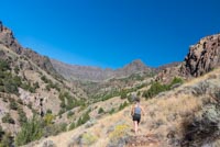
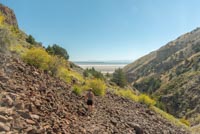
As you climb, you will pass a few rock talus slopes, but the trail is built into them and they are fairly easy to navigate. Just be aware the rocks may move a little on you. There are also some wet areas where you may flush some grouse or chukars, so try not and let them scare you and make you fall of the trail. This all sounds very ominous, but it’s really not that bad, and I believe in you.
Eventually, you will notice the trail starting to kind of peter out. You will cross over a small, spring fed creek and then climb up over a should and down to the first of three forks of Pike Creek. This is as good of a turning around spot as any. There is some user trail that continues up the middle fork and it will eventually connect you with the Dry Creek trail, but there isn’t any official trail linking the two yet.
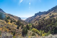
One cool thing about this hike, even though it is an out and back, is that the views on the way back are completely different than on the way up, and almost better, in my humble opinion. Rather than staring at the imposing face of the Steens ahead of you, you get to see the flat expanse of the Alvord Desert between the V of the canyon walls. It’s not so bad!
Directions
To reach the Pike Creek trailhead, take Highway 78 east from Burns towards Crane. Continue for 64 miles until you reach the turnoff onto Folly Farms Road towards Fields. The road will be paved for the first 11 miles, but then you will have another 28 miles on gravel road before reaching the trailhead. Keep an eye out for Mann Lake on our left, because that is about the hallway point. The trailhead is just a chained off road and cattle guard, but there is a sign and information board marking it. If you reach the Alvord Hot Springs, you’ve gone too far, but it may be worth remembering because it makes for a great place to soak those aching leg muscles.
Things to Know
Passes:No passes required
Dogs: Allowed and must be on leash or under voice command at all times.
Usage: Light
Open Season: The trail can be accessed year round, but expect to find some snow and ice between November and April. The creek can be fairly high as well into May, which may require fording
Bugs: Mosquitos can be bad during the early summer but usually clear out as the runoff period dies down.
Flowers: Flowers can be abudndant in the late spring, primarily late May.