Steens Mountain Summit
Distance: 0.9 miles
Elevation Gain: 210 feet.
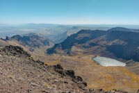
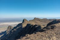
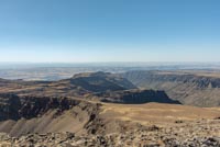
Steens Mountain is the largest fault block mountain in the northwest, stretching fifty miles from north to south and rising over 5,000 feet above the Alvord Desert to the east. As you may know, Oregon’s highest road will take you to the top of this mountain. Well almost. If you want to reach the actual summit, a short, but steep in places, hike is in your future.
Steens Mountain was formed via two different geologic forced. An ancient shield volcano spit out over 40 different layers of basalt between 14 and 17 million years ago. Then, pressure from deep within the Eart forced the eastern edge of the mountain upward, breaking away along a fault line. This has resulted in a steep face of multiple layers of lava rising dramatically from the east, and long gradual uphill slope on the west, taking over 25 miles to reach the summit block. These western slopes are bisected by some glacial gorges however, adding to their intrigue as well.
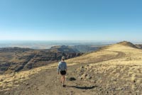
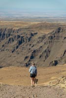
If you are looking to summit this impressive mountain, just drive the Steens Mountain Loop Road to the Steens Summit trailhead. From there, you will see a blocked off road heading further uphill. This is your “trail”. While just a road, it is fairly steep and loose at the beginning, so watch your step.
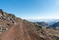
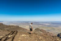
As you climb, keep your eyes peeled to your right and soon Wildhorse Lake will come into view. This beautiful lake sits perched at the head of a valley 1,000 feet below. As you keep climbing, things will level out and you will soon reach the communication towers complex located on the summit. Even though they kind of mar the beauty of the site, head past them so you can gaze over the edge of the eastern face and down to the Alvord Desert below. WAY below. You feel like you can see forever from up there.
Directions
To reach the Steens Summit Trailhead, head east on Highway 78 from Burns for 1.7 miles and then make a right onto Highway 205 towards Frenchglen. You will follow 205 for 58 miles until you reach Frenchglen and then, just after passing through this cute little town, make a left onto the Steens Mountain Loop Road. This road is gravel, but it is in very good shape and only washboardy in a few places. Follow the gravel road as it winds it way up the mountain, through beautiful stands of Aspen and past some scenic overlooks for 25 miles. Then, you will come to two intersections, one right after another. The first left will take you too the East Rim Overlook. Stay left but then at the second split, staying left will continue you on the Steens Mountain Loop and start heading back down the mountain. Vere right here and continue on the final two miles to the summit trailhead.
Things to Know
Passes:No passes required
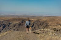
Dogs: Allowed and must be on leash or under voice command at all times.
Usage: Light
Open Season: The Steens Mountain Loop Road dosen't usually open until sometime in July, depending on snow, and will likely close in November.