White River Falls
Distance: 0.8 miles.
Elevation Gain: 170 feet.
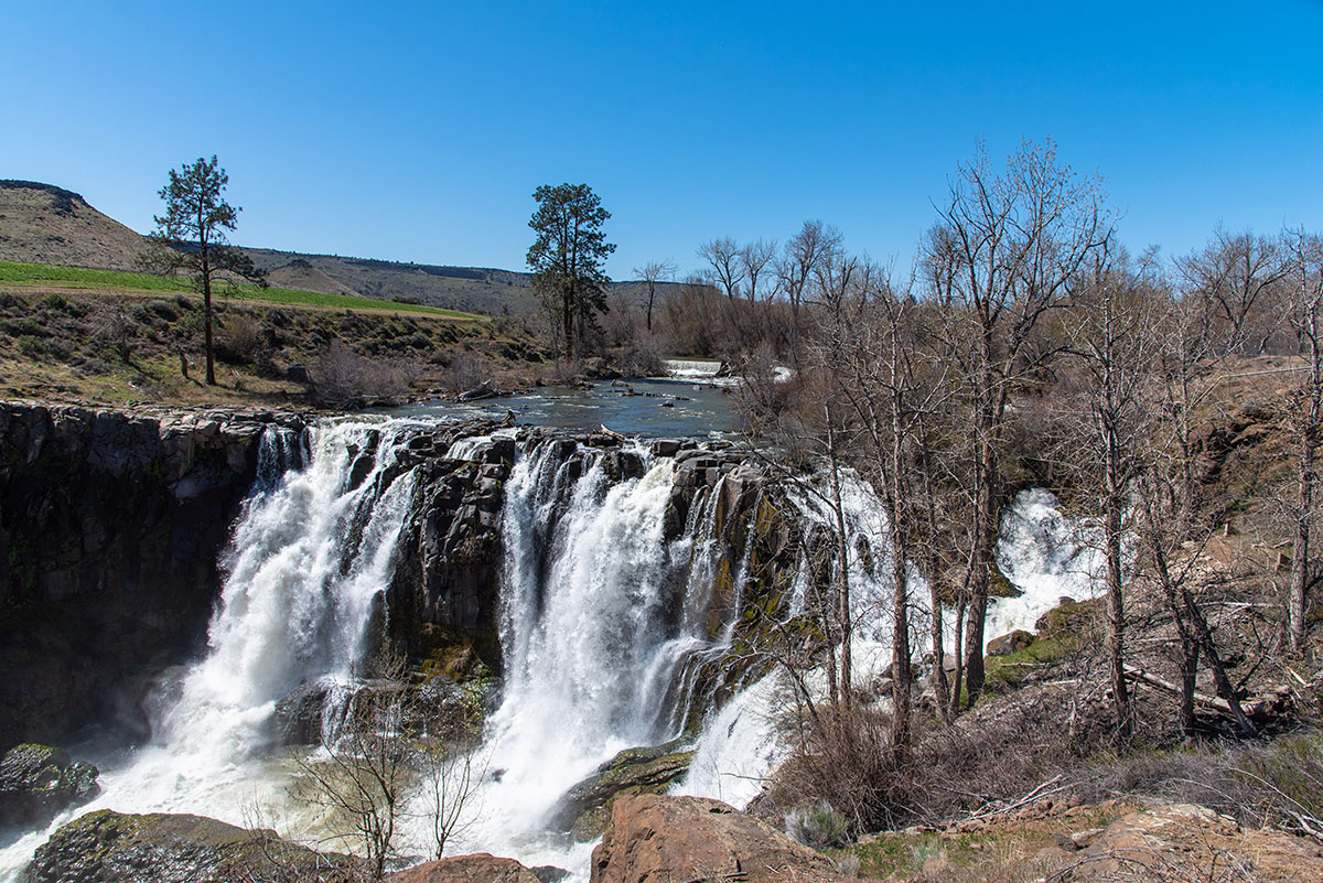
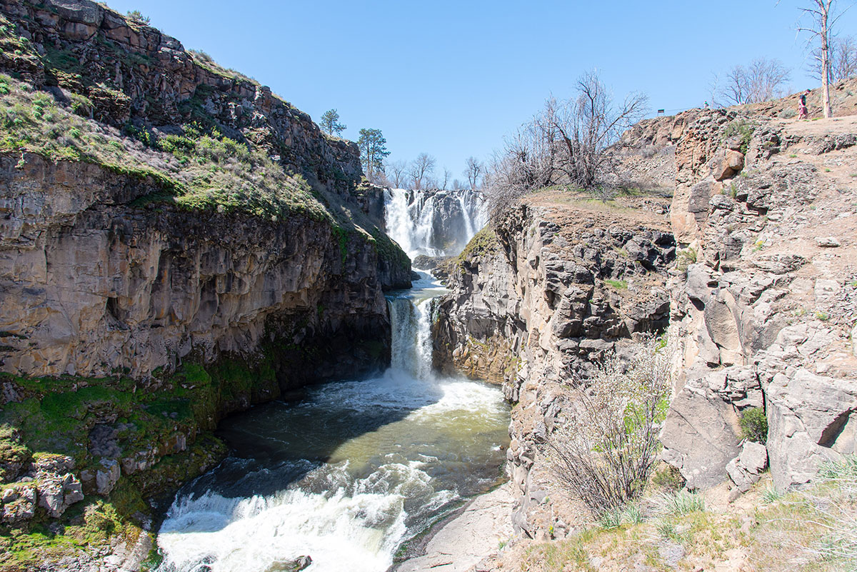
White River Falls is a beautiful, double-tiered waterfall that drops 90 feet into a narrow basalt gorge. The falls is easy to view from an overlook at White River Falls State Park, but if you really want to experience the falls, and see the lower tier, named Celestial Falls, which isn’t visible from the overlook, you need to make your way down the short but steep trail to the canyon bottom. You will get the chance to view some of Oregon’s history as well.
The hike begins from the parking area of White River Falls State Park. Simply just follow the paved path towards the overlook. Here, you can see the falls plunging into the depths of the canyon below you. Well, all the grandiose words kind of depend on the time of year. If you are visiting during the late summer to fall, the falls are likely to be little more than a tickle, but they are impressive in the spring.
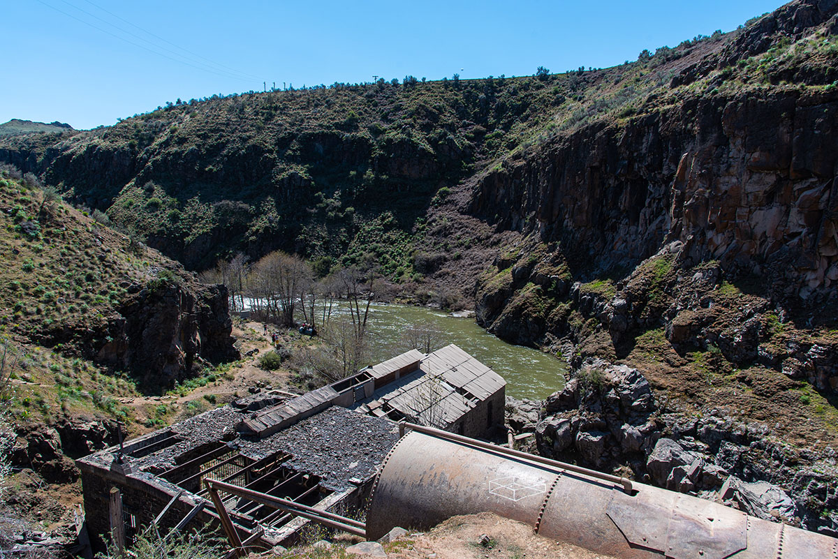
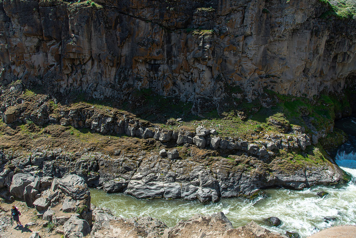
When you are ready to head down the canyon, look for the trail heading down the canyon behind you, and follow it, of course. Follow the trail as it heads over a bridge that spans a settling pond for an old powerplant which used to operate at the falls. You will be able to see the old powerplant for the dam beneath you, along the river. The hydroelectric facility was one of the first to operate in Oregon, coming online in 1910 and supplying power to Wasco and Sherman Counties. It was closed down in 1960 following the completion of the Dalles Dam on the Columbia.
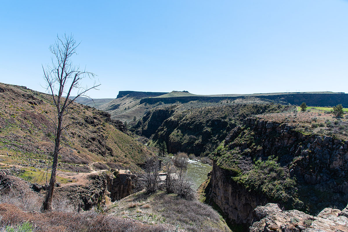
After crossing the bridge, the trail surface will change from paved to dirt and begin its steep descent into the canyon. The trail is loose with some big steps to maneuver on your way down, so take it slow and easy. About 2/3 of the way down the slope, you will come to a beautiful overlook of White River Falls, with Celestial Falls flowing into a beautiful pool right in front of you.
Head back to the main trail after viewing the falls and continue down to the river and powerplant. The building itself is still in pretty good shape, and you can look through some openings to see some of its inner workings. After viewing the plant, you can continue down river for a little less than a quarter mile to view Lower White River Falls, a nice little 15-foot drop, to complete your day.
Directions
To reach White River Falls State Park, head 14 miles north of Maupin, or 34 miles south of The Dalles on Highway 197. Watch for a sign directing you towards White River Falls State Park on highway, and then head east on Highway 216, towards Sherars Bridge. After 4 miles, the park will be on your right.
Things to Know
Passes: No passes are required.
Dogs: Allowed and must be on leash at all times.
Usage: Moderate in the spring, mainly weekends, but pretty light the rest of the year.
Open Season: All year but the parking area may be closed during winer storms. The flows over the falls are best in the spring and can dry up to little more than a trickle later in the summer.