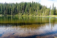
Carl Lake
Distance: 9.8 miles
Elevation Gain: 1,150 feet.
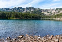
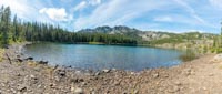
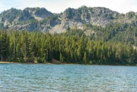
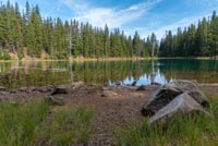
Carl Lake, sitting just below the eastern side of the Pacific Crest, is considered by many to be one of the jewels of the Mt Jefferson Wilderness. This 20-acre lake sits perched above a steep valley to the north and is rimmed by rugged, rocky cliffs. It’s a fairly long jaunt to get into the lake, but it also makes for a excellent backpacking destination, with numerous campsites located along the eastern and southern shores. Plus, this can make for a great basecamp to explore some of the deeper reaches of the Wilderness.
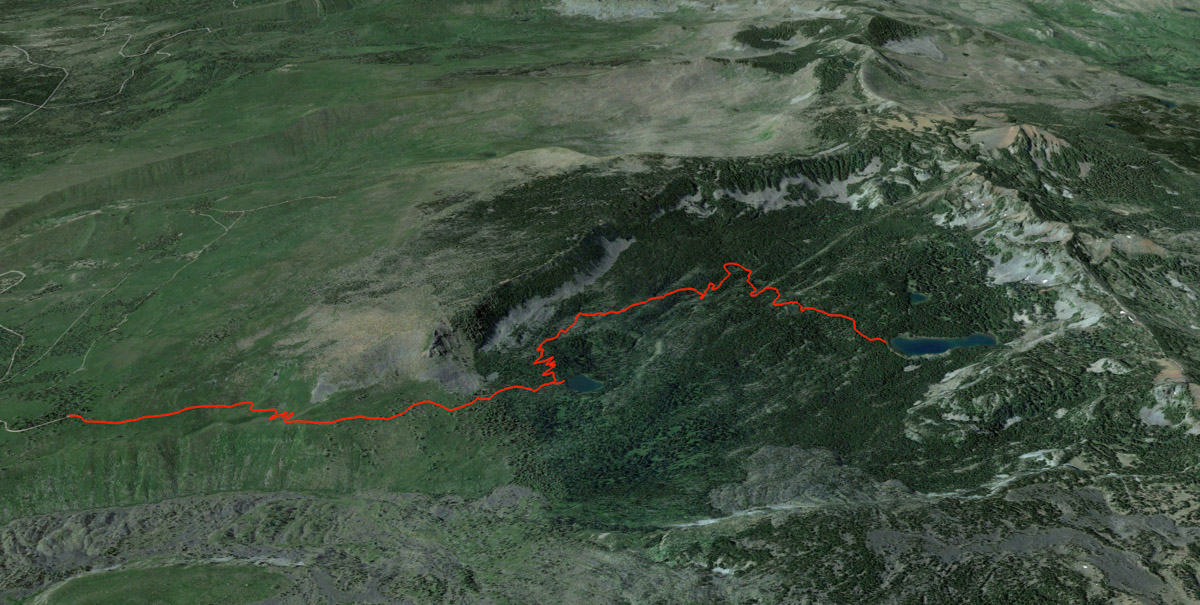
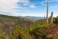
The hike to Carl Lake begins at the Cabot Lake trailhead, kind of near Camp Sherman. There are no facilities at this trailhead, and it isn’t the biggest, so it can get pretty full on summer weekends. The trail begins by wading through head high, or higher, ceanothus as you work your way through the 2003 B&B fire scar. Lodgepole Pine are making a comeback through, with some finally beginning to peak above the brush.
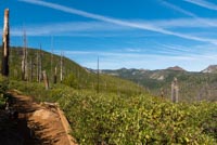
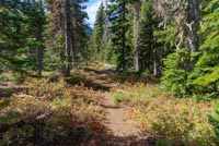
The trail doesn’t gain much in elevation as you press on towards Cabot Lake, but there are plenty of ups and downs as you navigate the ridgelines along the edge of Cabot Creek Canyon. Cliff and rock scree dominate the vistas along the opposite side of the canyon, and further to Sugar Pine Ridge. After about a mile and a half, you will have worked your way out of the burn and find the sweet serenity of forest.
Once through the burn, its only about half a mile to Cabot Lake. You probably won’t know it though, unless you’re watching your GPS. There will be an unmarked user trail on your left that makes the quick detour down to the lake. There may be some trees across it, so it’s had to see. If you start hitting the switchbacks and heading uphill, you missed it. It’s just a quick little downhill jaunt to Cabot Lake, and the trail pretty much dead ends right at the lake. Its not the most spectacular lake, but hey, its right off the trail so why not visit.
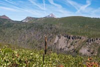
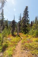
After Cabot Lake is when the climbing starts. Begin switchbacking up the ridge to the south and be happy this area didn’t burn as well. Once the switchbacks end, you may think you’re home free, but you will continue climbing at about the same rate most of the way to Carl Lake. It isn’t bad though, at a little less than 300 feet per mile. Huckleberry bushes will line the trail in the beginning of forested area aw well, providing a nice snack in the late summer and a splash of color in the early fall.
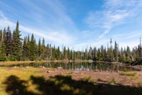
You will come across the first small pond a little over a mile and a half from Cabot Lake. Take heart, for you are nearing your destination (I tired to sound like a medieval travel guide there). You will loop around this first, and oftentimes dry pond, before passing two more. Once past the third, you will be within a half mile of Carl Lake.
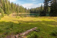
Keep marching and soon you will crest over a hill and you will see Carl Lake twinkling through the trees. Some of the best views of the lake are along the eastern shore, so if you are here for that, head along some user trails to the right and find a path down to the lake and enjoy that PB&J with some amazing views. This lake also tends to be a tad bit windy, so bear that in mind. If you are camping, there are a few small tent sites along the eastern shore, and several larger sites on the southern.
If you are wanting to do a little more exploring, pretty Shirley Lake is only about half mile south of Carl Lake and makes a quick little stop. And if you have a lot of pep in your step, Table Lake (~5 miles away) or South Cinder Peak (~2.5 miles away) make for some excellent additional adventures.
Directions
To reach the Cabot Lake Trailhead, Take Jack Lake road off of Highway 20, 17 miles north of Sisters or 4.4 miles east of Suttle Lake. Follow this paved portion of Jack Lake Road for 4.4 miles before making a left onto a gravel road at a sign for Jack Creek Campground and Jack Lake. Follow this gravel road for a mile before splitting off to the right at a sign for Sheep Springs Campground. About a mile and a half after this, you will pass another road with a sign saying to go right towards Sheep Springs Horse Camp or straight ahead for the trailheads. You’re a hiker, so keep going straight.
The road begins to degrade at this point with some rocks and ruts. A family sedan would probably have issues, but most crossover SUV class vehicle or hardier should have no issues. There will be several roads shooting off from this one, but it should be fairly obvious which road is the main on, so just keep plowing ahead. 4.7 miles after the Sheep Springs road, you will see another sign, directing you to the left to head to Cabot Lake Trailhead. Turn left here and in about half a mile, you will reach the trailhead. Good navigating!
Things to Know
Passes:A self-issue wilderness permit is required upon entering the wilderness. If you plan on backpacking, a Central Cascades Wilderness Permit is required camp in this area between June 15th and October 15th.
Dogs: Allowed and must be on leash or under voice command at all times.
Usage: Moderate
Open Season: The trail will usually melt out sometime in July and remain snow free until late October or early November.
Bugs: Mosquitos can be bad, real bad, during the early summer until they begin dying back sometime in August.