Kossah and Sahalie Falls Loop
Length: 2.5 miles
Elevation Gain: 550 feet.
The McKenzie River is a magical waterway, draining the western slope of much of the Central Oregon Cascades. The volcanic legacy of the area has also left its mark, with lava flows burying whole sections of the river causing the McKenzie to flow underground for miles, and damning up the valley, creating Clear Lake. The water of this amazing river can be an unreal blue in places, and the deep, green forest of old growth timber can help cool you on even the hottest day.
There are multiple different areas you can begin your hike from, with trailheads located at Sahalie Falls, Koosah Falls, and at Carmen Reservoir. Probably the best place to begin you hike would be at Carmen Reservoir, being that it is located at the lowest elevation of the hike and received much less traffic than the other trailheads. Unfortunately, this area is closed until at least through 2021, so I liked to pick the next best spot, Koosah Falls.
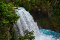
Right from the trailhead, you will find yourself at an overview of this dramatic falls. While only 64 feet high, the shear volume of water plunging over this drop makes Koosah Falls truly dramatic. Once you hit the trail and find the overlook, start heading downstream. There will be a couple other overlooks along the way, granting you different perspectives of the falls.
About a third of a mile from the trailhead, you will reach Carmen Reservoir. Water from the reservoir is piped beneath the ridge to the west and dumped into the Smith Reservoir, where it is again piped downstream to the Trail Bridge Reservoir for power generation. Carmen Reservoir also marks the lower end of the upper most section of the McKenzie River. The river enters a wide valley created by a lava flow just below the reservoir, and proceeds to dive underground through the porous rock. It doesn’t emerge again under it pops out at Blue Pool, nearly 4 miles downstream. Head to the bridge over the river and look for the restrooms. The trail from the parking area linking to the McKenzie River trail is located right next to them.
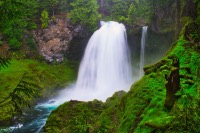
This section of trail will grant you some amazing views of both Koosah Falls and Sahalie Falls and you won’t have to fight with the crowds at the overlooks that are right off the highway. There are also some other, smaller falls and rapids between the two offering you more than enough to gawk at along the hike. You will see Koosah Falls quickly, only a quarter mile after joining the McKenzie River Trail, and 73 foot tall Sahalie Falls will come into view a half mile later. This section of trail contains the majority of the climbing along the hike, gaining 500 feet in about a mile. This is also a popular mountain bike trail, so keep your eyes peeled for bikers flying down the trail.
After Sahalie Falls, continue up the river for another 0.4 miles until you cross a bridge back over the McKenzie. Once over the bridge, find the waterfall trail heading off to your right. Sahalie Falls is only a half mile below the bridge and you will first come to it by reaching a viewpoint overlooking the top of the falls. Unfortunately, these are the viewpoints located along the highway, so you will likely notice a metric ton of people pressed up against the rails, trying to see. Like Koosah Falls, there are a couple other viewpoints as you head down the trail.
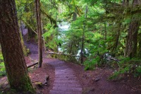
The trail between Sahalie and Koosah is very beautiful, hugging the river along some other, smaller falls for much of the time. It is also fairly steep, requiring you to navigate stairs on the way down, and can also be very muddy. Be sure to stop and check out the river from time to time though, it is magnificent. From Salahie Falls, it is only about half a mile back to the trailhead at Koosah Falls.
Directions
The Koosah Falls trailhead is located just off of Highway 126 at the entrace to the Ice Cap Creek Campground. The turnoff is located on the west side of the highway, approximately 6 miles south of the Highway 20/126 junction or 14 miles north of the Highway 126/242 junction, if you're coming from the Eugene area. Sahalie Falls Trailhead is located just about a half mile north of this.
Things to Know
Passes: No passes are required
Dogs: Allowed and must be on leash or under voice command at all times.
Usage: Heavy
Open Season: This area is accessible year round and could be snowshoed during the dead of winter. The trail along the McKenzie can get very muddy in the shoulder season.


