Rimrock Springs
Distance: 1.4 miles.
Elevation Gain: 110 feet.
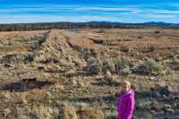
The Rimrock Springs trail makes for a nice little family hike in the Crooked River National Grasslands on Highway 26 between Madras and Prineville. The hike begins from the Rimrock Springs Trailhead as a paved trail just behind the kiosk. The trail offers interruptive signs along the way and remains paved all the way to the first viewing platform, about ¾ of a mile from the trailhead.
The first viewing platform looks out over a wetland which has been undergoing restoration since 1992. The marshes are oftentimes teeming with birds, including Canadian geese, great blue herons, marsh wrens, yellow-headed blackbirds, and mallards, but they like to hide in the vegetation so don’t forget your binoculars if you really want to view them.
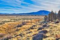
From this platform, you can continue along the now unpaved trail to a second viewing platform. You have to take a little side trail down to your left to reach it. After enjoying the view, head back up to the main trail. It will circle around the hill, offering some nice mountain views along the loop back to the trailhead.
Directions
Take Highway 26 about 10 miles south of Madras or 17 miles north of Prineville. There will be signs announcing the trailhead along the highway. The parking area in on the east side of the road.
Things to Know
Passes: No passes required
Dogs: Allowed and must be on leash or under voice command at all times.
Usage: Light
Open Season: Open year round.
Birds: Best time to view the nesting waterbirds is spring and early summer.